MyTopo
Willhoit Missouri US Topo Map
Couldn't load pickup availability
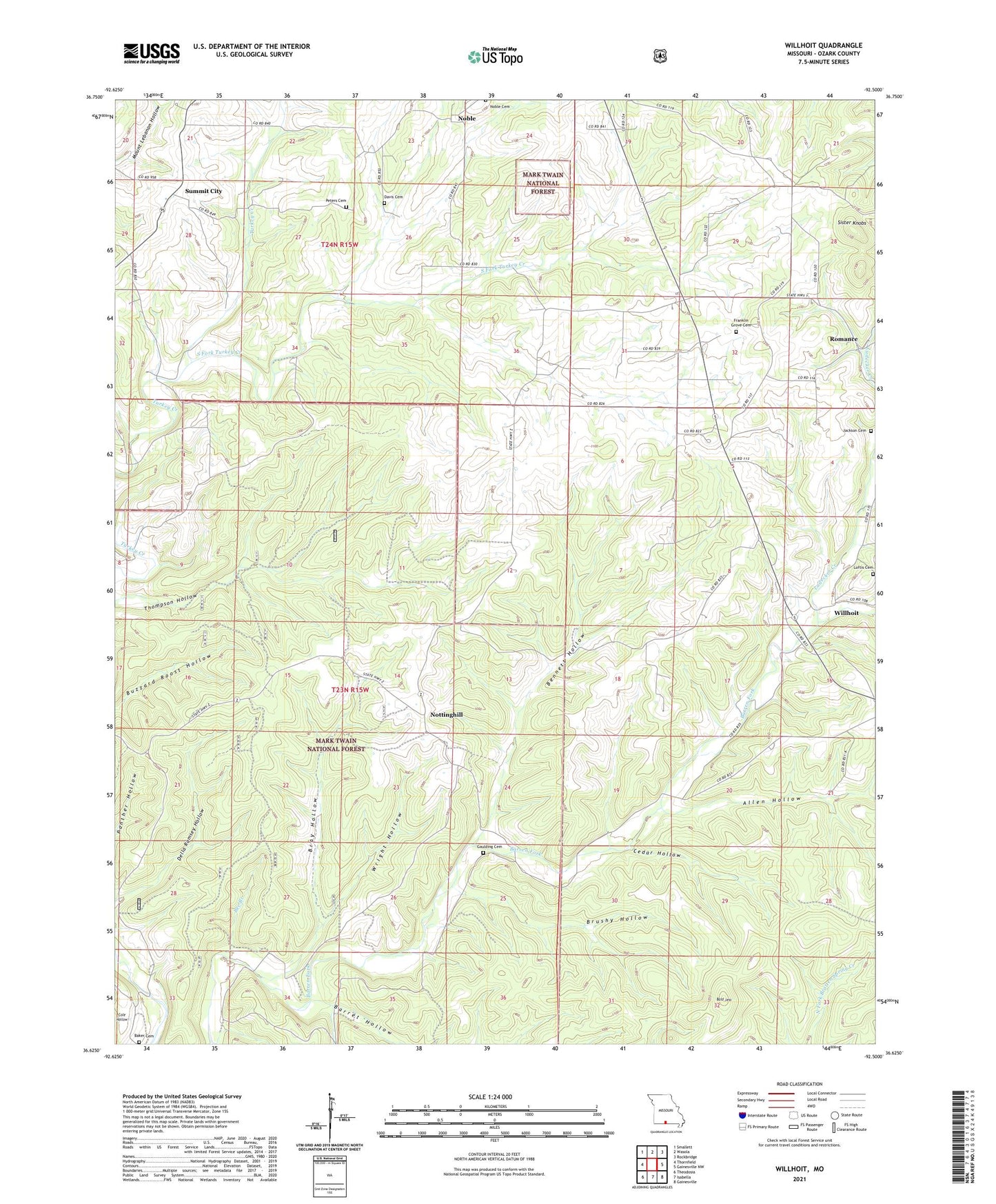
2021 topographic map quadrangle Willhoit in the state of Missouri. Scale: 1:24000. Based on the newly updated USGS 7.5' US Topo map series, this map is in the following counties: Ozark. The map contains contour data, water features, and other items you are used to seeing on USGS maps, but also has updated roads and other features. This is the next generation of topographic maps. Printed on high-quality waterproof paper with UV fade-resistant inks.
Quads adjacent to this one:
West: Thornfield
Northwest: Smallett
North: Wasola
Northeast: Rockbridge
East: Gainesville NW
Southeast: Gainesville
South: Isabella
Southwest: Theodosia
Contains the following named places: Allen Hollow, Baker Cemetery, Bald Jess, Barren Fork Church, Barren Fork School, Barret Hollow, Bee Branch, Bennett Hollow, Bray Hollow, Brushy Hollow, Cedar Hollow, Council Grove School, Davis Cemetery, Della Ramsey Hollow, Franklin Grove Cemetery, Franklin Grove Church, Gaulding Cemetery, Grabeel, Grabel Post Office, Jackson Cemetery, Loftis Cemetery, Ludecker Creek, Noble, Noble School, Nottinghill, Nottinghill Lookout Tower, Oakdale School, Peters Cemetery, Pond Hill School, Romance, Sister Knobs, South Fork Turkey Creek, Summit City, Thompson Hollow, Township of Nottinghill, Willhoit, Wright Hollow, ZIP Code: 65715