MyTopo
Antelope Montana US Topo Map
Couldn't load pickup availability
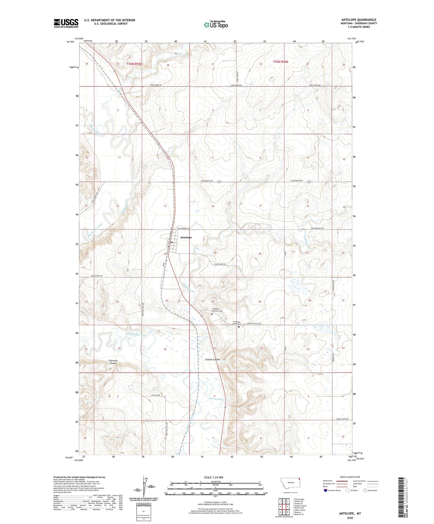
2020 topographic map quadrangle Antelope in the state of Montana. Scale: 1:24000. Based on the newly updated USGS 7.5' US Topo map series, this map is in the following counties: Sheridan. The map contains contour data, water features, and other items you are used to seeing on USGS maps, but also has updated roads and other features. This is the next generation of topographic maps. Printed on high-quality waterproof paper with UV fade-resistant inks.
Quads adjacent to this one:
West: Shippe Canyon
Northwest: Plentywood
North: Dooley SW
Northeast: Dooley SE
East: Reserve NE
Southeast: Reserve SE
South: Reserve
Southwest: Alkali Coulee
Contains the following named places: 33N56E03CC__01 Well, 33N56E05AB__01 Well, 33N56E07ACDA01 Well, 34N55E02AADA01 Well, 34N55E12BDCD01 Well, 34N55E23DDBB01 Well, 34N55E24AACB01 Well, 34N55E24ABDA01 Well, 34N55E24ABDA02 Well, 34N55E24ACAB01 Well, 34N55E24ACDA01 Well, 34N56E28ADBD01 Well, 34N56E32AADA01 Well, Adventist Church, Antelope, Antelope Catholic Cemetery, Antelope Census Designated Place, Antelope Creek, Antelope Creek Cemetery, Antelope Creek Lutheran Church, Antelope Grain Company, Antelope Post Office, Antelope School, Ator Creek, Blue Valley School, Clarence Coulee, Congregational Church, Folsom Coulee, Freske Number 1 Dam, McLaughlin Creek, Muddy School