MyTopo
Reserve Montana US Topo Map
Couldn't load pickup availability
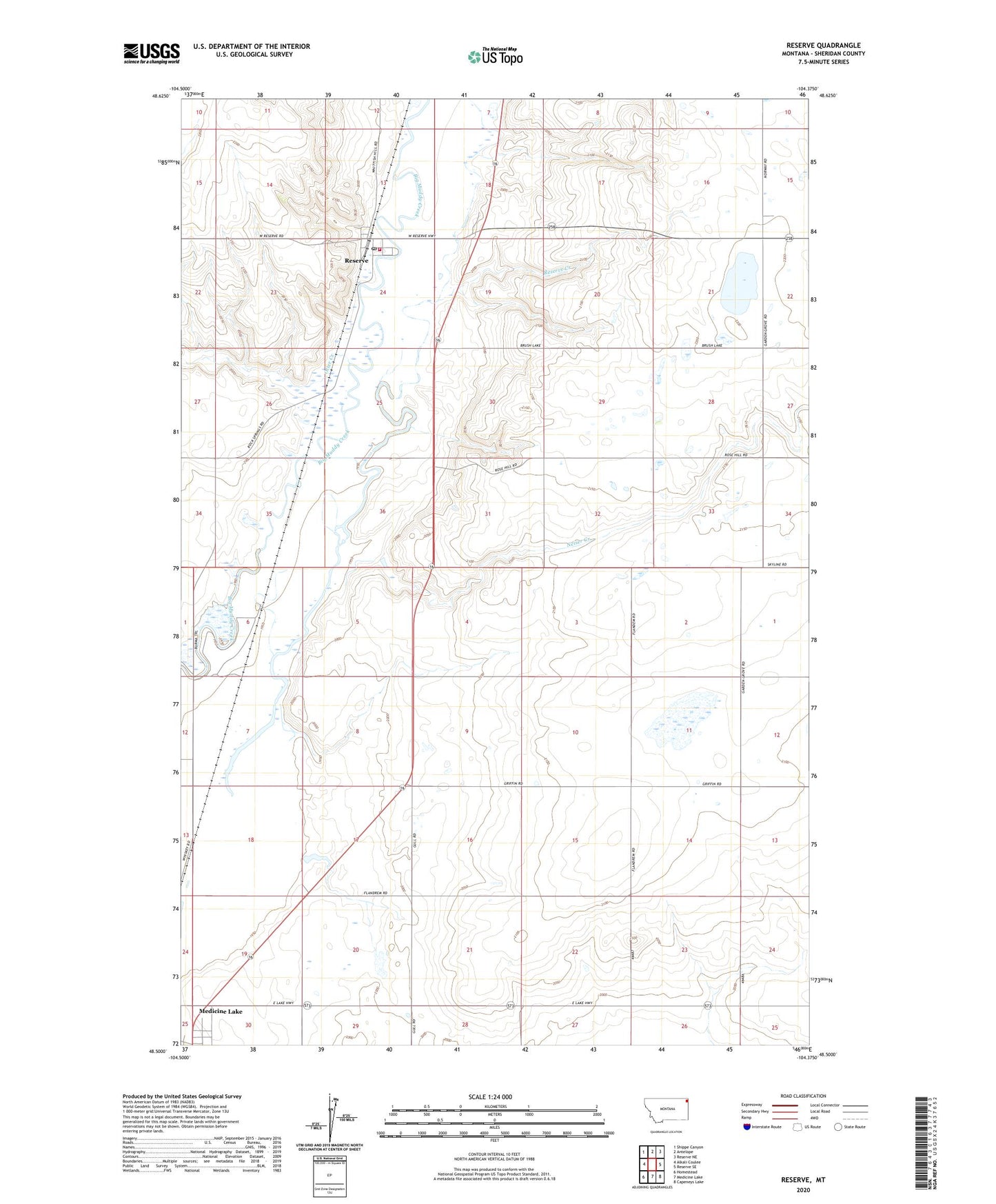
2024 topographic map quadrangle Reserve in the state of Montana. Scale: 1:24000. Based on the newly updated USGS 7.5' US Topo map series, this map is in the following counties: Sheridan. The map contains contour data, water features, and other items you are used to seeing on USGS maps, but also has updated roads and other features. This is the next generation of topographic maps. Printed on high-quality waterproof paper with UV fade-resistant inks.
Quads adjacent to this one:
West: Alkali Coulee
Northwest: Shippe Canyon
North: Antelope
Northeast: Reserve NE
East: Reserve SE
Southeast: Capeneys Lake
South: Medicine Lake
Southwest: Homestead
This map covers the same area as the classic USGS quad with code o48104e4.
Contains the following named places: 32N56E05DADB01 Well, 32N56E12CBBA01 Well, 32N56E17CCCB01 Well, 32N56E19BDDD01 Well, 32N56E20CCCC01 Well, 32N56E29AAAA01 Well, 33N48E18DCB_01 Well, 33N55E13CDCB01 Well, 33N56E28CBCD01 Well, 33N56E29BBBB01 Well, 33N56E31BBBC01 Well, 33N56E33ABAB01 Well, Bedford, Dewey Dam, Eden Valley, Medicine Lake Memorial Park, Medicine Lake Volunteer Fire Department Station 3 Reserve, Medicine Lake-Sheridan County Airport, Neiser Creek, Neiser Number 1 Dam, Otter Creek, Prairie States Cooperative, Reserve, Reserve Census Designated Place, Reserve Community Hall, Reserve Creek, Reserve Lutheran Church, Reserve Post Office, Reserve School, Rock Spring Congregation, Rose Hill School, Smith School