MyTopo
Austin Lake Montana US Topo Map
Couldn't load pickup availability
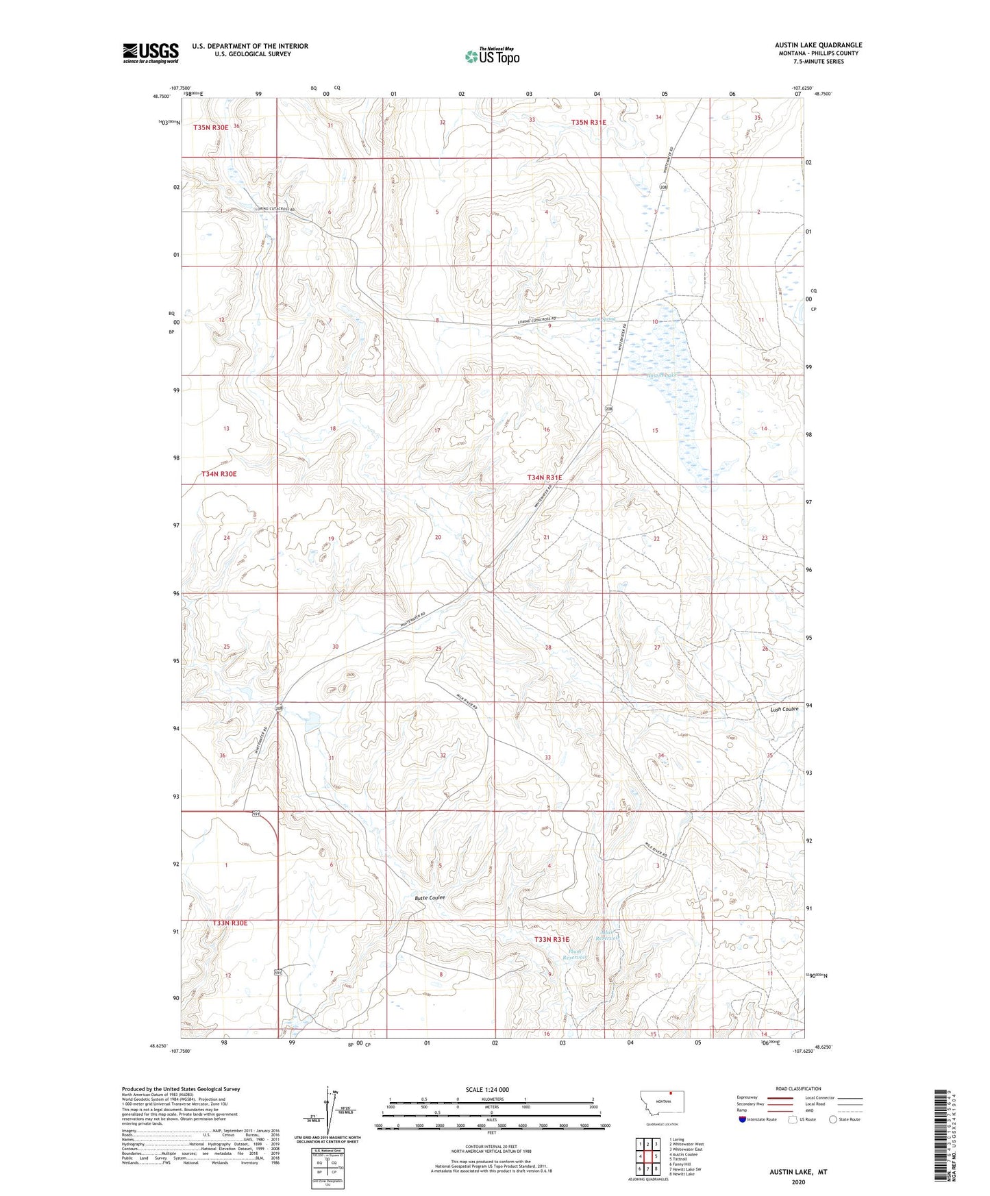
2024 topographic map quadrangle Austin Lake in the state of Montana. Scale: 1:24000. Based on the newly updated USGS 7.5' US Topo map series, this map is in the following counties: Phillips. The map contains contour data, water features, and other items you are used to seeing on USGS maps, but also has updated roads and other features. This is the next generation of topographic maps. Printed on high-quality waterproof paper with UV fade-resistant inks.
Quads adjacent to this one:
West: Austin Coulee
Northwest: Loring
North: Whitewater West
Northeast: Whitewater East
East: Tattnall
Southeast: Hewitt Lake
South: Hewitt Lake SW
Southwest: Fanny Hill
This map covers the same area as the classic USGS quad with code o48107f6.
Contains the following named places: 34N31E09DAAA01 Well, Adair Reservoir, Austin Lake, Austin School, Austin Spring, Butte Coulee, E Wasson Number 1 Dam, Plum Reservoir, White Dam