MyTopo
Baldy Lake Montana US Topo Map
Couldn't load pickup availability
Also explore the Baldy Lake Forest Service Topo of this same quad for updated USFS data
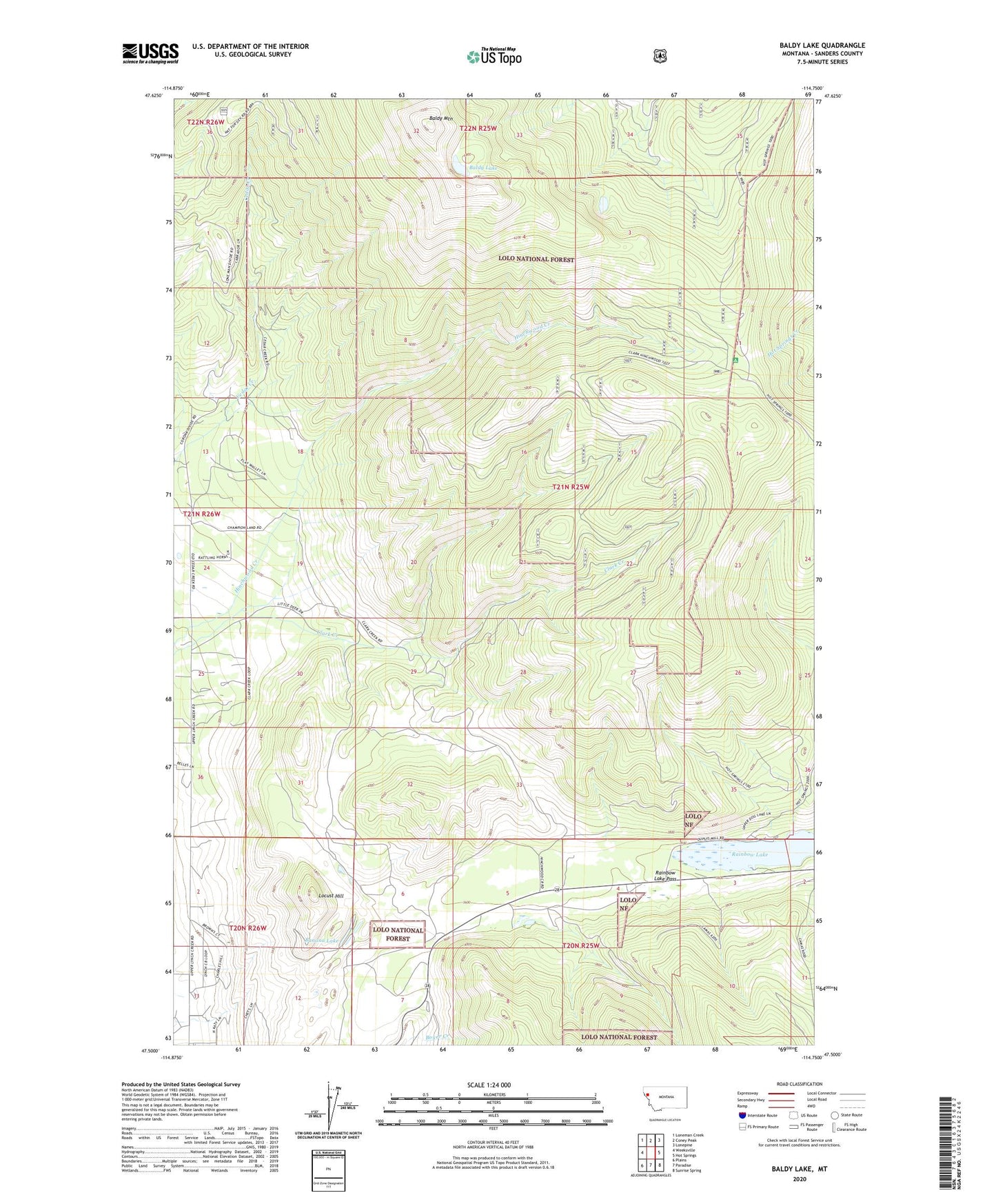
2024 topographic map quadrangle Baldy Lake in the state of Montana. Scale: 1:24000. Based on the newly updated USGS 7.5' US Topo map series, this map is in the following counties: Sanders. The map contains contour data, water features, and other items you are used to seeing on USGS maps, but also has updated roads and other features. This is the next generation of topographic maps. Printed on high-quality waterproof paper with UV fade-resistant inks.
Quads adjacent to this one:
West: Weeksville
Northwest: Loneman Creek
North: Coney Peak
Northeast: Lonepine
East: Hot Springs
Southeast: Sunrise Spring
South: Paradise
Southwest: Plains
This map covers the same area as the classic USGS quad with code o47114e7.
Contains the following named places: 20N25W03CBBA01 Well, 21N26W25DCDC01 Well, 59859, Baldy Lake, Baldy Mountain, Banana Lake, Blanchards Corner, Locust Hill, Rainbow Lake, Rainbow Lake Campground, Rainbow Lake Pass