MyTopo
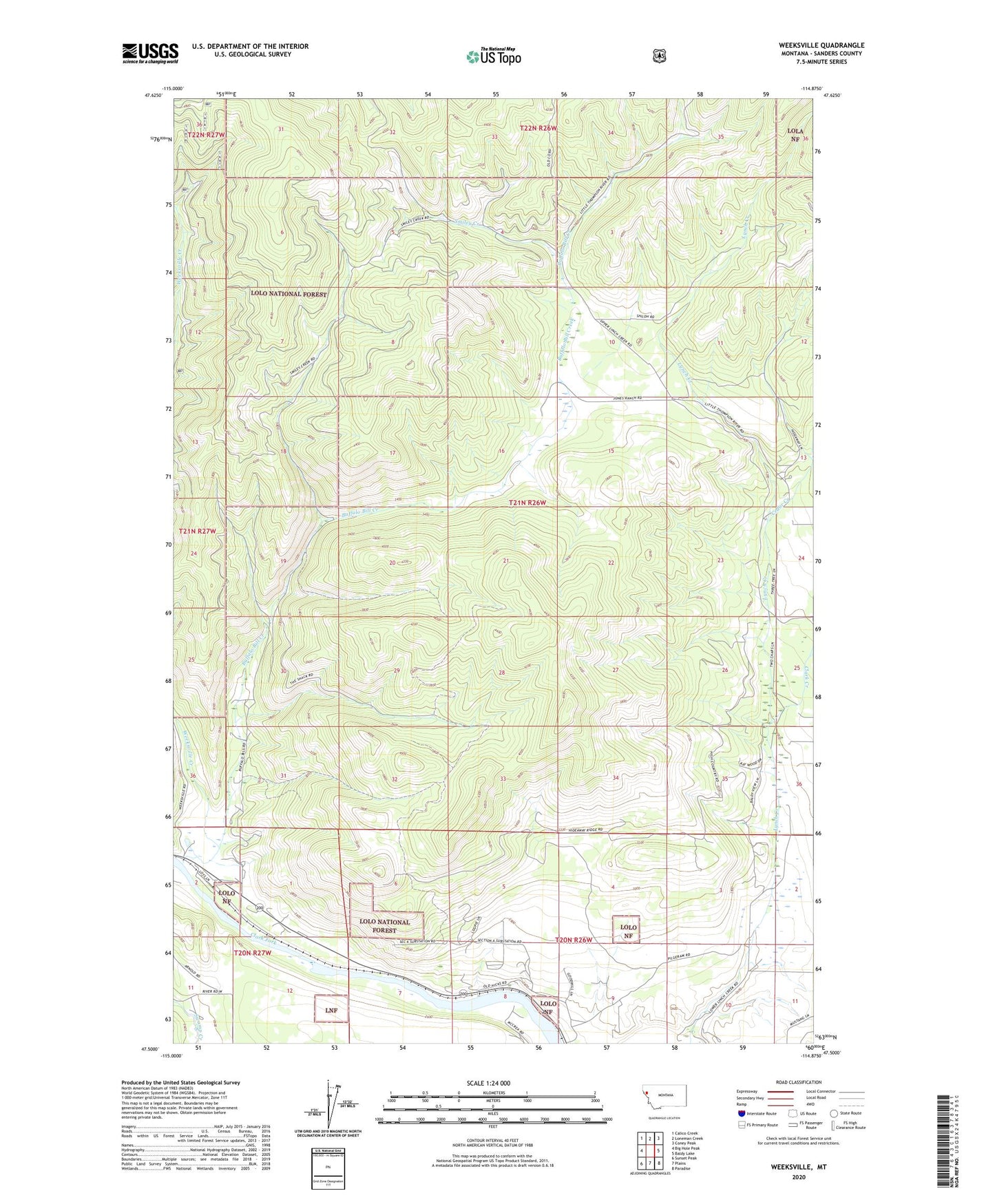
Weeksville Montana US Topo Map
Couldn't load pickup availability
Also explore the Weeksville Forest Service Topo of this same quad for updated USFS data
2024 topographic map quadrangle Weeksville in the state of Montana. Scale: 1:24000. Based on the newly updated USGS 7.5' US Topo map series, this map is in the following counties: Sanders. The map contains contour data, water features, and other items you are used to seeing on USGS maps, but also has updated roads and other features. This is the next generation of topographic maps. Printed on high-quality waterproof paper with UV fade-resistant inks.
Quads adjacent to this one:
West: Big Hole Peak
Northwest: Calico Creek
North: Loneman Creek
Northeast: Coney Peak
East: Baldy Lake
Southeast: Paradise
South: Plains
Southwest: Sunset Peak
This map covers the same area as the classic USGS quad with code o47114e8.
Contains the following named places: 20N26W03DCDA01 Well, 20N26W08BACD01 Well, 20N26W09CCBD01 Well, 20N27W01CBCD01 Well, Buffalo Bill Creek, Cedar Creek, Clark Creek, Hinchwood Creek, Smiley Creek, The Pines, Weeksville, Weeksville Creek