MyTopo
Becket NE Montana US Topo Map
Couldn't load pickup availability
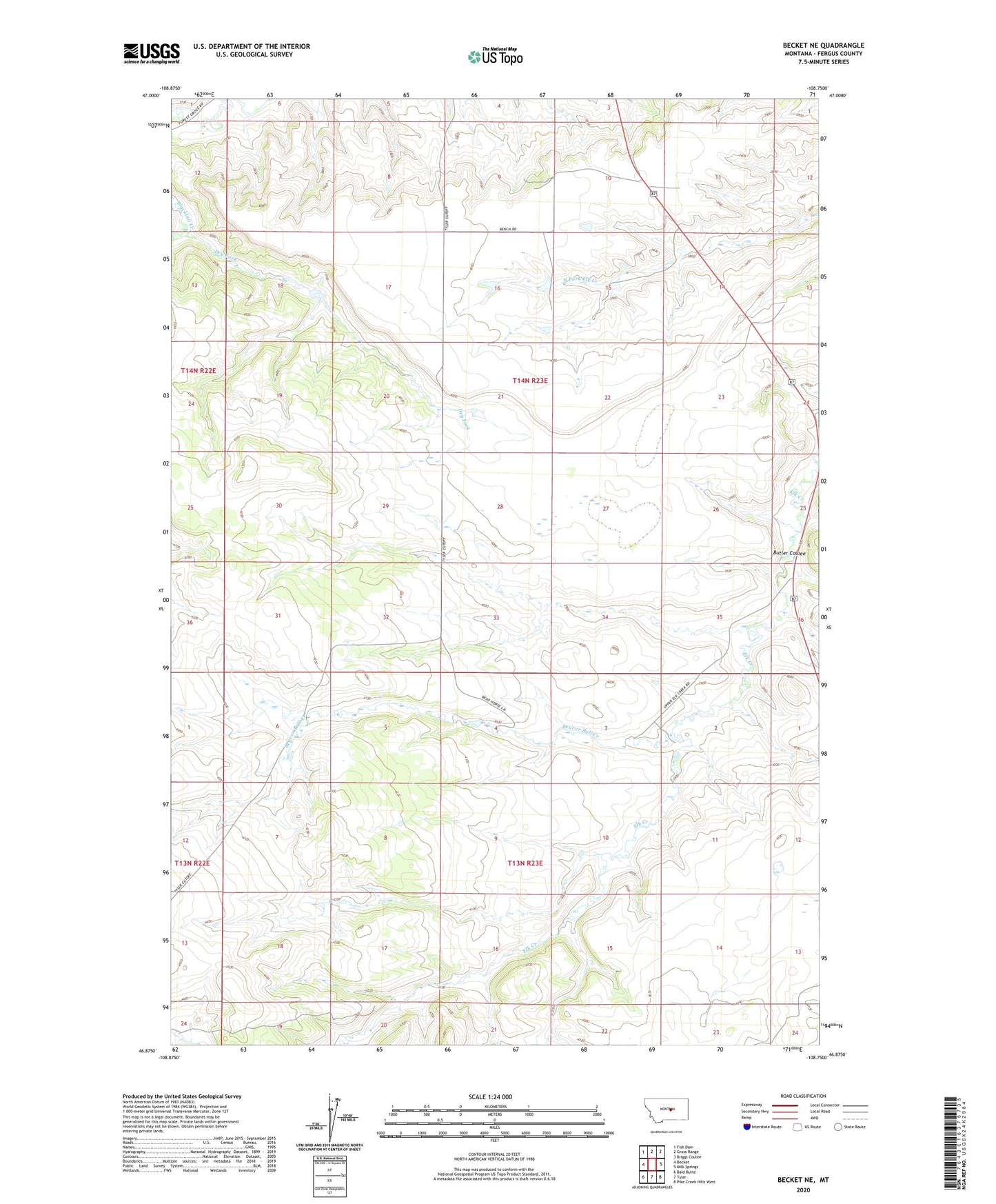
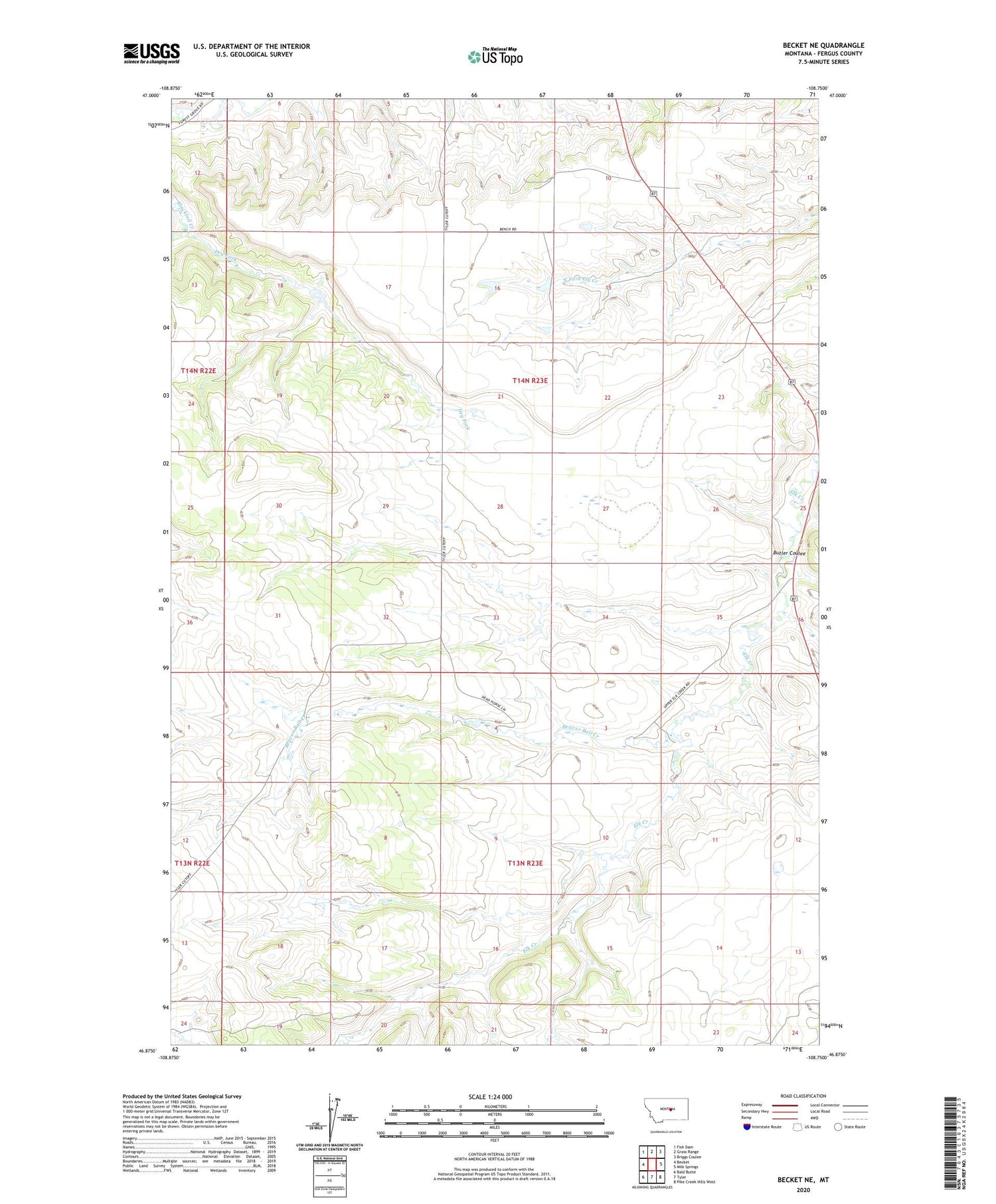
2020 topographic map quadrangle Becket NE in the state of Montana. Scale: 1:24000. Based on the newly updated USGS 7.5' US Topo map series, this map is in the following counties: Fergus. The map contains contour data, water features, and other items you are used to seeing on USGS maps, but also has updated roads and other features. This is the next generation of topographic maps. Printed on high-quality waterproof paper with UV fade-resistant inks.
Quads adjacent to this one:
West: Becket
Northwest: Fish Dam
North: Grass Range
Northeast: Briggs Coulee
East: Milk Springs
Southeast: Pike Creek Hills West
South: Tyler
Southwest: Bald Butte
Contains the following named places: 14N23E18CDB_01 Well, Beaver Ball Creek, Butler Coulee, Dry Fork, Finkbeiner School, Kuhry Dam, Lundstrand School, Maddox School, O Lane Number 1 Dam, Pine Ridge