MyTopo
Fish Dam Montana US Topo Map
Couldn't load pickup availability
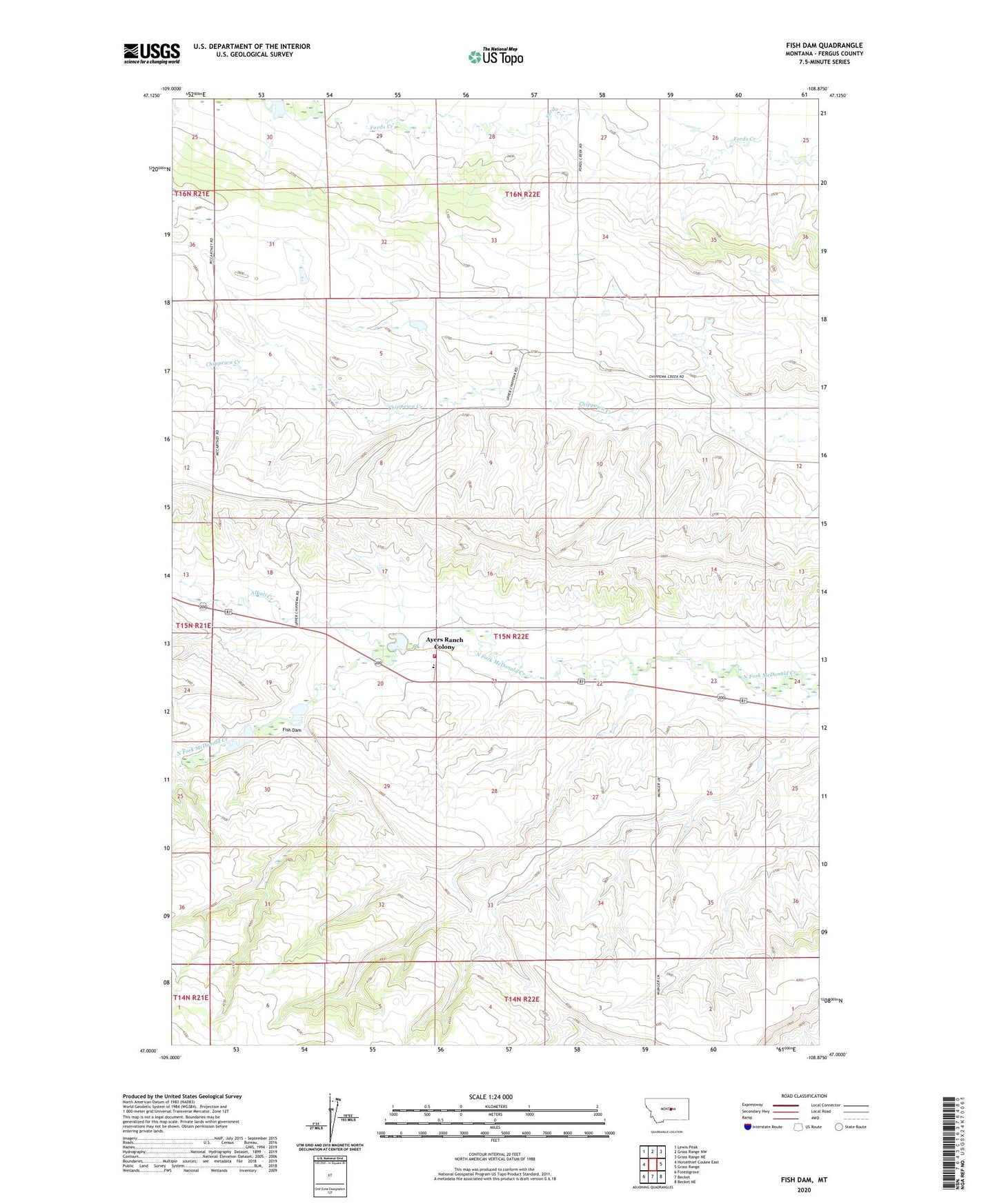
2024 topographic map quadrangle Fish Dam in the state of Montana. Scale: 1:24000. Based on the newly updated USGS 7.5' US Topo map series, this map is in the following counties: Fergus. The map contains contour data, water features, and other items you are used to seeing on USGS maps, but also has updated roads and other features. This is the next generation of topographic maps. Printed on high-quality waterproof paper with UV fade-resistant inks.
Quads adjacent to this one:
West: Horsethief Coulee East
Northwest: Lewis Peak
North: Grass Range NW
Northeast: Grass Range NE
East: Grass Range
Southeast: Becket NE
South: Becket
Southwest: Forestgrove
This map covers the same area as the classic USGS quad with code o47108a8.
Contains the following named places: 15N22E01BCC_01 Well, 15N22E29ADA_01 Well, 16N22E05DDB_01 Well, 16N22E35DDA_01 Well, Alkali Creek, Ayers Ranch Colony, Ayers Ranch Colony Census Designated Place, Ayers School, Cheadle Fire District, Chippewa, Chippewa School, Dryland, Drylander School, Fish Dam, Ford Dam, Irrigation Dam, Red Dam, Ruseteum Dam, Sheep Dam