MyTopo
Belmont Montana US Topo Map
Couldn't load pickup availability
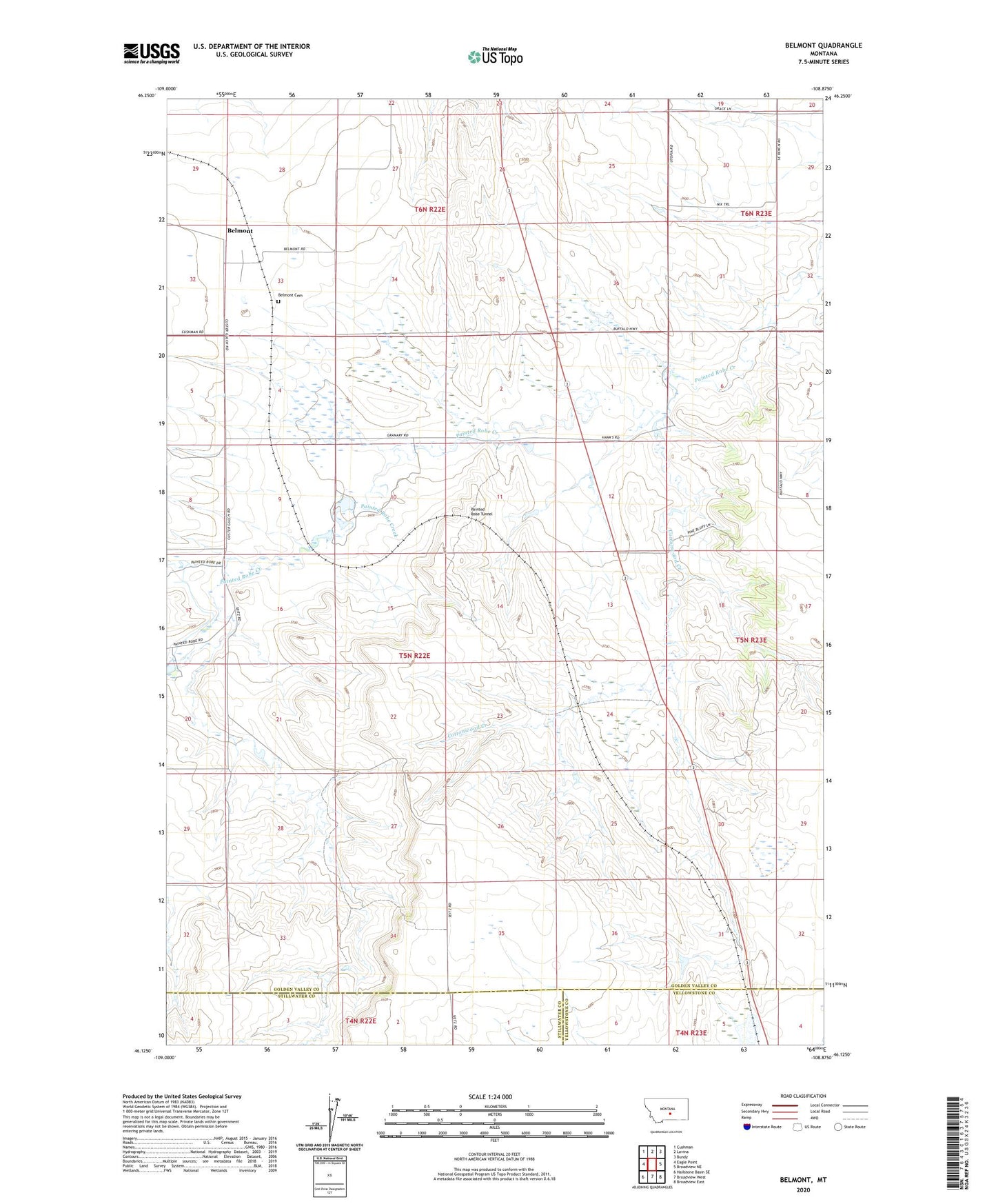
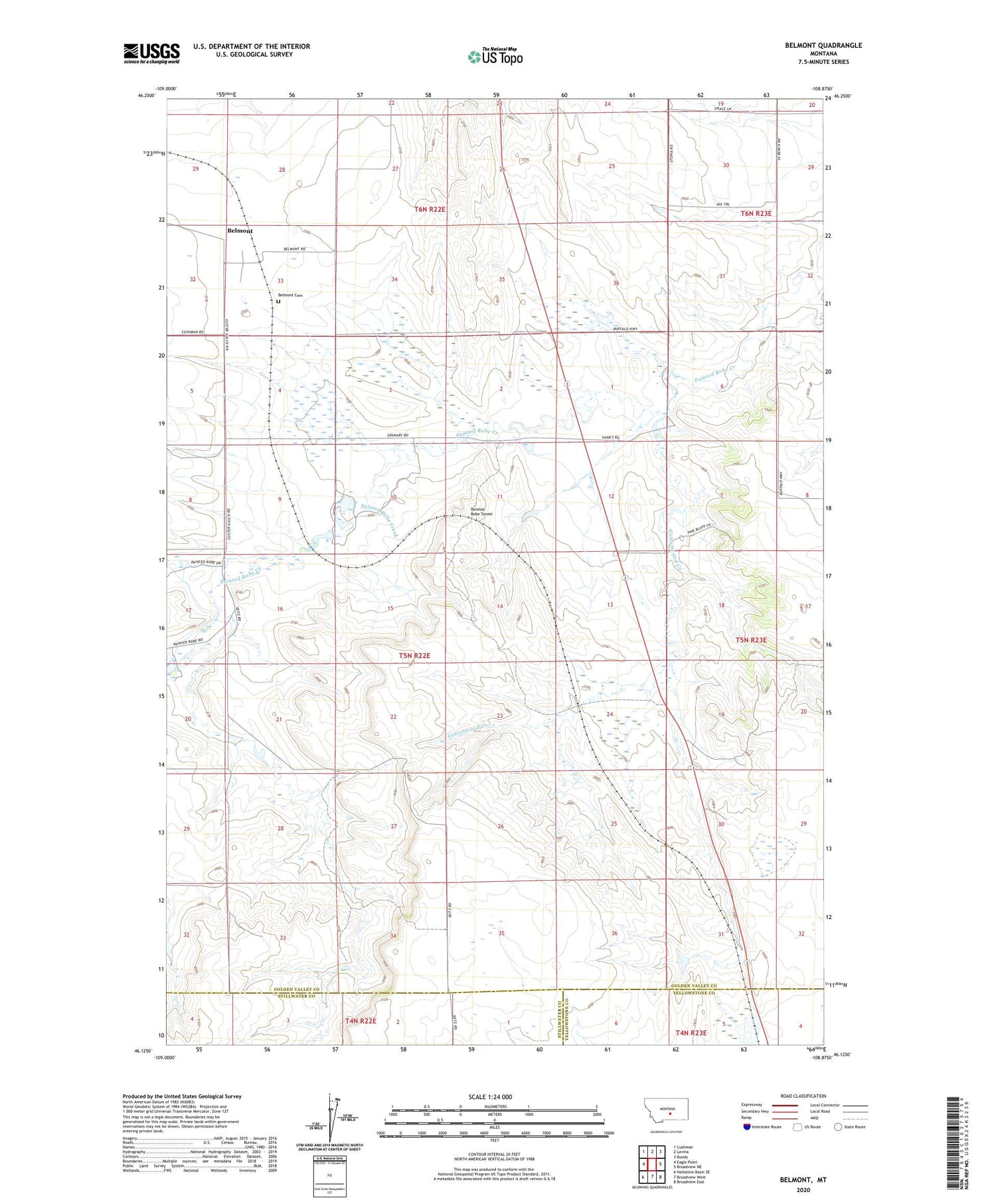
2020 topographic map quadrangle Belmont in the state of Montana. Scale: 1:24000. Based on the newly updated USGS 7.5' US Topo map series, this map is in the following counties: Golden Valley, Stillwater, Yellowstone. The map contains contour data, water features, and other items you are used to seeing on USGS maps, but also has updated roads and other features. This is the next generation of topographic maps. Printed on high-quality waterproof paper with UV fade-resistant inks.
Quads adjacent to this one:
West: Eagle Point
Northwest: Cushman
North: Lavina
Northeast: Bundy
East: Broadview NE
Southeast: Broadview East
South: Broadview West
Southwest: Hailstone Basin SE
Contains the following named places: 04N22E03BADD01 Well, 05N22E15BAC_01 Well, 05N22E34BCBD01 Well, 05N23E06BBDD01 Well, 06N22E02D___01 Well, Alkali Pond, Belmont, Belmont Cemetery, Belmont Lutheran Church, Belmont Post Office, Belmont School, Conover Number 1 Dam, Cottonwood Creek, Heikens Number 1 Dam, Heikens Number 2 Dam, Painted Robe, Painted Robe Tunnel