MyTopo
Bundy Montana US Topo Map
Couldn't load pickup availability
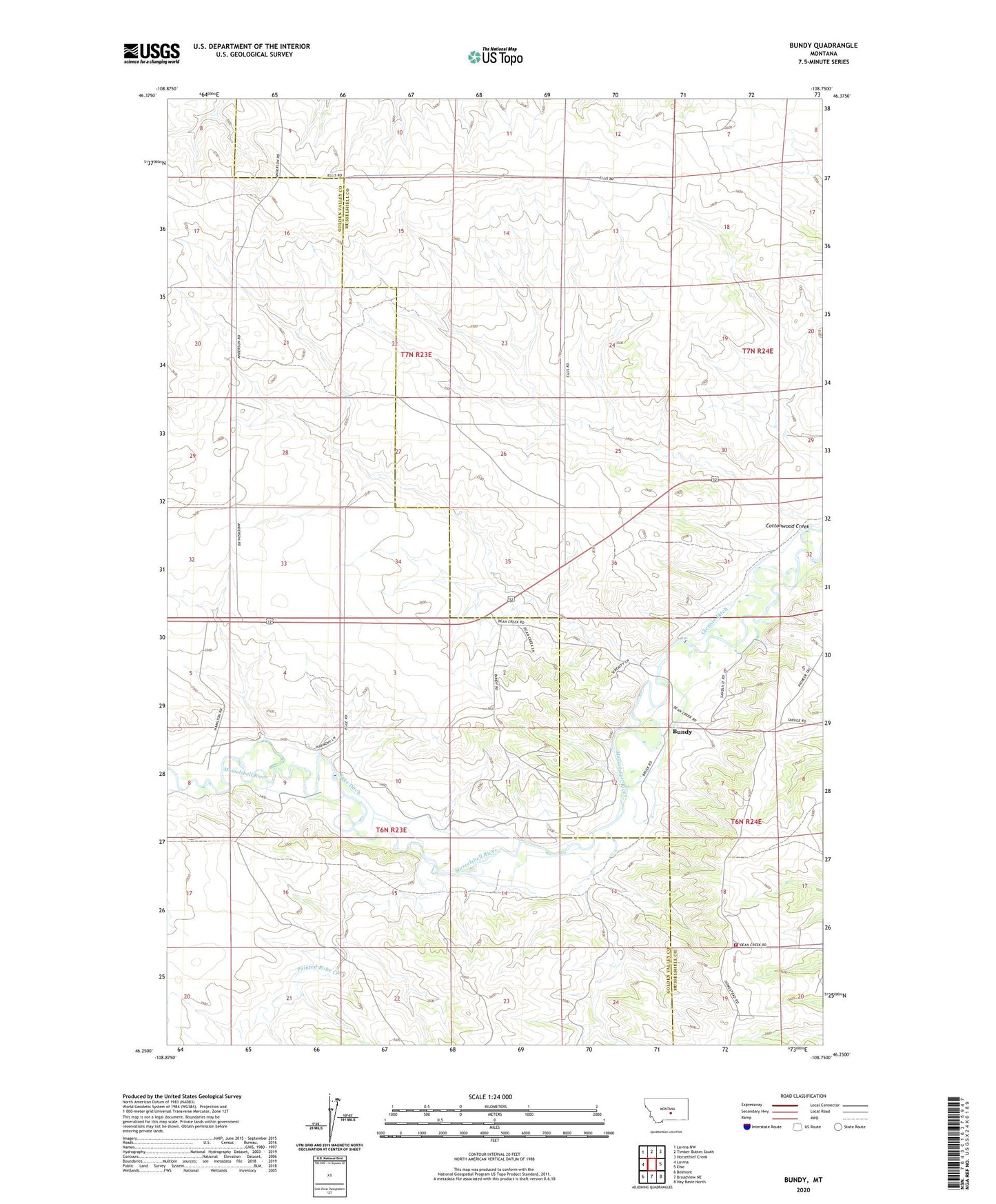
2024 topographic map quadrangle Bundy in the state of Montana. Scale: 1:24000. Based on the newly updated USGS 7.5' US Topo map series, this map is in the following counties: Musselshell, Golden Valley. The map contains contour data, water features, and other items you are used to seeing on USGS maps, but also has updated roads and other features. This is the next generation of topographic maps. Printed on high-quality waterproof paper with UV fade-resistant inks.
Quads adjacent to this one:
West: Lavina
Northwest: Lavina NW
North: Timber Buttes South
Northeast: Horsethief Creek
East: Elso
Southeast: Hay Basin North
South: Broadview NE
Southwest: Belmont
This map covers the same area as the classic USGS quad with code o46108c7.
Contains the following named places: 06N22E02AC__01 Well, 06N23E01CBDB01 Well, 06N23E02ACAD01 Well, 06N23E02CBAA01 Well, 06N24E06ADDD01 Well, 06N24E08C___01 Well, 06N24E18DCCD01 Well, 07N23E25BBCC01 Well, 07N23E27DBDC01 Well, 07N23E33AABA01 Well, Bundy, Bundy Post Office, Bundy School, Cottonwood Creek, Dean Creek Community Association Volunteer Fire Department, Egge Ditch, Glennie Ditch, Painted Robe Creek