
MyTopo
Bennett Lake NW Montana US Topo Map
Couldn't load pickup availability
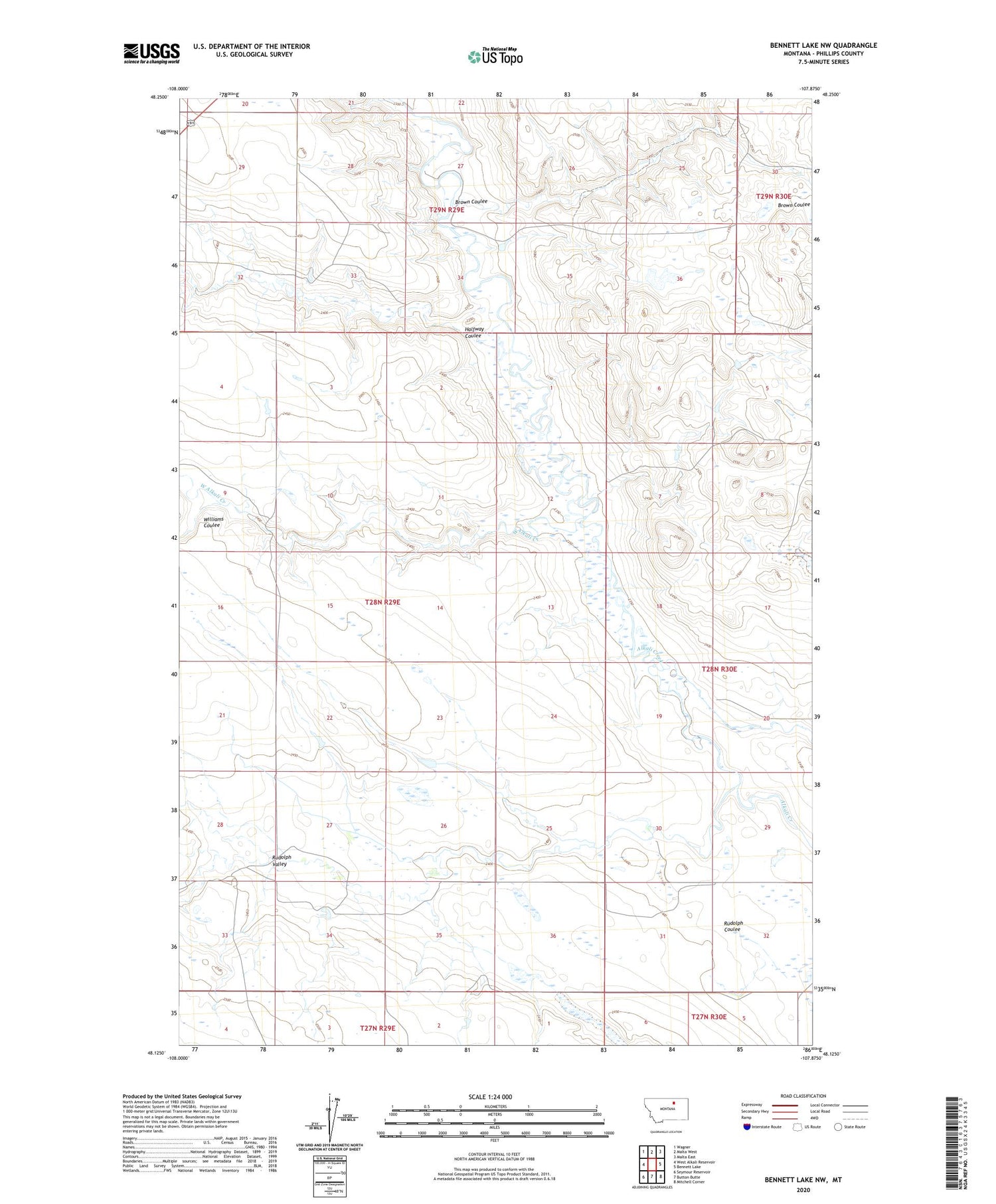
2020 topographic map quadrangle Bennett Lake NW in the state of Montana. Scale: 1:24000. Based on the newly updated USGS 7.5' US Topo map series, this map is in the following counties: Phillips. The map contains contour data, water features, and other items you are used to seeing on USGS maps, but also has updated roads and other features. This is the next generation of topographic maps. Printed on high-quality waterproof paper with UV fade-resistant inks.
Quads adjacent to this one:
West: West Alkali Reservoir
Northwest: Wagner
North: Malta West
Northeast: Malta East
East: Bennett Lake
Southeast: Mitchell Corner
South: Button Butte
Southwest: Seymour Reservoir
Contains the following named places: Alkali School, Brown Coulee, Halfway Coulee, Rudolph Coulee, Rudolph Valley, Slim Dam, West Alkali Creek, Williams Coulee


