MyTopo
Bennett Lake Montana US Topo Map
Couldn't load pickup availability
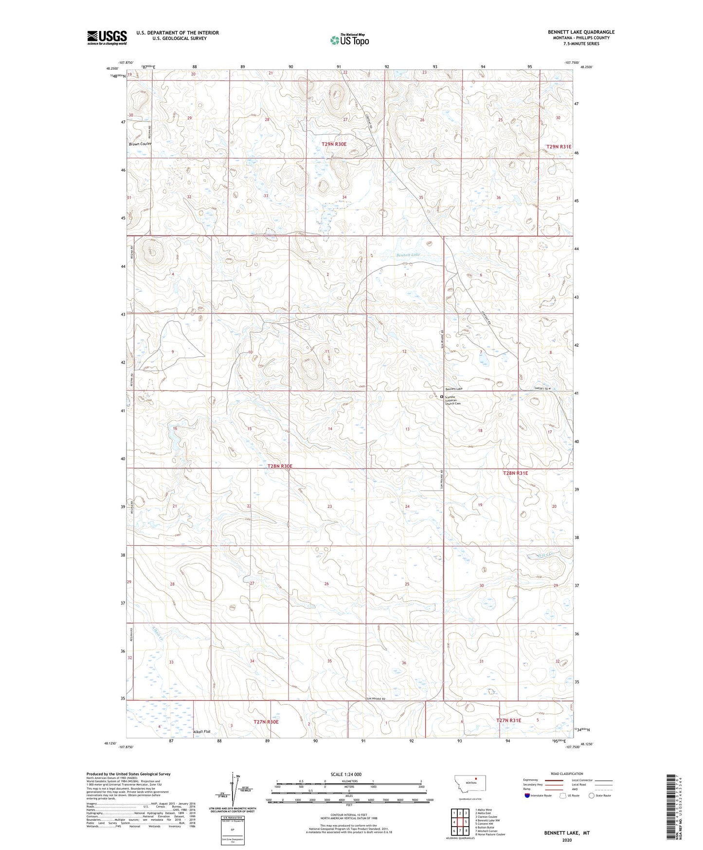
2024 topographic map quadrangle Bennett Lake in the state of Montana. Scale: 1:24000. Based on the newly updated USGS 7.5' US Topo map series, this map is in the following counties: Phillips. The map contains contour data, water features, and other items you are used to seeing on USGS maps, but also has updated roads and other features. This is the next generation of topographic maps. Printed on high-quality waterproof paper with UV fade-resistant inks.
Quads adjacent to this one:
West: Bennett Lake NW
Northwest: Malta West
North: Malta East
Northeast: Clanton Coulee
East: Content NW
Southeast: Horse Pasture Coulee
South: Mitchell Corner
Southwest: Button Butte
This map covers the same area as the classic USGS quad with code o48107b7.
Contains the following named places: 29N30E27DCD_01 Well, Bennett Lake, Busy Bee School, Colen Dam, Higdem School, Lefdehl Dam, Nordberg School, Robinson Dam, Scandia Lutheran Church, Scandia Lutheran Church Cemetery, Solberg Slough, South Bench School