MyTopo
Big Dry School Montana US Topo Map
Couldn't load pickup availability
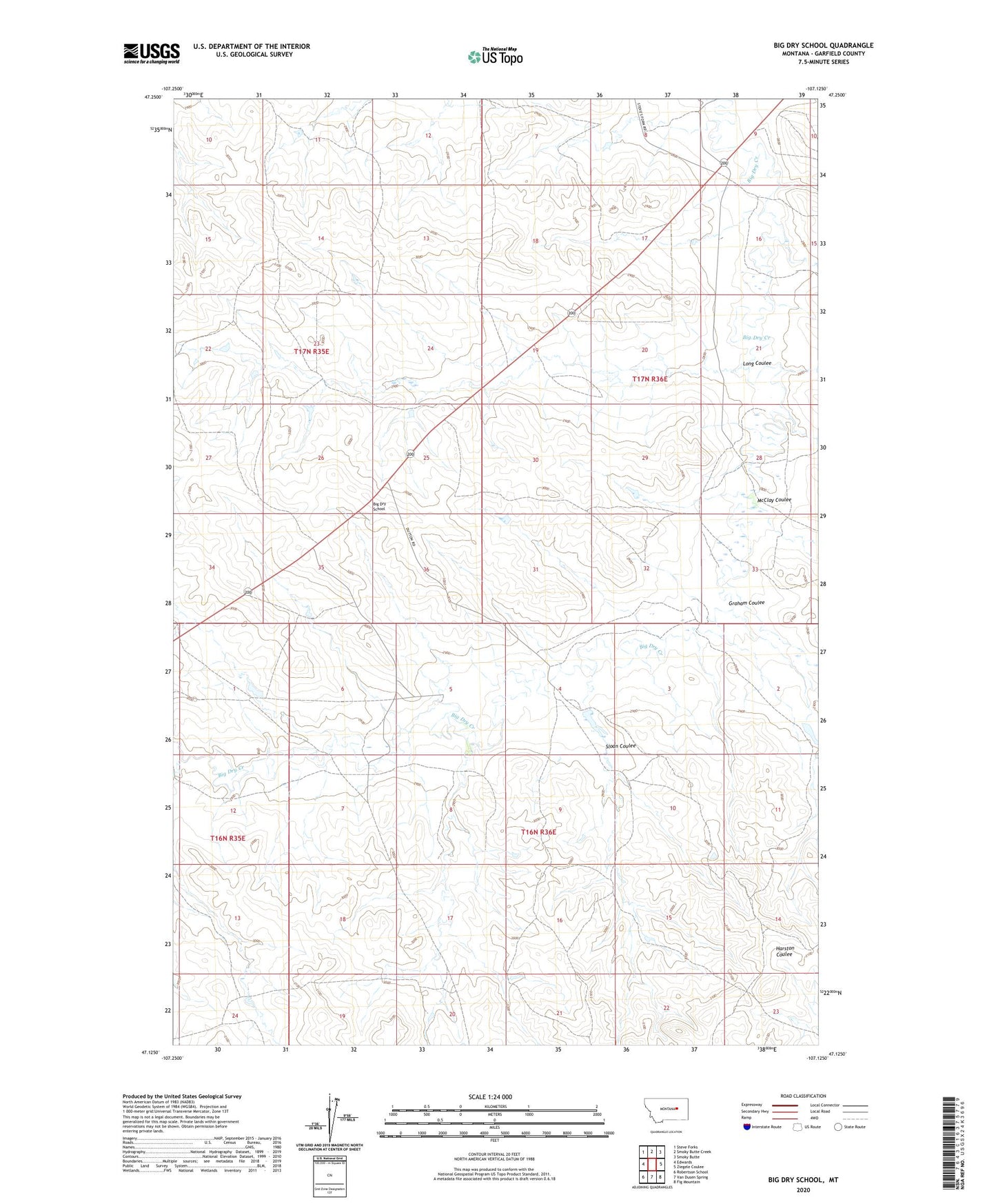
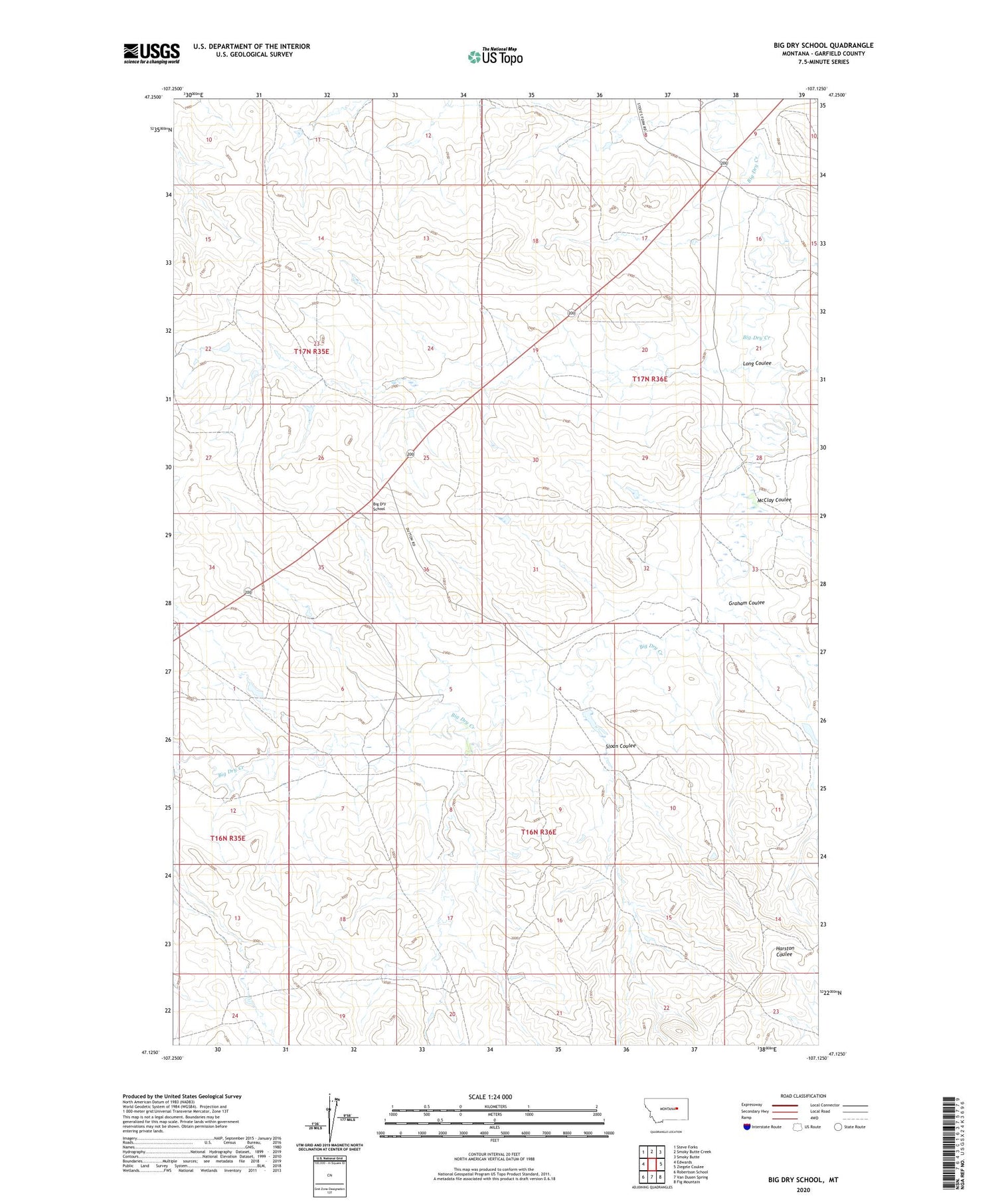
2020 topographic map quadrangle Big Dry School in the state of Montana. Scale: 1:24000. Based on the newly updated USGS 7.5' US Topo map series, this map is in the following counties: Garfield. The map contains contour data, water features, and other items you are used to seeing on USGS maps, but also has updated roads and other features. This is the next generation of topographic maps. Printed on high-quality waterproof paper with UV fade-resistant inks.
Quads adjacent to this one:
West: Edwards
Northwest: Steve Forks
North: Smoky Butte Creek
Northeast: Smoky Butte
East: Ziegele Coulee
Southeast: Fig Mountain
South: Van Dusen Spring
Southwest: Robertson School
Contains the following named places: 16N36E11CDDD01 Well, 17N35E12CCBB01 Well, Big Dry School, Friel Post Office, Graham Coulee, Hooker Dam, Jarden Reservoir Dam, Long Coulee, McClay Coulee, School Number 1 Dam, School Number 2 Dam, Sloan Coulee, Tom Number 1 Dam