MyTopo
Smoky Butte Montana US Topo Map
Couldn't load pickup availability
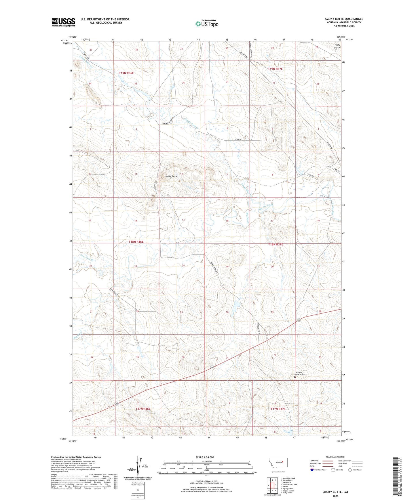
2024 topographic map quadrangle Smoky Butte in the state of Montana. Scale: 1:24000. Based on the newly updated USGS 7.5' US Topo map series, this map is in the following counties: Garfield. The map contains contour data, water features, and other items you are used to seeing on USGS maps, but also has updated roads and other features. This is the next generation of topographic maps. Printed on high-quality waterproof paper with UV fade-resistant inks.
Quads adjacent to this one:
West: Smoky Butte Creek
Northwest: Moonlight Creek
North: Biscuit Butte
Northeast: Jordan NW
East: Jordan
Southeast: Darby Buttes
South: Ziegele Coulee
Southwest: Big Dry School
This map covers the same area as the classic USGS quad with code o47107c1.
Contains the following named places: 18N37E31AB__01 Well, Big Mac Number 1 Dam, Brusett Dam, Lone Tree Creek, Smoky Butte, Smoky Butte Creek, The Zions Lutheran Cemetery