MyTopo
Birdseye Spring Montana US Topo Map
Couldn't load pickup availability
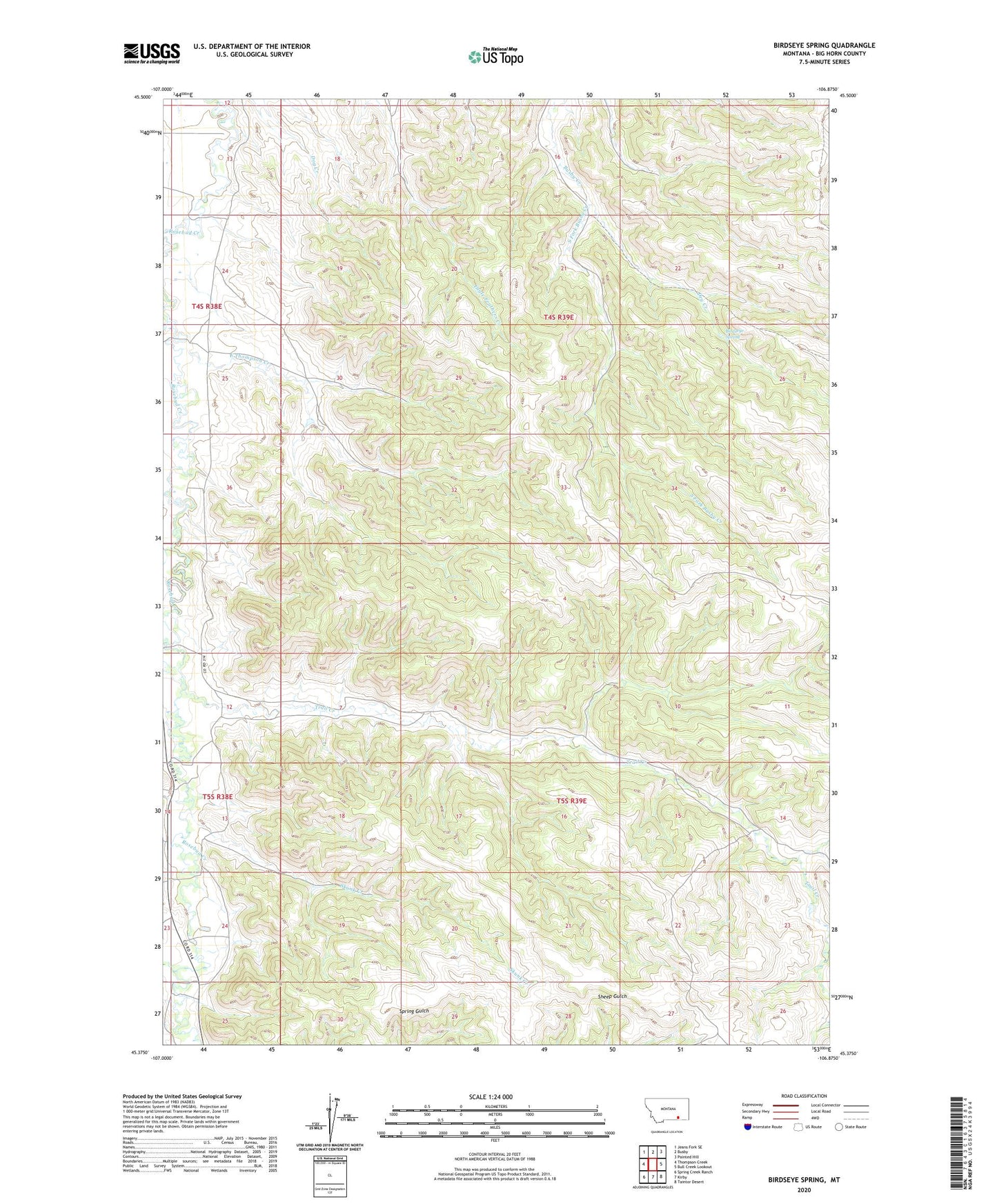
2020 topographic map quadrangle Birdseye Spring in the state of Montana. Scale: 1:24000. Based on the newly updated USGS 7.5' US Topo map series, this map is in the following counties: Big Horn. The map contains contour data, water features, and other items you are used to seeing on USGS maps, but also has updated roads and other features. This is the next generation of topographic maps. Printed on high-quality waterproof paper with UV fade-resistant inks.
Quads adjacent to this one:
West: Thompson Creek
Northwest: Jeans Fork SE
North: Busby
Northeast: Painted Hill
East: Bull Creek Lookout
Southeast: Taintor Desert
South: Kirby
Southwest: Spring Creek Ranch
Contains the following named places: 04S38E13ABBC01 Well, 04S38E36BCBA01 Well, 04S38E36BCBB01 Well, 04S38E36BCBD01 Well, 04S39E16BDBD01 Well, 05S39E07ACDD01 Well, 59016, Birdseye Spring, Corral Creek, Dry Creek, East Thompson Creek, Hutton Post Office, Pine Creek, Skunk Creek, South Fork Busby Creek, Thompson Creek, Trail Creek, Wolf Creek