MyTopo
Kirby Montana US Topo Map
Couldn't load pickup availability
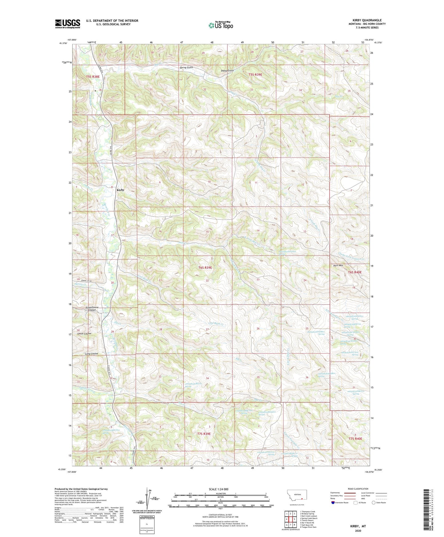
2024 topographic map quadrangle Kirby in the state of Montana. Scale: 1:24000. Based on the newly updated USGS 7.5' US Topo map series, this map is in the following counties: Big Horn. The map contains contour data, water features, and other items you are used to seeing on USGS maps, but also has updated roads and other features. This is the next generation of topographic maps. Printed on high-quality waterproof paper with UV fade-resistant inks.
Quads adjacent to this one:
West: Spring Creek Ranch
Northwest: Thompson Creek
North: Birdseye Spring
Northeast: Bull Creek Lookout
East: Taintor Desert
Southeast: Tongue River Dam
South: Half Moon Hill
Southwest: Bar V Ranch NE
This map covers the same area as the classic USGS quad with code o45106c8.
Contains the following named places: 05S38E36CAAB01 Well, 05S38E36CAAB02 Well, 06S39E08DBBD01 Well, 06S39E15CCC_01 Well, 06S39E15DDBC01 Well, 06S39E17BDBC01 Well, 06S39E17CDAC01 Well, 06S39E20ABD_01 Well, 06S39E23AAAA01 Spring, 06S39E25ACD_01 Well, 06S39E25DADB01 Spring, 06S39E26AABB01 Well, 06S39E34CBCC01 Spring, 06S39E36ACDB01 Spring, 06S40E30BACC01 Spring, 06S40E30BADD01 Spring, 06S40E30CAAA01 Spring, 06S40E30CBAA01 Spring, 06S40E30DCCA01 Spring, 06S40E31DBCC01 Spring, 07S39E01DCA_01 Well, 07S39E02BBCA01 Spring, 07S39E02BDAD01 Spring, 07S39E02DDCC01 Spring, 07S39E05BDCD01 Spring, 07S39E11AAC_01 Well, 07S39E12BAB_01 Spring, Cache Creek, Coal Bank Creek, Dale Creek, Dry Creek, Elk Creek, Elk Creek School, Horn Mountain, Indian Creek, Kirby, Kirby Post Office, Log School, Long Coulee, North Fork Dale Creek, Saint Francis Church, Schoolhouse Coulee, Sheep Gulch, Smith Coulee, South Fork Dale Creek, South Fork Dry Creek, Spring Creek, Spring Gulch