MyTopo
Spring Creek Ranch Montana US Topo Map
Couldn't load pickup availability
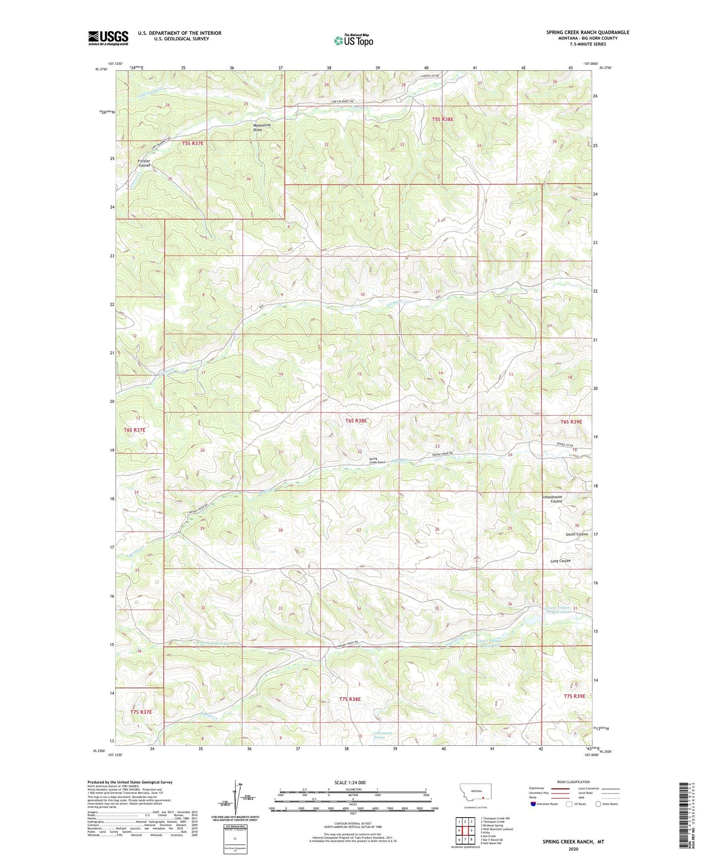
2024 topographic map quadrangle Spring Creek Ranch in the state of Montana. Scale: 1:24000. Based on the newly updated USGS 7.5' US Topo map series, this map is in the following counties: Big Horn. The map contains contour data, water features, and other items you are used to seeing on USGS maps, but also has updated roads and other features. This is the next generation of topographic maps. Printed on high-quality waterproof paper with UV fade-resistant inks.
Quads adjacent to this one:
West: Wolf Mountain Lookout
Northwest: Thompson Creek NW
North: Thompson Creek
Northeast: Birdseye Spring
East: Kirby
Southeast: Half Moon Hill
South: Bar V Ranch NE
Southwest: Kid Creek
This map covers the same area as the classic USGS quad with code o45107c1.
Contains the following named places: Commissary Springs, Fritzler Coulee, Little Corral Creek, Lower Indian Creek Reservoir, Lower Indian Creek Reservoir Dam, Moonshine Draw, North Fork Indian Creek, Spring Creek Ranch, Upper Indian Creek Reservoir