MyTopo
Biscuit Butte Montana US Topo Map
Couldn't load pickup availability
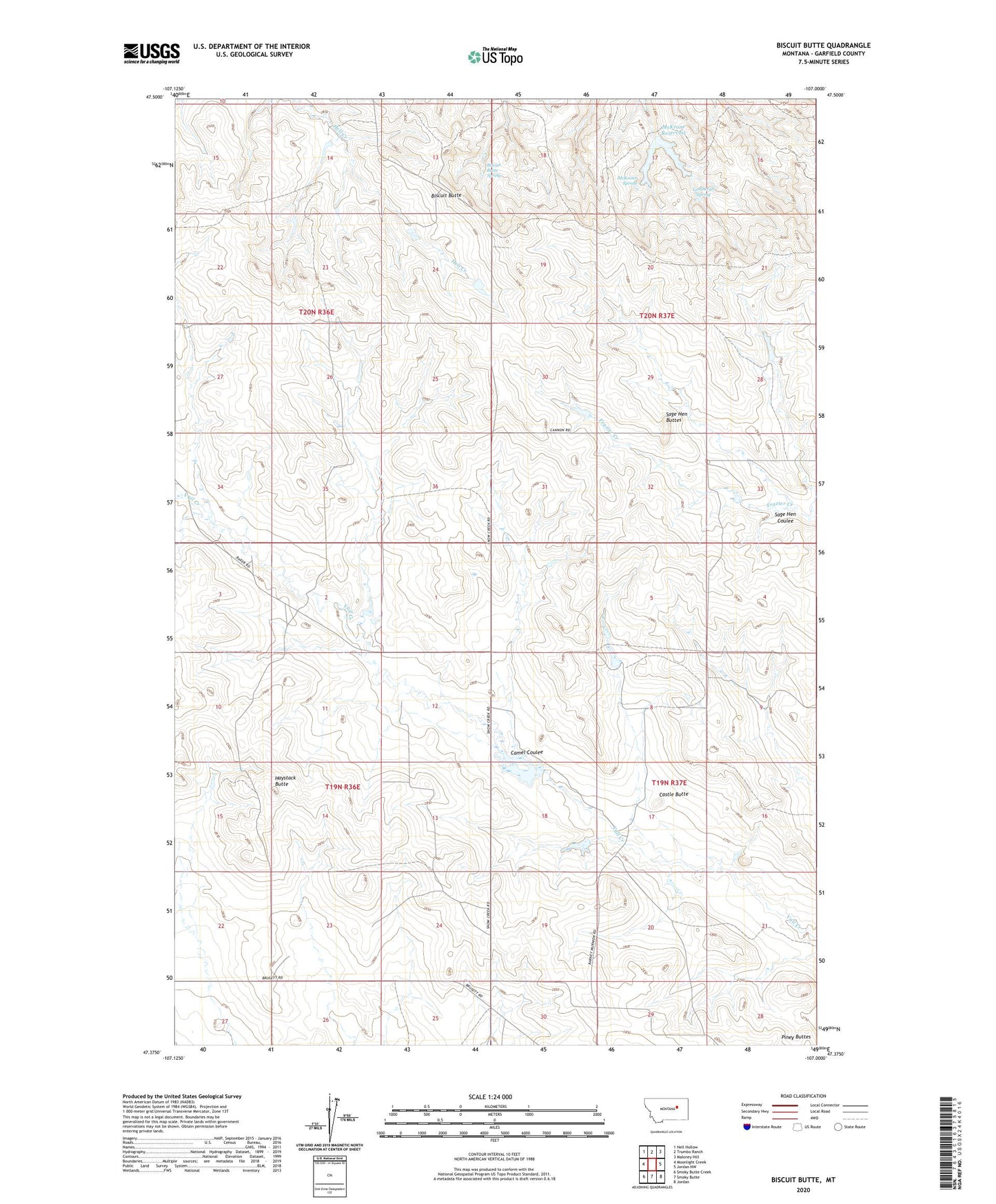
2020 topographic map quadrangle Biscuit Butte in the state of Montana. Scale: 1:24000. Based on the newly updated USGS 7.5' US Topo map series, this map is in the following counties: Garfield. The map contains contour data, water features, and other items you are used to seeing on USGS maps, but also has updated roads and other features. This is the next generation of topographic maps. Printed on high-quality waterproof paper with UV fade-resistant inks.
Quads adjacent to this one:
West: Moonlight Creek
Northwest: Hell Hollow
North: Trumbo Ranch
Northeast: Maloney Hill
East: Jordan NW
Southeast: Jordan
South: Smoky Butte
Southwest: Smoky Butte Creek
Contains the following named places: 19N36E03AA__01 Well, 20N36E27CCA_01 Well, B Murion Number 3 Dam, Biscuit Butte, Biscuit Butte Spring, Camel Coulee, Castle Butte, Engdahl Number 3 Dam, Fannon Number 1 Dam, Fannon Number 2 Dam, Finger Butte Post Office, Haystack Butte, Lehner Dam, Lindbergh Spring, McKrone Reservoir, McKrone Spring, Murion B Number 2 Dam, Murnion Dam, North Garfield Division, Sage Hen Buttes, Sage Hen Coulee