MyTopo
Jordan Montana US Topo Map
Couldn't load pickup availability
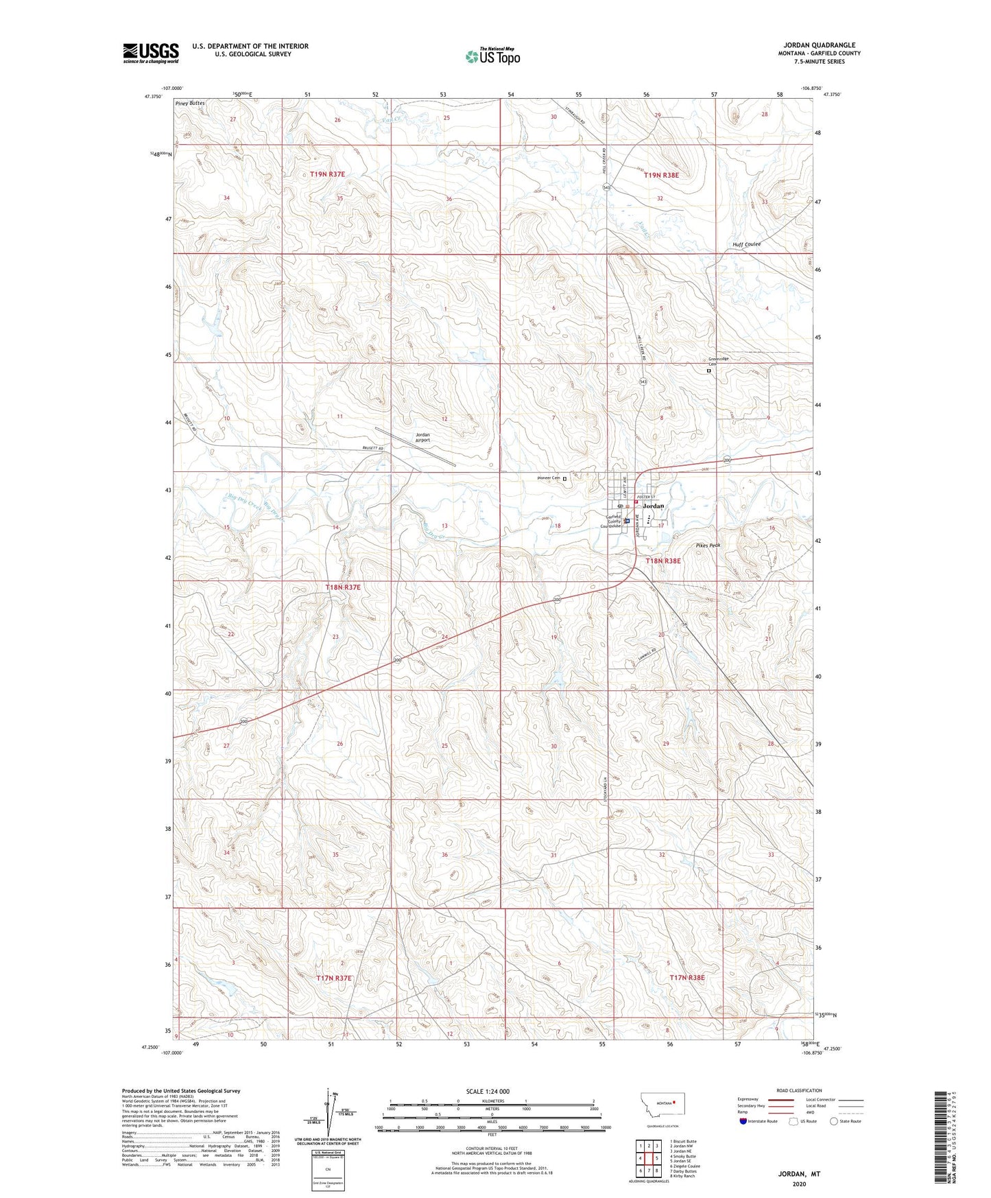
2024 topographic map quadrangle Jordan in the state of Montana. Scale: 1:24000. Based on the newly updated USGS 7.5' US Topo map series, this map is in the following counties: Garfield. The map contains contour data, water features, and other items you are used to seeing on USGS maps, but also has updated roads and other features. This is the next generation of topographic maps. Printed on high-quality waterproof paper with UV fade-resistant inks.
Quads adjacent to this one:
West: Smoky Butte
Northwest: Biscuit Butte
North: Jordan NW
Northeast: Jordan NE
East: Jordan SE
Southeast: Kirby Ranch
South: Darby Buttes
Southwest: Ziegele Coulee
This map covers the same area as the classic USGS quad with code o47106c8.
Contains the following named places: 18N38E17B___01 Well, 18N38E17B___02 Well, 18N38E18AACC01 Well, 18N38E20BBAB01 Well, 19N38E31A___01 Well, Assembly of God Church, Coleman Number 1 Dam, Community Presbyterian Church, Garfield County, Garfield County Ambulance, Garfield County Courthouse, Garfield County Fairground, Garfield County Health Center - Hospital, Garfield County High School, Garfield County Library, Garfield County Museum, Garfield County Sheriff's Office, Greenridge Cemetery, Happy Jack Number 1 Dam, Huff Coulee, Indian Country Historical Marker, John Boy Number 2 Dam, Jordan, Jordan Airport, Jordan Elementary School, Jordan Mobile Home Park, Jordan Post Office, Jordan Seventh Day Adventist Church, Jordan Volunteer Fire Department, Kamp Katie, Kariotis Park, Mister PP Dam, Panwitz Park, Pikes Peak, Pioneer Cemetery, Saint John the Baptist Church, Saint Johns Evangelical Lutheran Church, The Church of Jesus Christ of Latter Day Saints, Town of Jordan, Willems Park, Woodland Park