MyTopo
Maloney Hill Montana US Topo Map
Couldn't load pickup availability
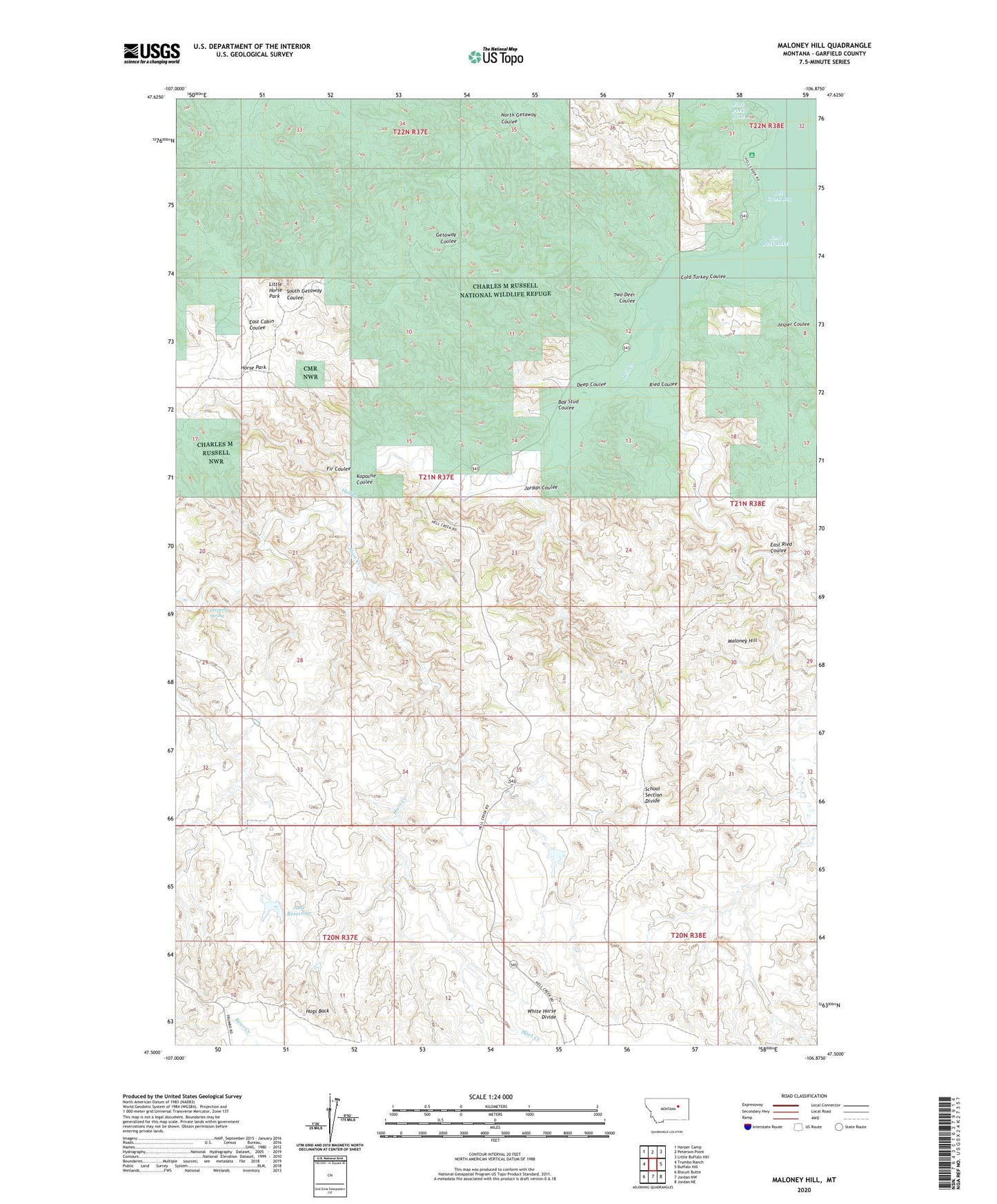
2024 topographic map quadrangle Maloney Hill in the state of Montana. Scale: 1:24000. Based on the newly updated USGS 7.5' US Topo map series, this map is in the following counties: Garfield. The map contains contour data, water features, and other items you are used to seeing on USGS maps, but also has updated roads and other features. This is the next generation of topographic maps. Printed on high-quality waterproof paper with UV fade-resistant inks.
Quads adjacent to this one:
West: Trumbo Ranch
Northwest: Harper Camp
North: Peterson Point
Northeast: Little Buffalo Hill
East: Buffalo Hill
Southeast: Jordan NE
South: Jordan NW
Southwest: Biscuit Butte
This map covers the same area as the classic USGS quad with code o47106e8.
Contains the following named places: Bay Stud Coulee, Cold Turkey Coulee, Deep Coulee, Dripping Spring, East Ried Coulee, Fir Coulee, Hart Creek, Hell Creek, Hell Creek Recreation Area, Hell Creek State Park, Hogs Back, Horse Park, Jade Reservoir, Jasper Coulee, Jordan Coulee, Kapache Coulee, Little Horse Park, Maloney Hill, Manaige Spring, Ried Coulee, School Section Divide, Two Deer Coulee, White Horse Divide