MyTopo
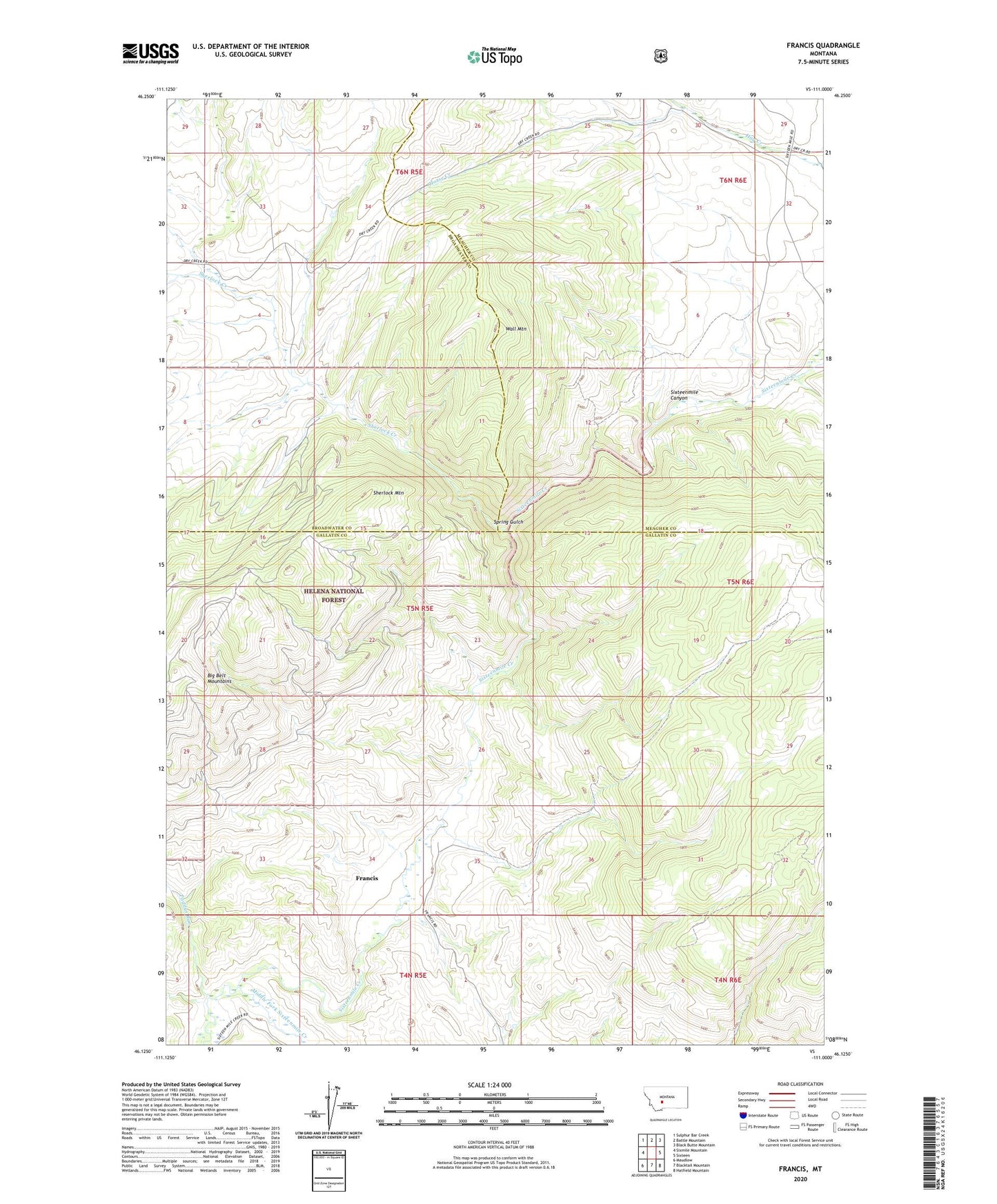
Francis Montana US Topo Map
Couldn't load pickup availability
Also explore the Francis Forest Service Topo of this same quad for updated USFS data
2024 topographic map quadrangle Francis in the state of Montana. Scale: 1:24000. Based on the newly updated USGS 7.5' US Topo map series, this map is in the following counties: Gallatin, Meagher, Broadwater. The map contains contour data, water features, and other items you are used to seeing on USGS maps, but also has updated roads and other features. This is the next generation of topographic maps. Printed on high-quality waterproof paper with UV fade-resistant inks.
Quads adjacent to this one:
West: Sixmile Mountain
Northwest: Sulphur Bar Creek
North: Battle Mountain
Northeast: Black Butte Mountain
East: Sixteen
Southeast: Hatfield Mountain
South: Blacktail Mountain
Southwest: Maudlow
This map covers the same area as the classic USGS quad with code o46111b1.
Contains the following named places: A Doig Ranch, Canyon, Christison Ranch, Doig Ranch, Francis, Francis Post Office, Francis Ranch, Francis School, Horse Creek, Middle Fork Sixteenmile Creek, Mitchell Ranch, Paddys Run, Sherlock Creek, Sherlock Mountain, Spring Gulch, Wall Mountain