MyTopo
Black Hills Montana US Topo Map
Couldn't load pickup availability
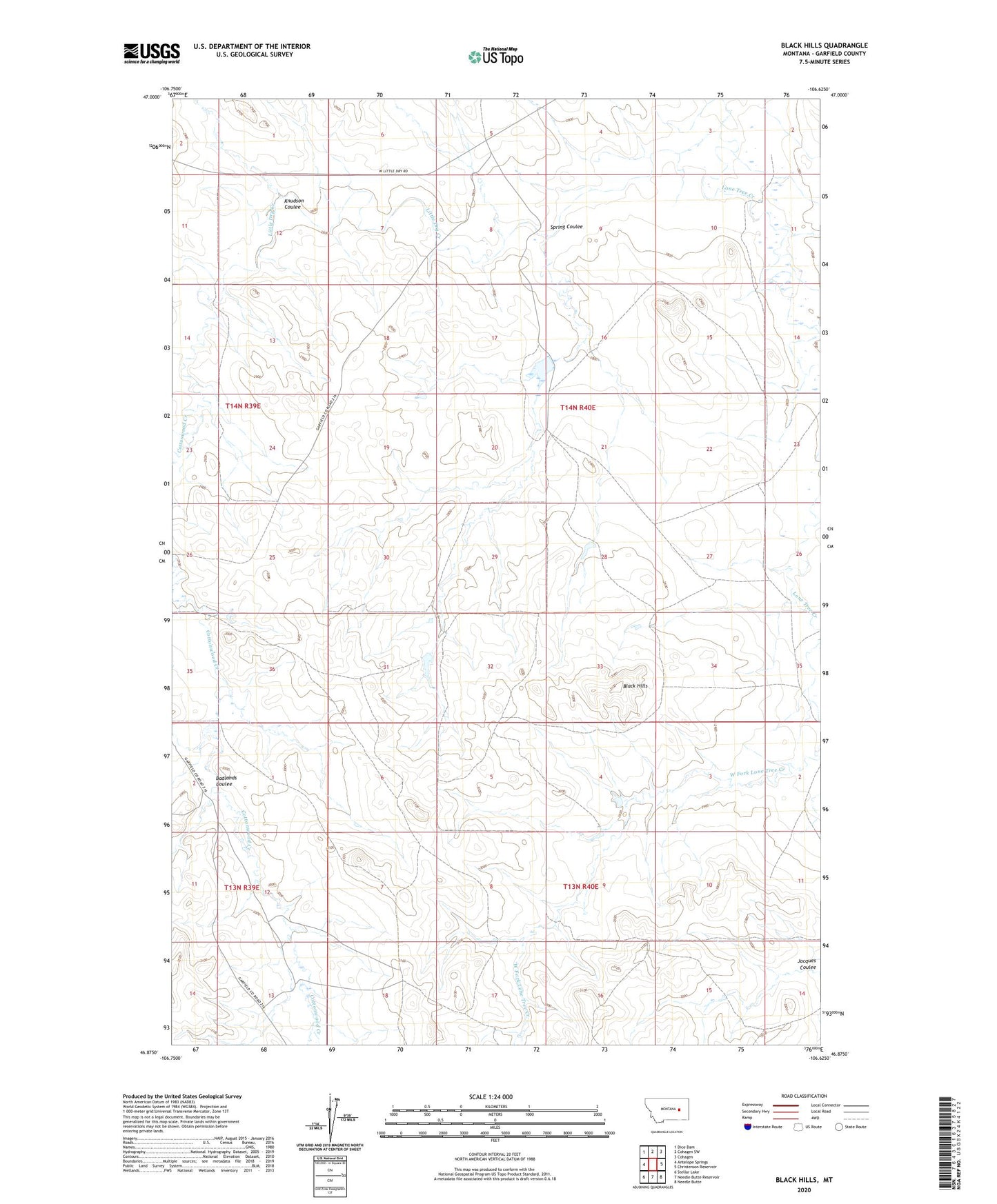
2024 topographic map quadrangle Black Hills in the state of Montana. Scale: 1:24000. Based on the newly updated USGS 7.5' US Topo map series, this map is in the following counties: Garfield. The map contains contour data, water features, and other items you are used to seeing on USGS maps, but also has updated roads and other features. This is the next generation of topographic maps. Printed on high-quality waterproof paper with UV fade-resistant inks.
Quads adjacent to this one:
West: Antelope Springs
Northwest: Dice Dam
North: Cohagen SW
Northeast: Cohagen
East: Christenson Reservoir
Southeast: Needle Butte
South: Needle Butte Reservoir
Southwest: Stellar Lake
This map covers the same area as the classic USGS quad with code o46106h6.
Contains the following named places: 14N40E07BCBD01 Well, Aybee Dam, Badlands Coulee, Beecher Number 1 Dam, Beecher Number 3 Dam, Black Hills, Bob Number 2 Dam, Bob Number 3 Dam, Cottonwood Creek, East Fork Post Office, Knudson Coulee, Lone Tree Creek, Smith Ranch 2 Dam, Smith Ranch Number 1 Dam, Smith Ranch Number 5 Dam, Spring Coulee