MyTopo
Needle Butte Reservoir Montana US Topo Map
Couldn't load pickup availability
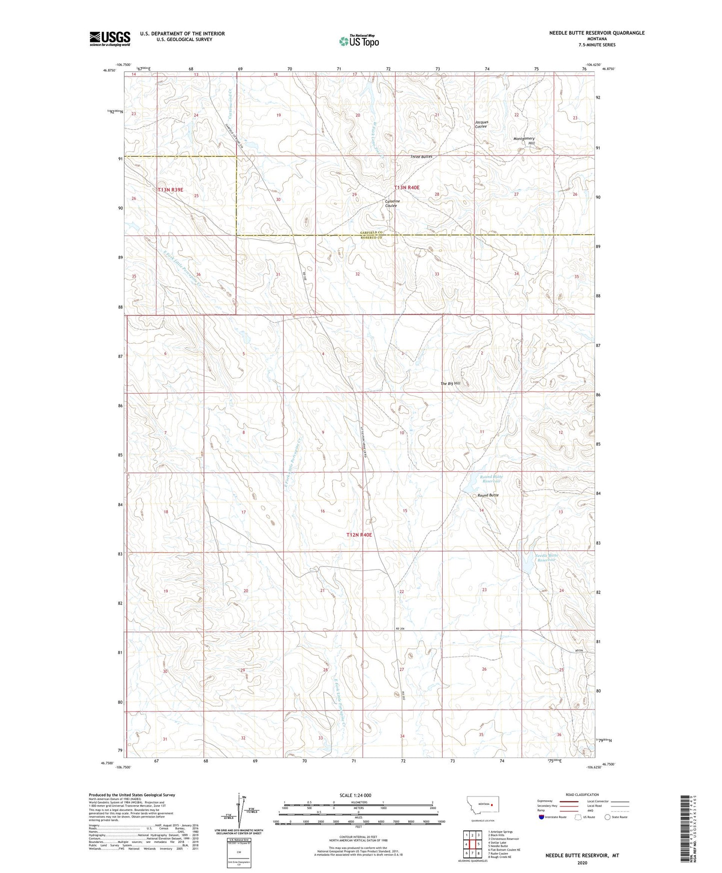
2024 topographic map quadrangle Needle Butte Reservoir in the state of Montana. Scale: 1:24000. Based on the newly updated USGS 7.5' US Topo map series, this map is in the following counties: Rosebud, Garfield. The map contains contour data, water features, and other items you are used to seeing on USGS maps, but also has updated roads and other features. This is the next generation of topographic maps. Printed on high-quality waterproof paper with UV fade-resistant inks.
Quads adjacent to this one:
West: Stellar Lake
Northwest: Antelope Springs
North: Black Hills
Northeast: Christenson Reservoir
East: Needle Butte
Southeast: Rough Creek NE
South: Rudie Coulee
Southwest: Flat Bottom Coulee NE
This map covers the same area as the classic USGS quad with code o46106g6.
Contains the following named places: Beecher Number 4 Dam, Beecher Number 5 Dam, Le Poidevin Dam, McKensie Dam, Montgomery Hill, Needle Butte Reservoir, Needle Butte Reservoir Dam, Ringstveit Reservoir Dam, Round Butte, Round Butte Reservoir, Round Butte Reservoir Dam, Schessler Number 10 Dam, The Big Hill, Three Buttes