MyTopo
Blue Point Montana US Topo Map
Couldn't load pickup availability
Also explore the Blue Point Forest Service Topo of this same quad for updated USFS data
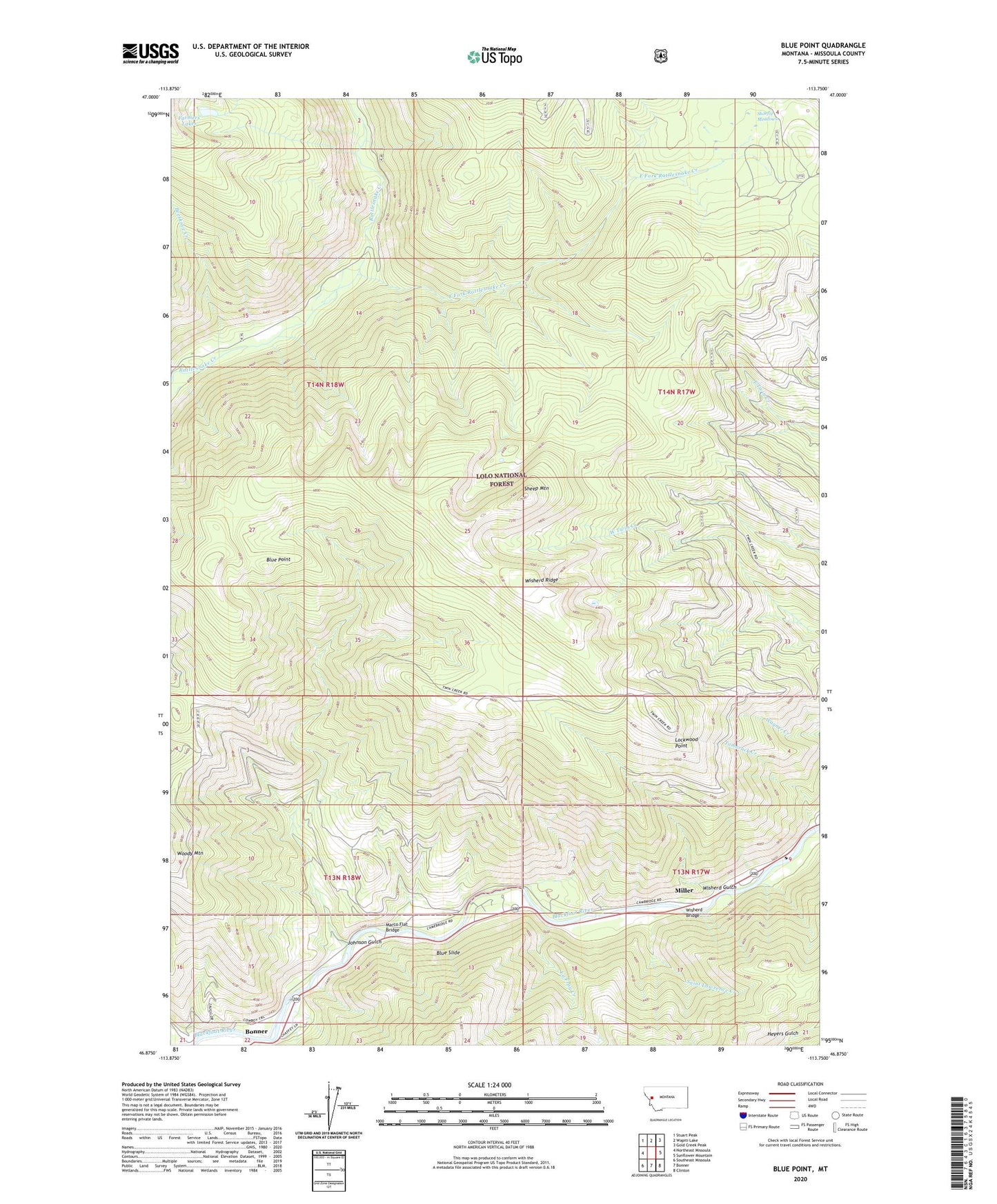
2024 topographic map quadrangle Blue Point in the state of Montana. Scale: 1:24000. Based on the newly updated USGS 7.5' US Topo map series, this map is in the following counties: Missoula. The map contains contour data, water features, and other items you are used to seeing on USGS maps, but also has updated roads and other features. This is the next generation of topographic maps. Printed on high-quality waterproof paper with UV fade-resistant inks.
Quads adjacent to this one:
West: Northeast Missoula
Northwest: Stuart Peak
North: Wapiti Lake
Northeast: Gold Creek Peak
East: Sunflower Mountain
Southeast: Clinton
South: Bonner
Southwest: Southeast Missoula
This map covers the same area as the classic USGS quad with code o46113h7.
Contains the following named places: Angevine Park Picnic Area, Beeskove Creek, Big Blackfoot Railway Historical Marker, Blue Point, Blue Slide, Blue Slide Campground, East Fork Rattlesnake Creek, Johnson Gulch, La Fray Creek, Lockwood Point, Marco Flat Bridge, Marco Flat Picnic Area, Marco Flats Fishing Access Site, Miller, Saint Lawrence Creek, Sheep Mountain, Shoofly Meadows, Tamarack Creek, Wisherd Bridge, Wisherd Gulch, Wisherd Ridge