
MyTopo
Bobcat Creek Montana US Topo Map
Couldn't load pickup availability
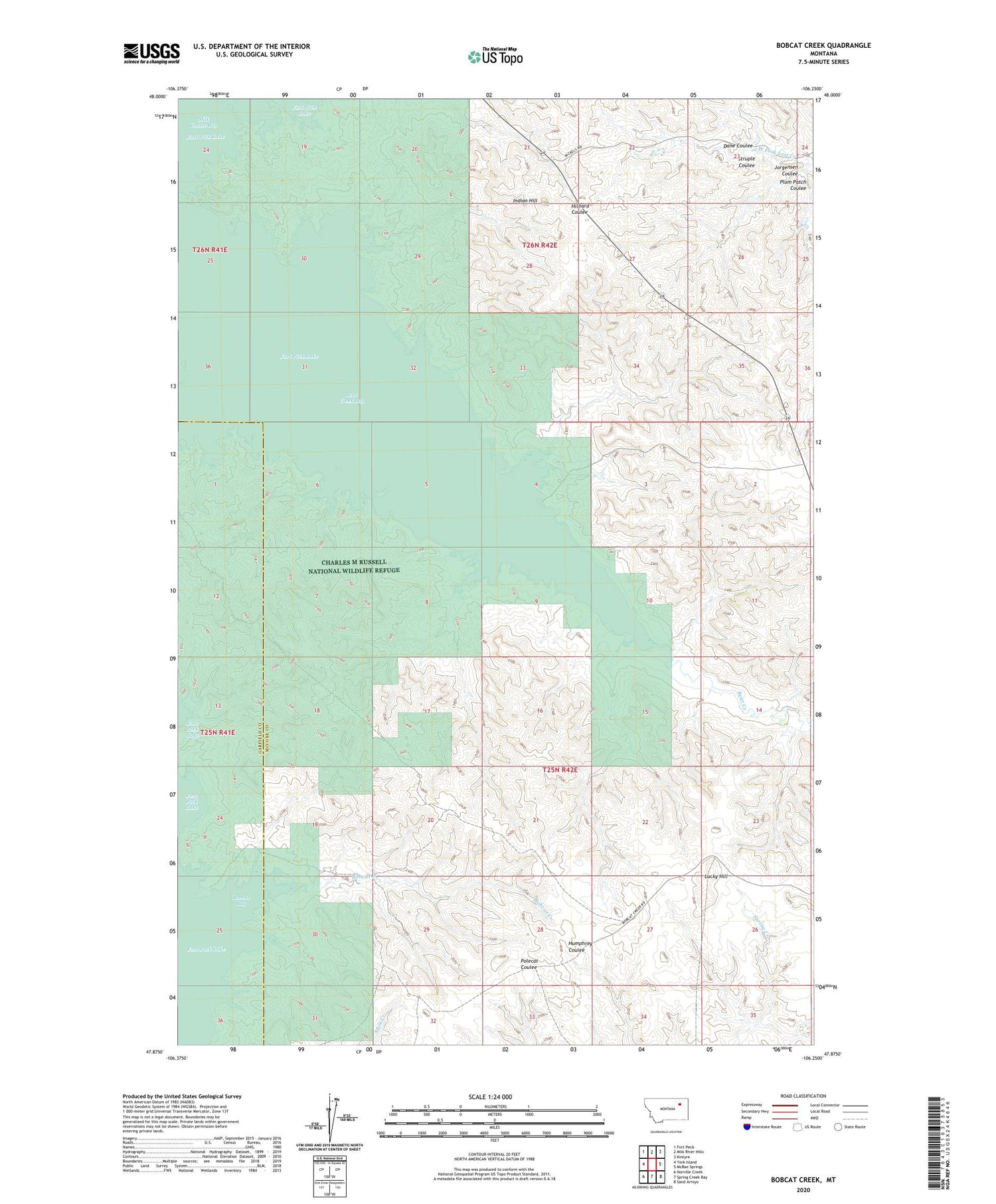
2020 topographic map quadrangle Bobcat Creek in the state of Montana. Scale: 1:24000. Based on the newly updated USGS 7.5' US Topo map series, this map is in the following counties: McCone, Garfield. The map contains contour data, water features, and other items you are used to seeing on USGS maps, but also has updated roads and other features. This is the next generation of topographic maps. Printed on high-quality waterproof paper with UV fade-resistant inks.
Quads adjacent to this one:
West: York Island
Northwest: Fort Peck
North: Milk River Hills
Northeast: Kintyre
East: McRae Springs
Southeast: Sand Arroyo
South: Spring Creek Bay
Southwest: Norville Creek
Contains the following named places: Bear Creek, Bear Creek Bay, Bear Creek Recreation Area, Bobcat Bay, Bobcat Creek, Dane Coulee, Indian Hill, Jorgensen Coulee, Lucky Hill, Plum Patch Coulee, Struple Coulee


