MyTopo
Bowery Peak Montana US Topo Map
Couldn't load pickup availability
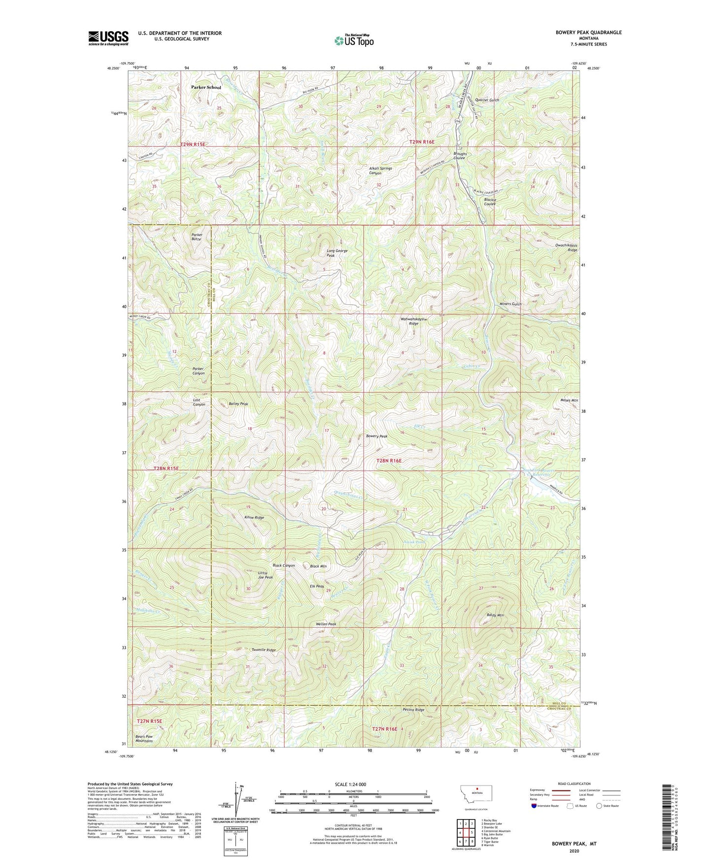
2024 topographic map quadrangle Bowery Peak in the state of Montana. Scale: 1:24000. Based on the newly updated USGS 7.5' US Topo map series, this map is in the following counties: Hill, Chouteau. The map contains contour data, water features, and other items you are used to seeing on USGS maps, but also has updated roads and other features. This is the next generation of topographic maps. Printed on high-quality waterproof paper with UV fade-resistant inks.
Quads adjacent to this one:
West: Centennial Mountain
Northwest: Rocky Boy
North: Bearpaw Lake
Northeast: Shambo SE
East: Big John Butte
Southeast: Warrick
South: Tiger Butte
Southwest: Ryan Butte
This map covers the same area as the classic USGS quad with code o48109b6.
Contains the following named places: Amisk Pond, Bailey Peak, Baldy Mountain, Bear Paw Ski Bowl, Black Mountain, Blackie Coulee, Bowery Peak, Broughs Coulee, Cabin Creek, East Fork Beaver Creek, East Fork Beaver Creek Reservoir, Eastfork Beaver Creek Reservation Dam, Elk Creek, Elk Peak, Kihiw Ridge, KPQX-FM (Havre), KXEI-FM (Havre), Little Joe Peak, Long George Peak, Miners Gulch, Mogul Alley Ski Trail, North Bowl Ski Trail, Otayachinas Creek, Owachikaysis Ridge, Parker Butte, Parker School, Parker School Census Designated Place, Pecora Ridge, Quarter Gulch, Rocky Boy Recreation Area, Screaming Eagle Ski Trail, Silver King Mine, Small Boy Creek, Teacup Ski Trail, The Face Ski Trail, Towering Heights Ski Trail, Twomile Ridge, Wahwahskaysiw Ridge, Wellen Peak, West Fork Beaver Creek