MyTopo
Tiger Butte Montana US Topo Map
Couldn't load pickup availability
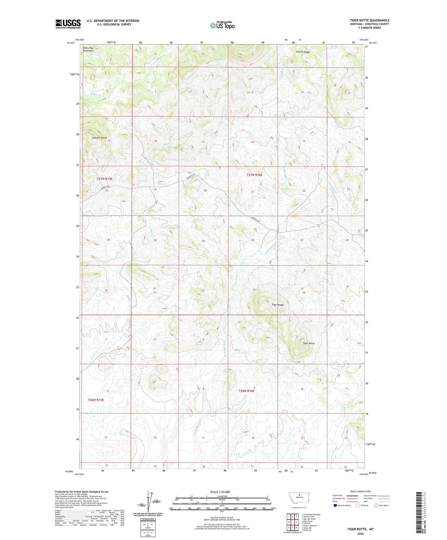
2024 topographic map quadrangle Tiger Butte in the state of Montana. Scale: 1:24000. Based on the newly updated USGS 7.5' US Topo map series, this map is in the following counties: Chouteau. The map contains contour data, water features, and other items you are used to seeing on USGS maps, but also has updated roads and other features. This is the next generation of topographic maps. Printed on high-quality waterproof paper with UV fade-resistant inks.
Quads adjacent to this one:
West: Ryan Butte
Northwest: Centennial Mountain
North: Bowery Peak
Northeast: Big John Butte
East: Warrick
Southeast: Eskay NE
South: Eskay NW
Southwest: Seifort Reservoir
This map covers the same area as the classic USGS quad with code o48109a6.
Contains the following named places: Deirdre Dam, Ix Ranch Dam, Sawmill Butte, Tiger Butte, Tiger Ridge, Upper Dog Creek School