MyTopo
Brady Montana US Topo Map
Couldn't load pickup availability
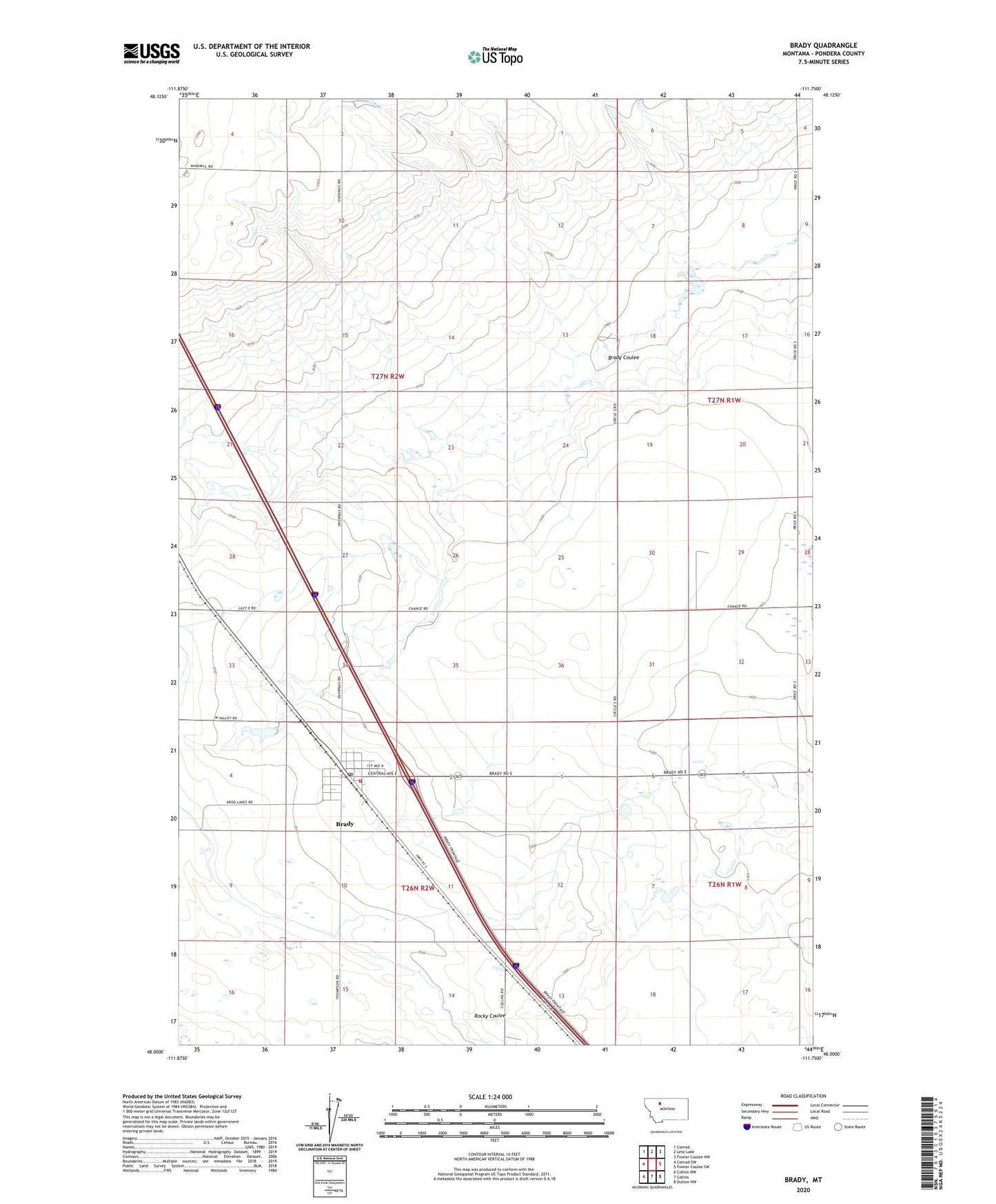
2024 topographic map quadrangle Brady in the state of Montana. Scale: 1:24000. Based on the newly updated USGS 7.5' US Topo map series, this map is in the following counties: Pondera. The map contains contour data, water features, and other items you are used to seeing on USGS maps, but also has updated roads and other features. This is the next generation of topographic maps. Printed on high-quality waterproof paper with UV fade-resistant inks.
Quads adjacent to this one:
West: Conrad SW
Northwest: Conrad
North: Letz Lake
Northeast: Fowler Coulee NW
East: Fowler Coulee SW
Southeast: Dutton NW
South: Collins
Southwest: Collins NW
This map covers the same area as the classic USGS quad with code o48111a7.
Contains the following named places: Brady, Brady Census Designated Place, Brady Coulee, Brady Post Office, Brady Public Schools, Brady United Methodist Church, Brady Volunteer Fire Department, Freds Trailer Court, Great Western Malting Company Elevator, Kauk Dam, Knees Community Church, Otilalda Dam, Pondera County Rural Fire District Station 1, Rigby Dam, South Rigby Dam, Triangle Terminal Co-Operative Association Elevator