MyTopo
Brown Pass Montana US Topo Map
Couldn't load pickup availability
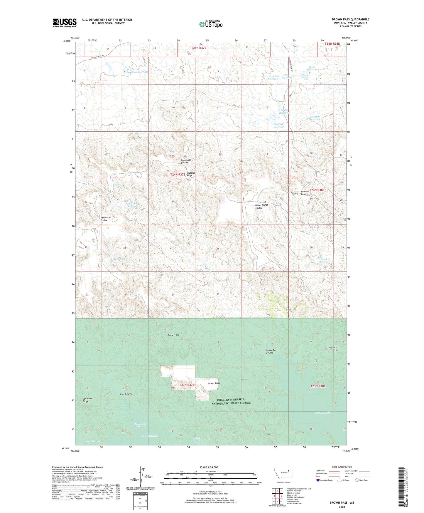
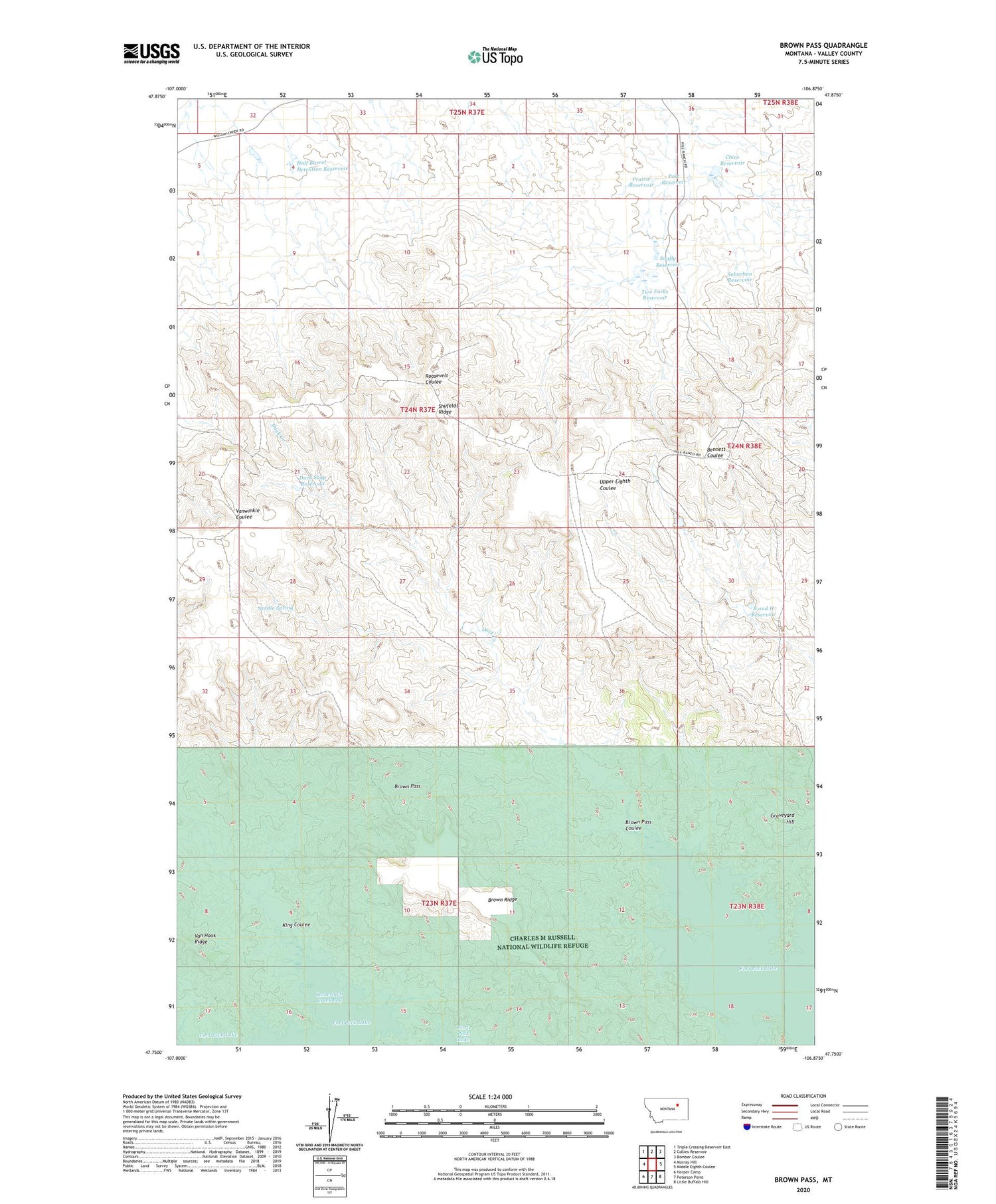
2020 topographic map quadrangle Brown Pass in the state of Montana. Scale: 1:24000. Based on the newly updated USGS 7.5' US Topo map series, this map is in the following counties: Valley. The map contains contour data, water features, and other items you are used to seeing on USGS maps, but also has updated roads and other features. This is the next generation of topographic maps. Printed on high-quality waterproof paper with UV fade-resistant inks.
Quads adjacent to this one:
West: Murray Hill
Northwest: Triple Crossing Reservoir East
North: Collins Reservoir
Northeast: Bomber Coulee
East: Middle Eighth Coulee
Southeast: Little Buffalo Hill
South: Peterson Point
Southwest: Harper Camp
Contains the following named places: B and H Reservoir, Brown Pass, Brown Pass Coulee, Brown Ridge, Chico Flats Dam, Chico Reservoir, Duck Creek, Duck Creek Reservoir, Duck Soup Reservoir, Half Barrel Dam, Half Barrel Detention Reservoir, King Coulee, Magruder Ranch, Needle Spring, Post Reservoir, Prairie Reservoir, Shufeldt Ridge, Soufly Reservoir, Suburban Reservoir, Two Forks Dam, Two Forks Reservoir, Wittmayer Ranch