MyTopo
Little Buffalo Hill Montana US Topo Map
Couldn't load pickup availability
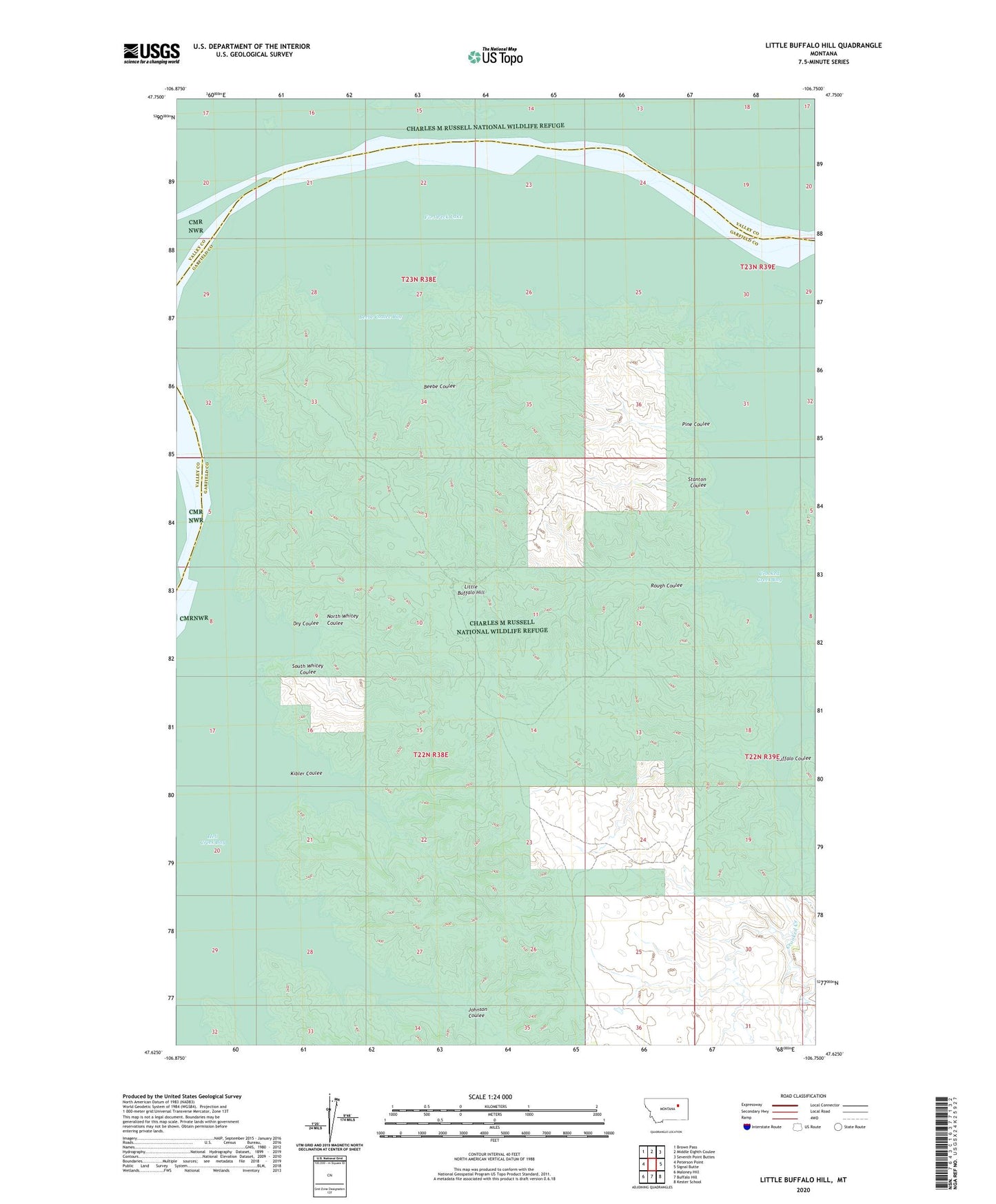
2024 topographic map quadrangle Little Buffalo Hill in the state of Montana. Scale: 1:24000. Based on the newly updated USGS 7.5' US Topo map series, this map is in the following counties: Garfield, Valley. The map contains contour data, water features, and other items you are used to seeing on USGS maps, but also has updated roads and other features. This is the next generation of topographic maps. Printed on high-quality waterproof paper with UV fade-resistant inks.
Quads adjacent to this one:
West: Peterson Point
Northwest: Brown Pass
North: Middle Eighth Coulee
Northeast: Seventh Point Buttes
East: Signal Butte
Southeast: Kester School
South: Buffalo Hill
Southwest: Maloney Hill
This map covers the same area as the classic USGS quad with code o47106f7.
Contains the following named places: Beebe Coulee, Beebe Coulee Bay, Buffalo Coulee, Crooked Creek, Crooked Creek Bay, Dry Coulee, Hell Creek Bay, Johnson Coulee, Kibler Coulee, Little Buffalo Hill, North Whitey Coulee, Pine Coulee, Rough Coulee, South Whitey Coulee, Stanton Coulee