MyTopo
Browning Montana US Topo Map
Couldn't load pickup availability
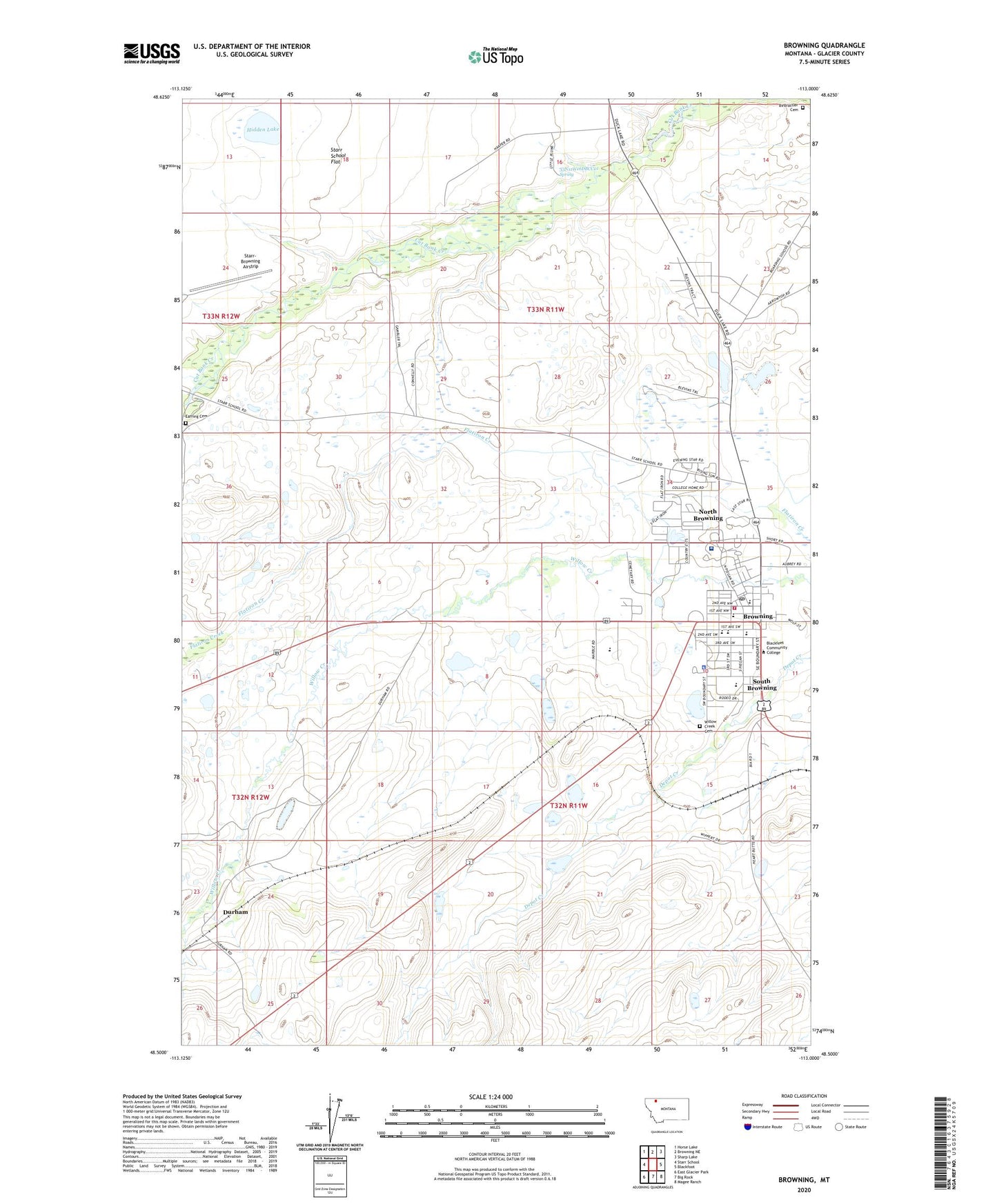
2020 topographic map quadrangle Browning in the state of Montana. Scale: 1:24000. Based on the newly updated USGS 7.5' US Topo map series, this map is in the following counties: Glacier. The map contains contour data, water features, and other items you are used to seeing on USGS maps, but also has updated roads and other features. This is the next generation of topographic maps. Printed on high-quality waterproof paper with UV fade-resistant inks.
Quads adjacent to this one:
West: Starr School
Northwest: Horse Lake
North: Browning NE
Northeast: Sharp Lake
East: Blackfoot
Southeast: Magee Ranch
South: Big Rock
Southwest: East Glacier Park
Contains the following named places: 32N11W03CAAC01 Well, 32N11W03CBAD01 Well, 32N11W03CDDB01 Well, 32N11W03DAD_01 Well, 32N11W03DD__01 Well, 32N11W09DDBC01 Well, 32N12W12AADA01 Well, 32N12W12AADB01 Well, 33N11W16DBCC01 Spring, 33N11W27DDBA01 Well, 33N12W25BDCB01 Well, 33N12W25CBAA01 Well, 33N12W25CBAC01 Well, Birdrattler Cemetery, Blackfeet Agency, Blackfeet Community College, Blackfeet Community Hospital, Blackfeet Nation Historical Marker, Blackfeet Nursing Home, Blackfeet United Methodist Parish, Browning, Browning Branch Library, Browning Emergency Medical Services, Browning Evangelist Church, Browning High School, Browning Independent Baptist Church, Browning Middle School, Browning Post Office, Browning Station, Browning United Methodist Church, Browning Volunteer Fire Department, Bureau of Indian Affairs Law Enforcement Browning Police Department, Calvary Assembly of God Church, Columbia Grain Incorporated Elevator, Douglas Gold School, Durham, Durham School, Earring Cemetery, Glacier View Baptist Church, Hidden Lake, K W Bergan Elementary School, Little Flower Parish, Museum of the Plains Indian, North Browning, North Browning Census Designated Place, Old Agency 1880-1894 Historical Marker, Scriver Museum of Montana Wild Life, Sleeping Wolf Campground, Sommer Haven Christian Church, South Browning, South Browning Census Designated Place, Starr School Flat, Starr-Browning Airstrip, Town of Browning, Triple Divide, Vina Chattin School, Willow Creek Cemetery