MyTopo
Starr School Montana US Topo Map
Couldn't load pickup availability
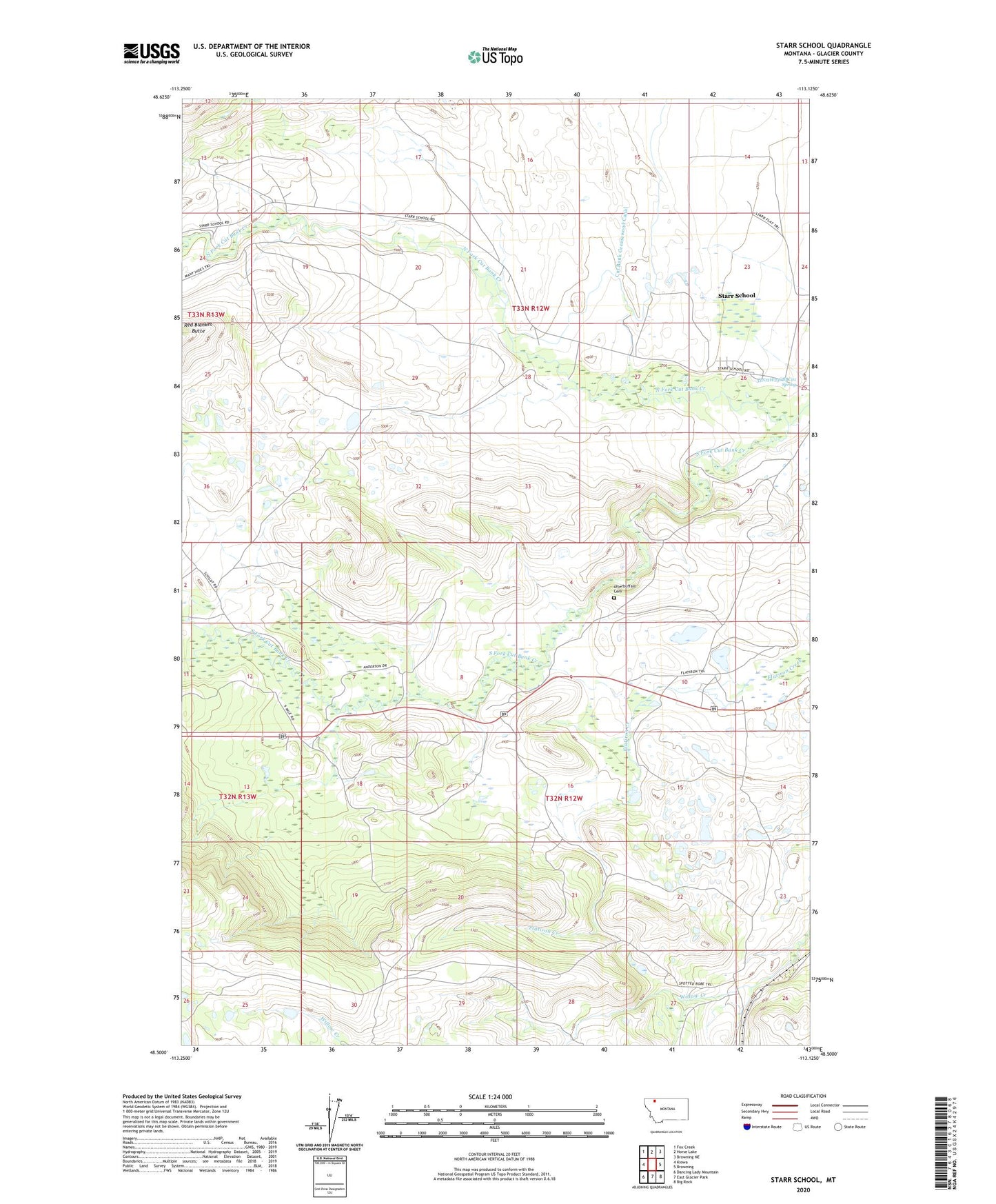
2024 topographic map quadrangle Starr School in the state of Montana. Scale: 1:24000. Based on the newly updated USGS 7.5' US Topo map series, this map is in the following counties: Glacier. The map contains contour data, water features, and other items you are used to seeing on USGS maps, but also has updated roads and other features. This is the next generation of topographic maps. Printed on high-quality waterproof paper with UV fade-resistant inks.
Quads adjacent to this one:
West: Kiowa
Northwest: Fox Creek
North: Horse Lake
Northeast: Browning NE
East: Browning
Southeast: Big Rock
South: East Glacier Park
Southwest: Dancing Lady Mountain
This map covers the same area as the classic USGS quad with code o48113e2.
Contains the following named places: 33N12W25BBCC01 Well, 33N12W25BCBC01 Well, 33N12W25CBBC01 Spring, Afterbuffalo Cemetery, Aspenwood Camp, North Fork Cut Bank Creek, Sacred Heart Mission, South Fork Cut Bank Creek, Star, Starr Baptist Church, Starr Elementary School, Starr School, Starr School Census Designated Place