MyTopo
Spring Draw Montana US Topo Map
Couldn't load pickup availability
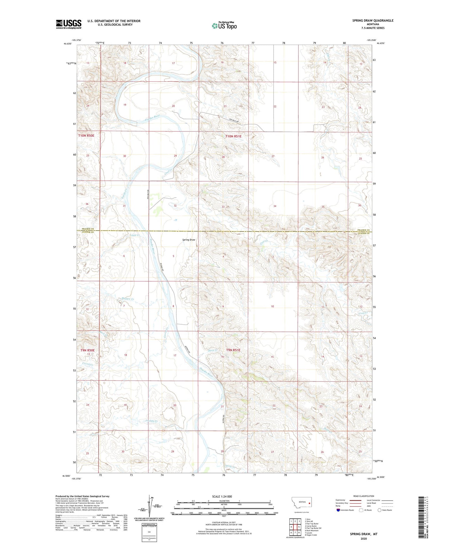
2024 topographic map quadrangle Spring Draw in the state of Montana. Scale: 1:24000. Based on the newly updated USGS 7.5' US Topo map series, this map is in the following counties: Custer, Prairie. The map contains contour data, water features, and other items you are used to seeing on USGS maps, but also has updated roads and other features. This is the next generation of topographic maps. Printed on high-quality waterproof paper with UV fade-resistant inks.
Quads adjacent to this one:
West: Corral Butte
Northwest: Zero
North: Zero NE
Northeast: Flat Top Butte
East: Flat Top Butte SW
Southeast: Hogan Creek
South: Locate
Southwest: Buck Mountain
This map covers the same area as the classic USGS quad with code o46105e3.
Contains the following named places: 09N51E28BD__01 Well, 10N51E19ACCB01 Well, 10N51E20DDAB01 Well, 10N51E26BABB01 Well, Buck Creek, Coal Creek, Coal Creek Number 2 Dam, Corral Creek, Deep Creek, Dondarlee Number 1 Dam, Freddie Creek, Griffin Dam, Louie Creek, Maggie Creek, N P Number 3 Dam, Snow Creek, Spring Draw, Sutherland, Sutherland Post Office, Sutherland School, Swede Creek, Ten Mile School, Young Number 1 Dam