MyTopo
Buffalo Reservoir Montana US Topo Map
Couldn't load pickup availability
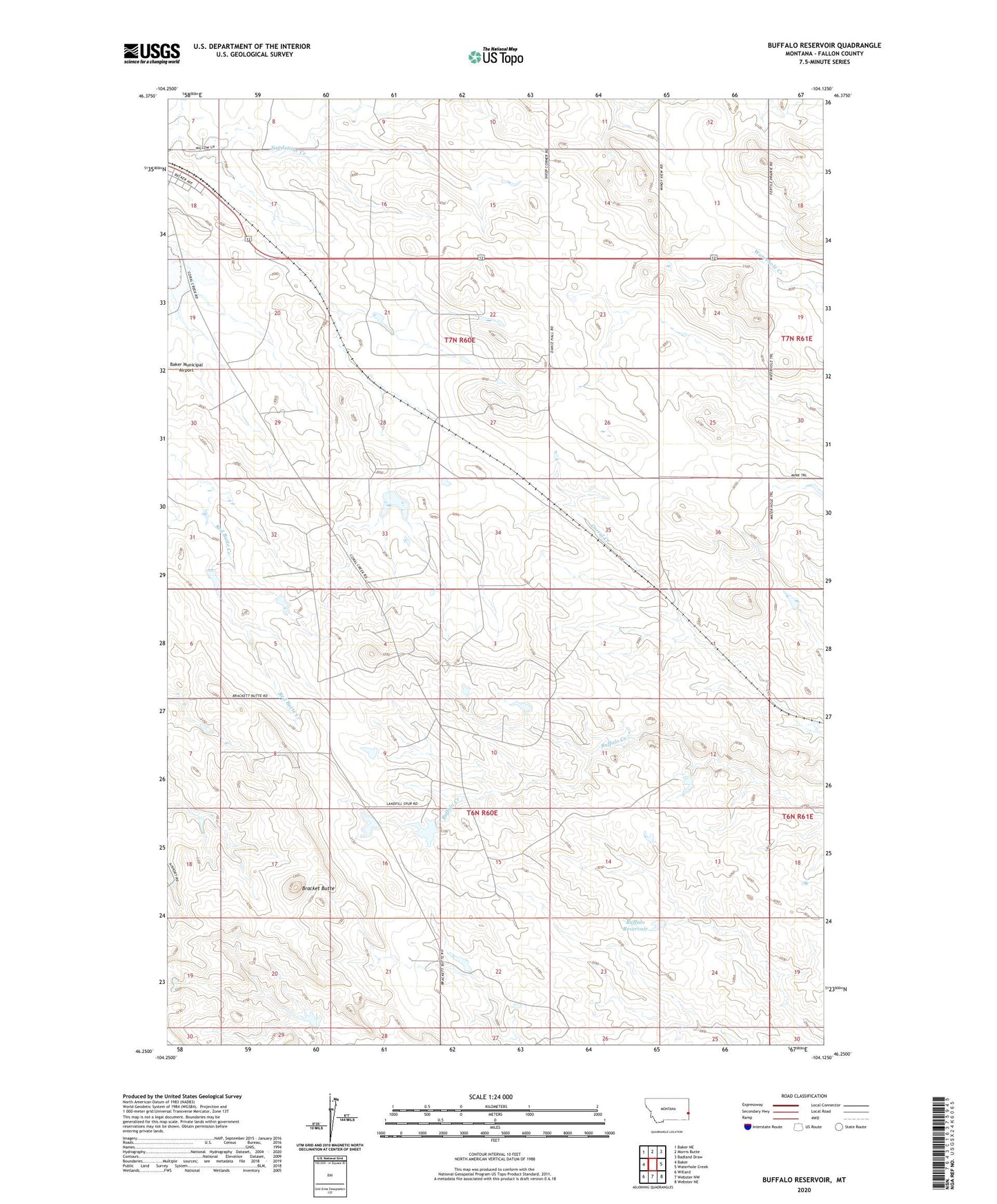
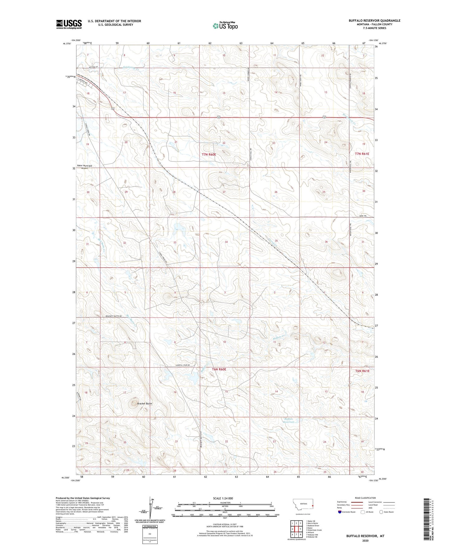
2020 topographic map quadrangle Buffalo Reservoir in the state of Montana. Scale: 1:24000. Based on the newly updated USGS 7.5' US Topo map series, this map is in the following counties: Fallon. The map contains contour data, water features, and other items you are used to seeing on USGS maps, but also has updated roads and other features. This is the next generation of topographic maps. Printed on high-quality waterproof paper with UV fade-resistant inks.
Quads adjacent to this one:
West: Baker
Northwest: Baker NE
North: Morris Butte
Northeast: Badland Draw
East: Waterhole Creek
Southeast: Webster NE
South: Webster NW
Southwest: Willard
Contains the following named places: 06N60E06AC__01 Well, 06N60E21AC__01 Well, 07N60E31AC__01 Well, 59313, Baker Division, Bracket Butte, Buffalo Reservoir, Kingmont Siding, Kirschten Number 1 Dam, Pinnaw Dam