MyTopo
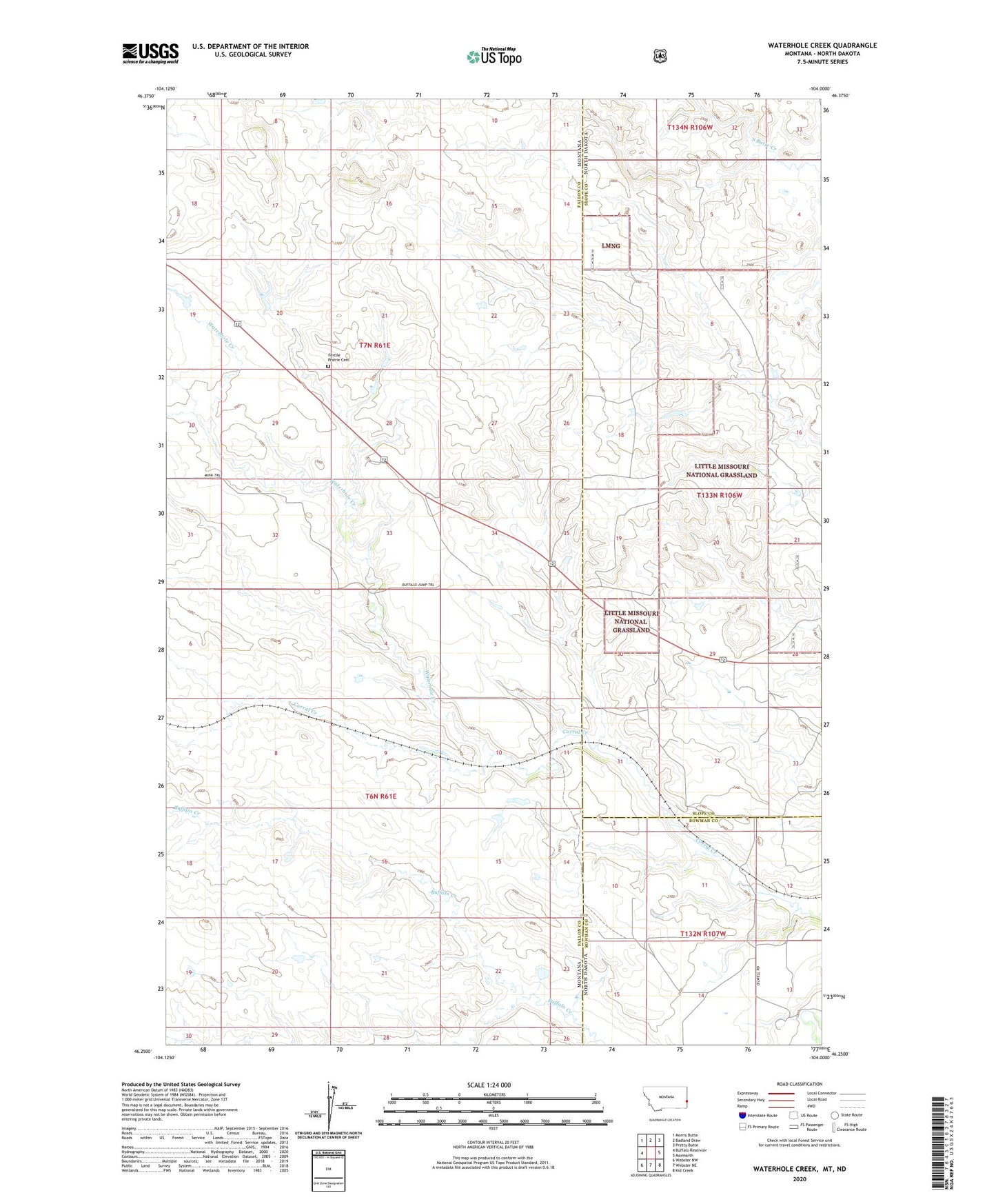
Waterhole Creek Montana US Topo Map
Couldn't load pickup availability
Also explore the Waterhole Creek Forest Service Topo of this same quad for updated USFS data
2024 topographic map quadrangle Waterhole Creek in the states of Montana, North Dakota. Scale: 1:24000. Based on the newly updated USGS 7.5' US Topo map series, this map is in the following counties: Fallon, Slope, Bowman. The map contains contour data, water features, and other items you are used to seeing on USGS maps, but also has updated roads and other features. This is the next generation of topographic maps. Printed on high-quality waterproof paper with UV fade-resistant inks.
Quads adjacent to this one:
West: Buffalo Reservoir
Northwest: Morris Butte
North: Badland Draw
Northeast: Pretty Butte
East: Marmarth
Southeast: Kid Creek
South: Webster NE
Southwest: Webster NW
Contains the following named places: 07N54E08AC__01 Well, 761 Lang Dam, Corral Creek, Dodge, Fertile Prairie Cemetery, Fertile Prairie School