MyTopo
Bug Creek Montana US Topo Map
Couldn't load pickup availability
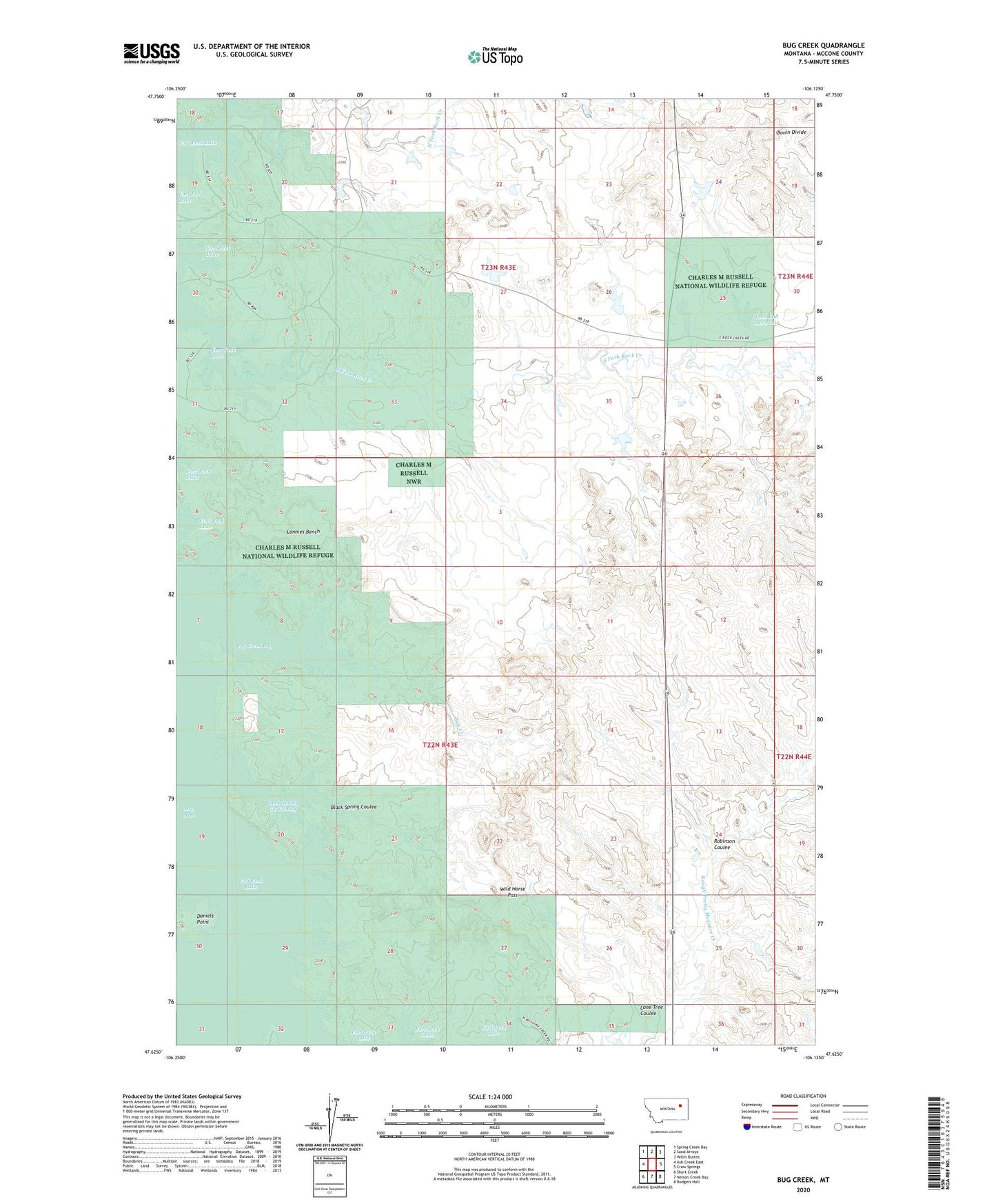
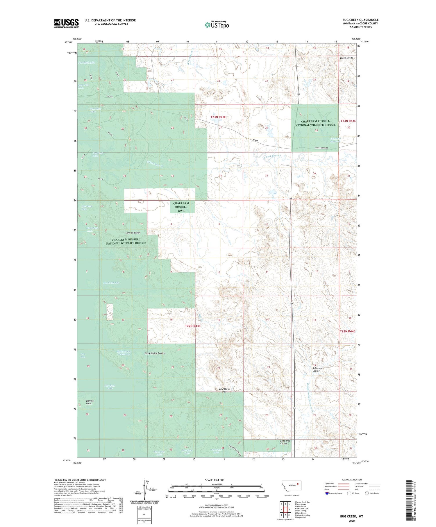
2020 topographic map quadrangle Bug Creek in the state of Montana. Scale: 1:24000. Based on the newly updated USGS 7.5' US Topo map series, this map is in the following counties: McCone. The map contains contour data, water features, and other items you are used to seeing on USGS maps, but also has updated roads and other features. This is the next generation of topographic maps. Printed on high-quality waterproof paper with UV fade-resistant inks.
Quads adjacent to this one:
West: Ash Creek East
Northwest: Spring Creek Bay
North: Sand Arroyo
Northeast: Willis Buttes
East: Crow Springs
Southeast: Rodgers Hall
South: Nelson Creek Bay
Southwest: Short Creek
Contains the following named places: 22N43E03ACAD01 Well, 22N44E18BB__01 Well, 23N43E21AAAB01 Well, 23N43E34BABC01 Well, Black Spring Coulee, Black Spring Coulee Bay, Bug Creek, Bug Creek Bay, Bug Dam, Daniels Point, John Ball Dam, John Ball Reservoir, John Ball Reservoir Dam, Lone Tree Coulee, Lonnies Bench, Lyle Nelson Number 1 Dam, Lyle Nelson Number 3 Dam, Lyle Nelson Number 5 Dam, Lyle Nelson Number 6 Dam, Nelson Reservoir Number 2 Dam, Nomland Dam, North Fork Rock Creek, Robinson Coulee, South Fork Rock Creek, Towe Farms Number 1 Dam, Towe Farms Number 2 Dam, Wild Horse Pass