MyTopo
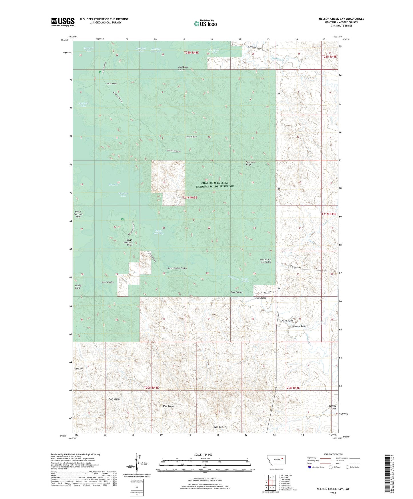
Nelson Creek Bay Montana US Topo Map
Couldn't load pickup availability
2024 topographic map quadrangle Nelson Creek Bay in the state of Montana. Scale: 1:24000. Based on the newly updated USGS 7.5' US Topo map series, this map is in the following counties: McCone. The map contains contour data, water features, and other items you are used to seeing on USGS maps, but also has updated roads and other features. This is the next generation of topographic maps. Printed on high-quality waterproof paper with UV fade-resistant inks.
Quads adjacent to this one:
West: Short Creek
Northwest: Ash Creek East
North: Bug Creek
Northeast: Crow Springs
East: Rodgers Hall
Southeast: Johnson Coulee West
South: Fortyfour Coulee
Southwest: Frank Coulee
This map covers the same area as the classic USGS quad with code o47106e2.
Contains the following named places: 01N45E29BBCC01 Well, 01N45E31BCBA01 Well, 20N43E01AABD01 Well, 21N43E36BCCD01 Well, 21N43E36DAAC01 Well, 21N43E36DAAD01 Well, Carney Springs, Coal Bank Coulee, Deer Coulee, Jacks Point, Jacks Ridge, Jim Coulee, McGuire Creek, McGuire Creek Bay, McGuire Creek Recreation Area, Nelson Creek, Nelson Creek Bay, Nelson Creek Recreation Area, North Fork Jim Coulee, North Twitchell Point, Pine Coulee, R C Mothershead Number 1 Dam, Racetrack Ridge, Romine Coulee, Rough Prong McGuire Creek, South Foster Coulee, South Twitchell Point, Steer Coulee