MyTopo
Bull Creek Lookout Montana US Topo Map
Couldn't load pickup availability
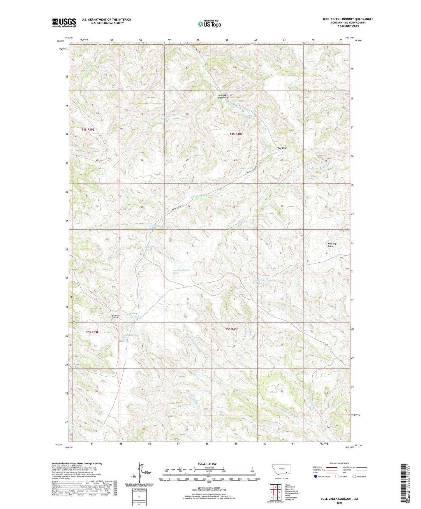
2020 topographic map quadrangle Bull Creek Lookout in the state of Montana. Scale: 1:24000. Based on the newly updated USGS 7.5' US Topo map series, this map is in the following counties: Big Horn. The map contains contour data, water features, and other items you are used to seeing on USGS maps, but also has updated roads and other features. This is the next generation of topographic maps. Printed on high-quality waterproof paper with UV fade-resistant inks.
Quads adjacent to this one:
West: Birdseye Spring
Northwest: Busby
North: Painted Hill
Northeast: Lame Deer
East: Cook Creek Butte
Southeast: Birney SW
South: Taintor Desert
Southwest: Kirby
Contains the following named places: 01N43E08ACCD01 Well, 04S40E17ABD_01 Well, 05S40E05CCCC01 Spring, 05S40E06ABAB01 Spring, 05S40E09AADD01 Spring, 05S40E18BCCA01 Spring, Big Bend, Brady Creek, Brown Camp, Bull Creek Lookout, Hardrobe Creek, Hardrobe Spring, Hardrobe Water Gap, Killsnight Spring, Middle Fork Bull Creek, Muddy Lake, North Fork Bull Creek, Wild Hog Basin