MyTopo
Camas Prairie Montana US Topo Map
Couldn't load pickup availability
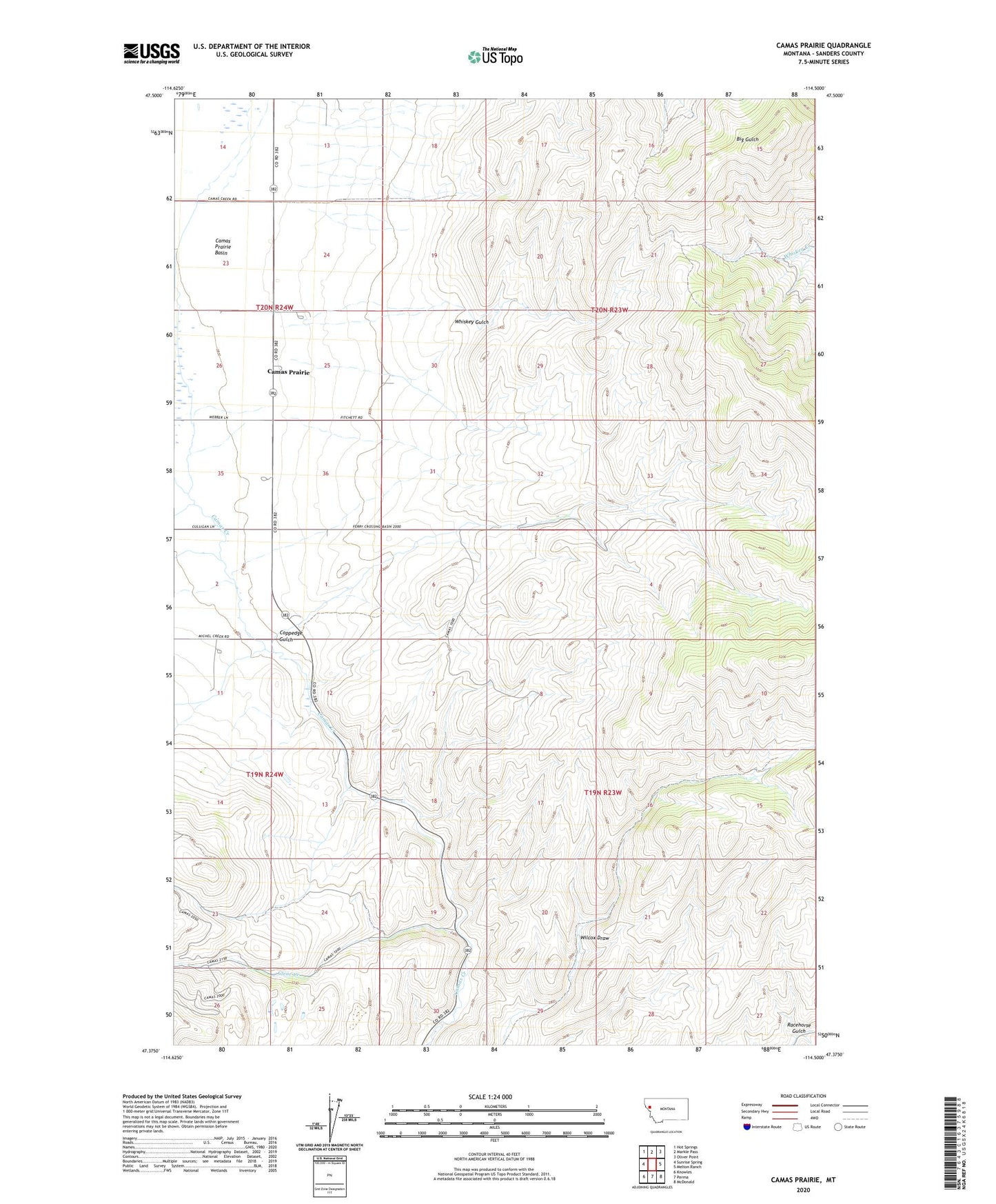
2020 topographic map quadrangle Camas Prairie in the state of Montana. Scale: 1:24000. Based on the newly updated USGS 7.5' US Topo map series, this map is in the following counties: Sanders. The map contains contour data, water features, and other items you are used to seeing on USGS maps, but also has updated roads and other features. This is the next generation of topographic maps. Printed on high-quality waterproof paper with UV fade-resistant inks.
Quads adjacent to this one:
West: Sunrise Spring
Northwest: Hot Springs
North: Markle Pass
Northeast: Oliver Point
East: Melton Ranch
Southeast: McDonald
South: Perma
Southwest: Knowles
Contains the following named places: 19N24W01CBB_01 Well, 19N24W02AAA_01 Well, 19N24W02CCD_01 Well, 19N24W02DCDD01 Well, 19N24W02DDCD01 Well, 20N24W14CCA_01 Well, 20N24W23CBAA01 Well, 20N24W23CBAA02 Well, 20N24W24CBBC01 Well, 20N24W26BAA_01 Well, 20N24W26DAA_01 Well, 20N24W26DAD_01 Well, 20N24W35AAAA01 Well, 20N24W35AAD_01 Well, 20N24W36CBB_01 Well, Camas Prairie, Camas Prairie Basin, Camas Prairie Elementary School, Camas Prairie Post Office, Clear Creek, Coppedge Gulch, Flathead Reservation Division, Micharl Creek, Whiskey Gulch