MyTopo
Knowles Montana US Topo Map
Couldn't load pickup availability
Also explore the Knowles Forest Service Topo of this same quad for updated USFS data
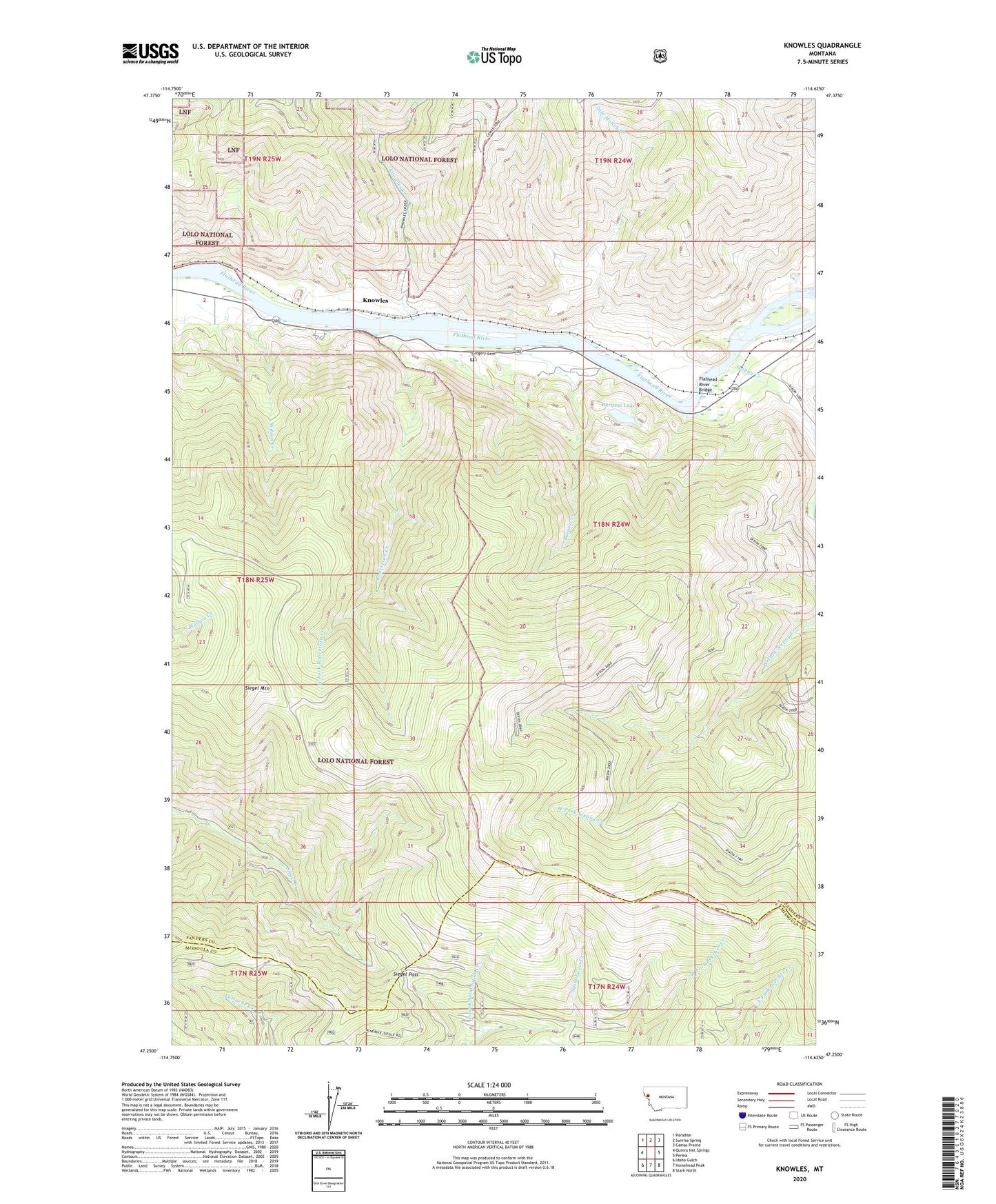
2024 topographic map quadrangle Knowles in the state of Montana. Scale: 1:24000. Based on the newly updated USGS 7.5' US Topo map series, this map is in the following counties: Sanders, Missoula. The map contains contour data, water features, and other items you are used to seeing on USGS maps, but also has updated roads and other features. This is the next generation of topographic maps. Printed on high-quality waterproof paper with UV fade-resistant inks.
Quads adjacent to this one:
West: Quinns Hot Springs
Northwest: Paradise
North: Sunrise Spring
Northeast: Camas Prairie
East: Perma
Southeast: Stark North
South: Horsehead Peak
Southwest: Idaho Gulch
This map covers the same area as the classic USGS quad with code o47114c6.
Contains the following named places: Burgess Creek, Burgess Lake, East Fork Saint Louis Creek, Flathead River Bridge, Gingery Cemetery, Joe Wallit Mine, Knowles, Knowles Creek, Last Chance, Little Money Creek, Robertson Creek, Seepay Creek, Siegel Mountain, Siegel Pass, Third Crossing, West Fork Robertson Creek, Wilson Creek, ZIP Code: 59856