MyTopo
Perma Montana US Topo Map
Couldn't load pickup availability
Also explore the Perma Forest Service Topo of this same quad for updated USFS data
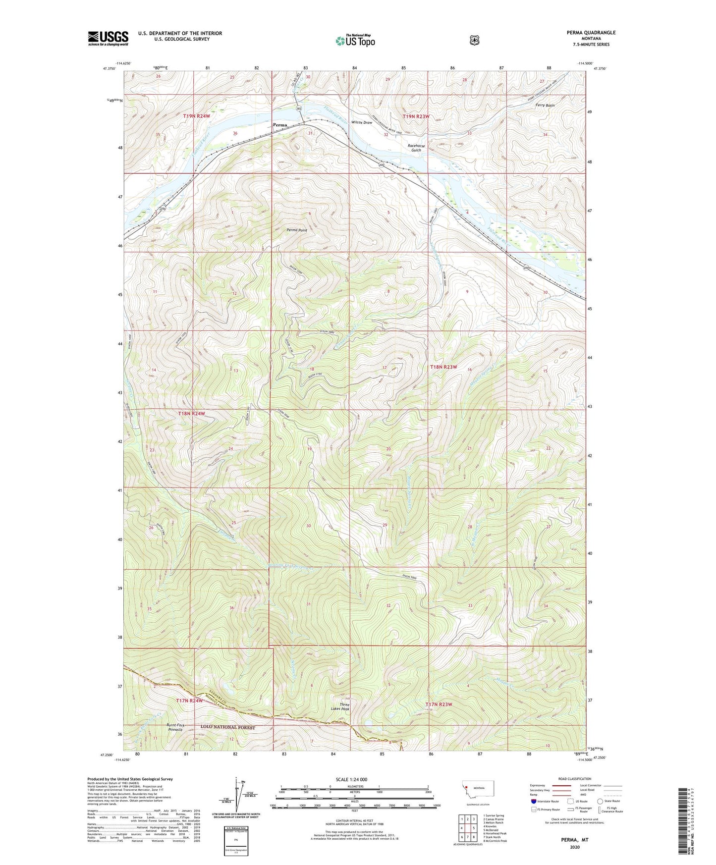
2024 topographic map quadrangle Perma in the state of Montana. Scale: 1:24000. Based on the newly updated USGS 7.5' US Topo map series, this map is in the following counties: Sanders, Missoula. The map contains contour data, water features, and other items you are used to seeing on USGS maps, but also has updated roads and other features. This is the next generation of topographic maps. Printed on high-quality waterproof paper with UV fade-resistant inks.
Quads adjacent to this one:
West: Knowles
Northwest: Sunrise Spring
North: Camas Prairie
Northeast: Melton Ranch
East: McDonald
Southeast: McCormick Peak
South: Stark North
Southwest: Horsehead Peak
This map covers the same area as the classic USGS quad with code o47114c5.
Contains the following named places: 18N23W03CDD_01 Well, 19N23W32BCBA01 Well, Burnt Fork Pinnacle, Camas Creek, Ferry Basin, Forest Service Winter Range, Magpie Spring Creek, Makiness, Perma, Perma Point, Perma Post Office, Racehorse Gulch, Roaring Fork Seepay Creek, Teddy Tunnel, Three Lakes Peak, Vanderburg Creek, West Fork Seepay Creek, Wilcox Draw