MyTopo
Cameron Lake Montana US Topo Map
Couldn't load pickup availability
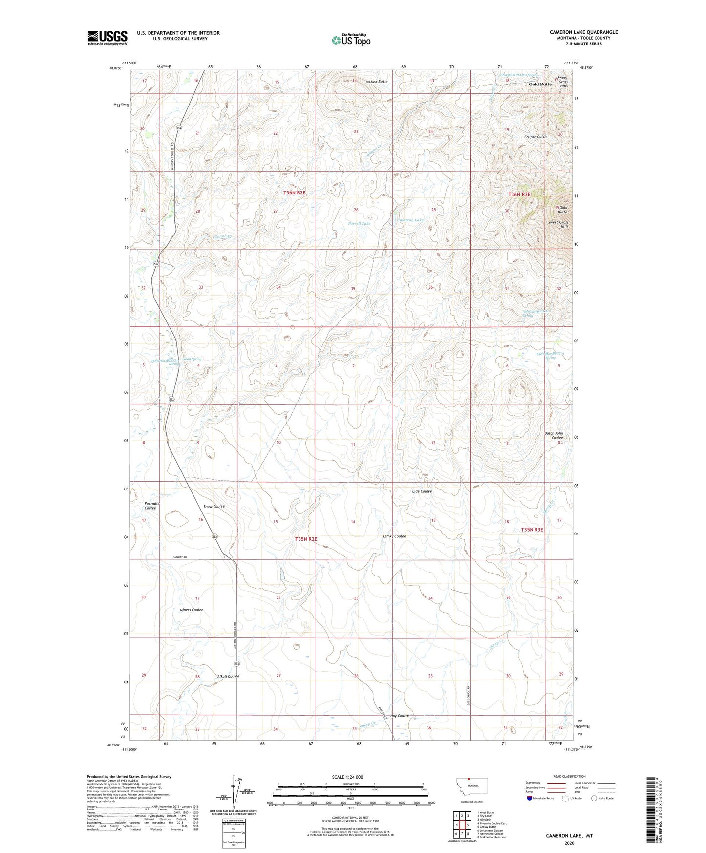
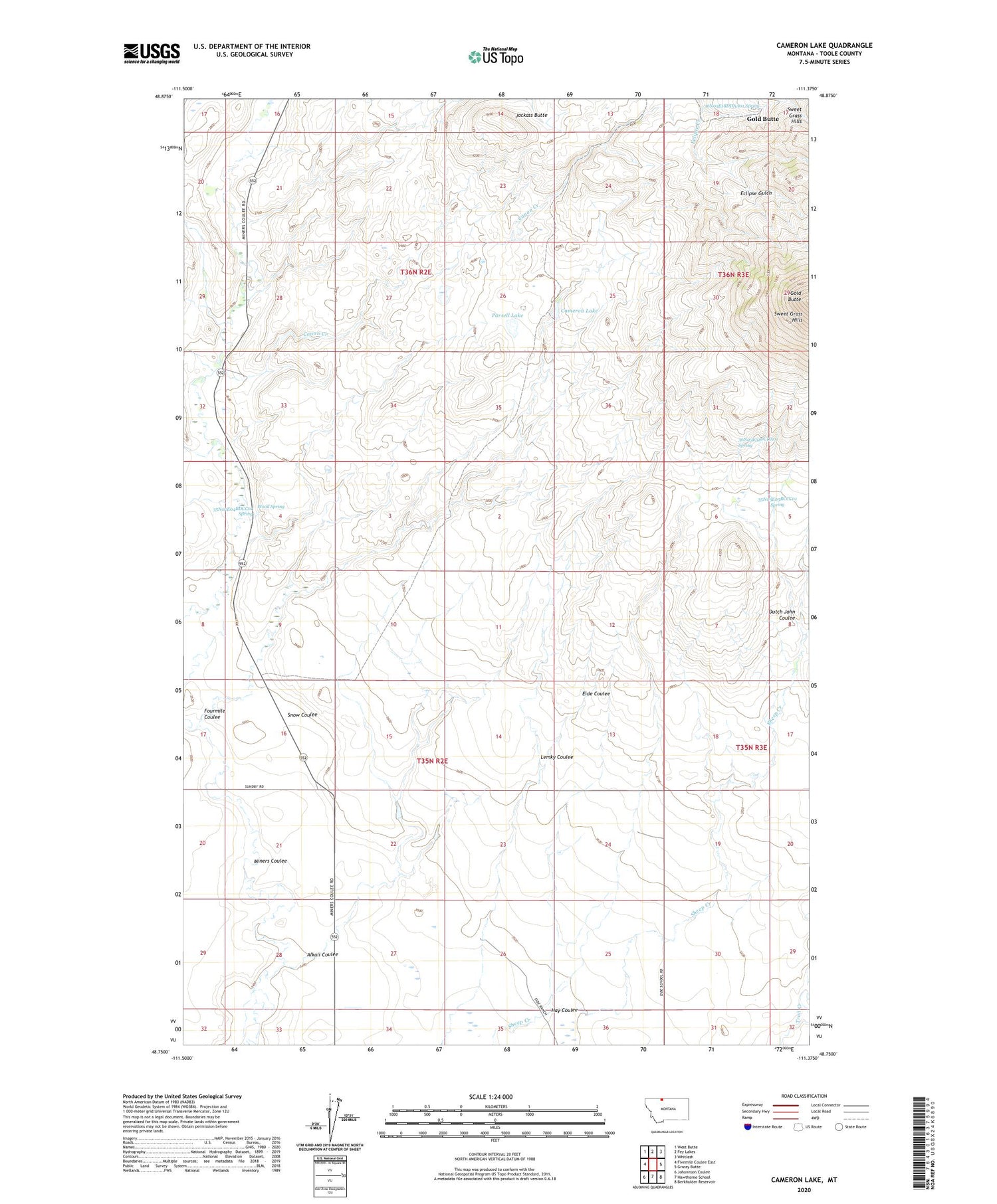
2020 topographic map quadrangle Cameron Lake in the state of Montana. Scale: 1:24000. Based on the newly updated USGS 7.5' US Topo map series, this map is in the following counties: Toole. The map contains contour data, water features, and other items you are used to seeing on USGS maps, but also has updated roads and other features. This is the next generation of topographic maps. Printed on high-quality waterproof paper with UV fade-resistant inks.
Quads adjacent to this one:
West: Fivemile Coulee East
Northwest: West Butte
North: Fey Lakes
Northeast: Whitlash
East: Grassy Butte
Southeast: Berkholder Reservoir
South: Hawthorne School
Southwest: Johannson Coulee
Contains the following named places: 35N02E04BDCC01 Spring, 35N02E10DD__01 Well, 35N02E22CCCA01 Well, 35N02E23BBBB01 Well, 35N02E27AABD01 Well, 35N03E05BCCC01 Spring, 35N03E05BCCC01 Well, 36N03E18DDAA01 Spring, 36N03E31DCDA01 Spring, Alkali Coulee, Cameron Dam, Cameron Lake, Canon Creek, Dutch John Coulee, Eide Ranch, Fourmile Coulee, Gold Butte, Goldbutte Post Office, Hay Coulee, Jackass Butte, Lemky Coulee, MacHale Dam, MacHale Reservoir, Old Berthelote Ranch, Parsell Lake, Scalese Ranch, Snow Coulee, Sweet Grass Hills, Wood Dam, Wood Ranch, Wood Reservoir, Wood Spring