MyTopo
Berkholder Reservoir Montana US Topo Map
Couldn't load pickup availability
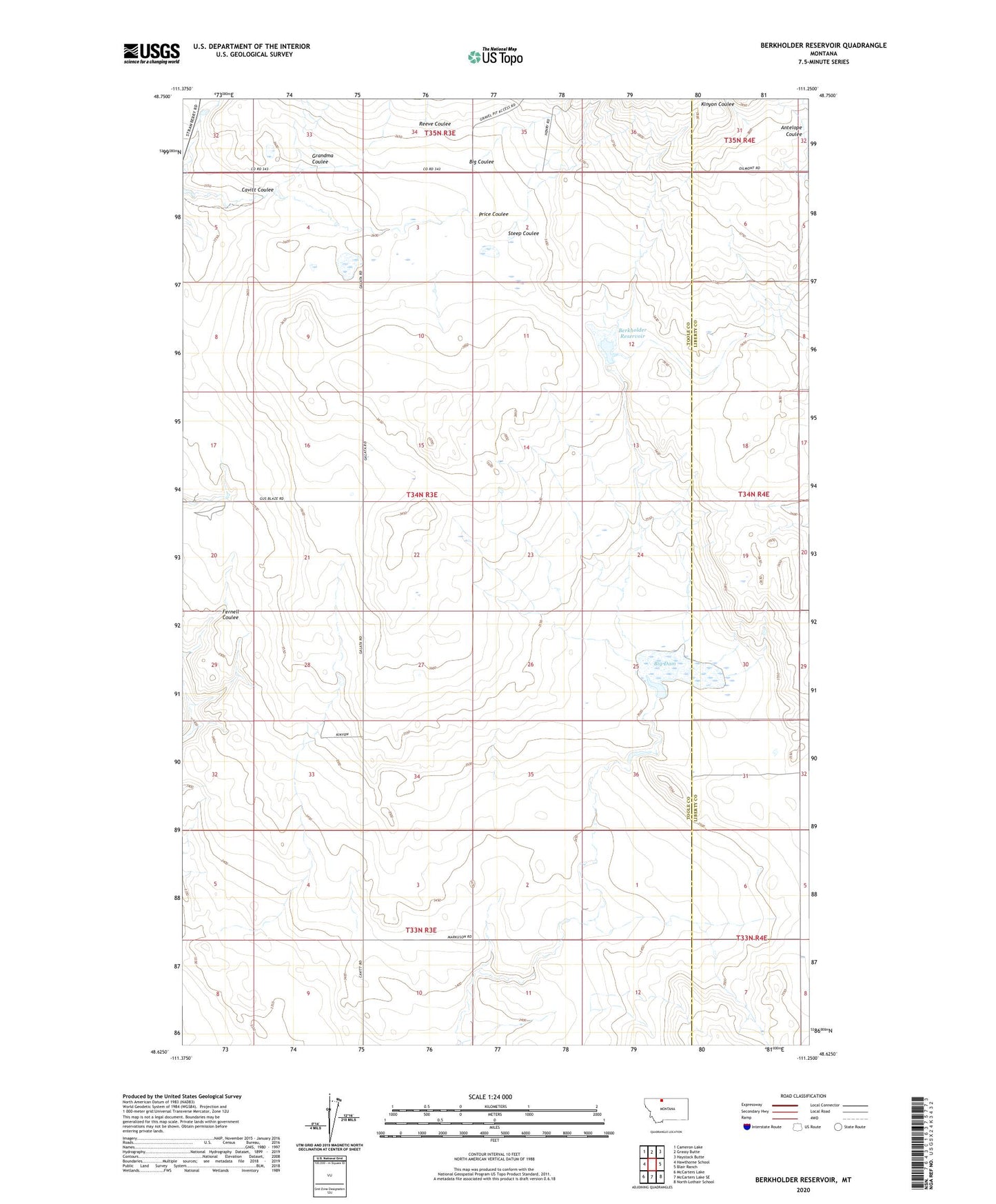
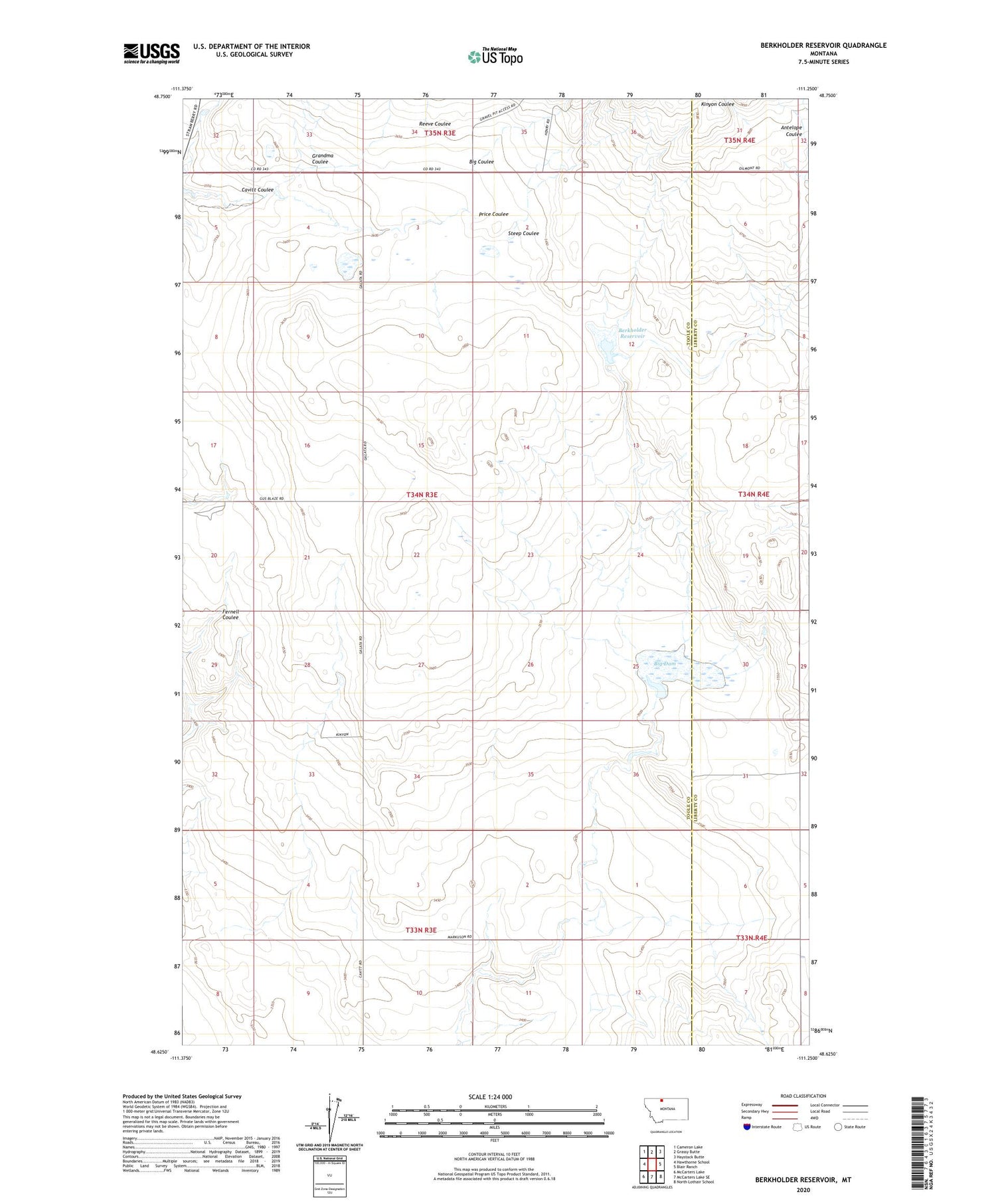
2024 topographic map quadrangle Berkholder Reservoir in the state of Montana. Scale: 1:24000. Based on the newly updated USGS 7.5' US Topo map series, this map is in the following counties: Toole, Liberty. The map contains contour data, water features, and other items you are used to seeing on USGS maps, but also has updated roads and other features. This is the next generation of topographic maps. Printed on high-quality waterproof paper with UV fade-resistant inks.
Quads adjacent to this one:
West: Hawthorne School
Northwest: Cameron Lake
North: Grassy Butte
Northeast: Haystack Butte
East: Blair Ranch
Southeast: North Lothair School
South: McCarters Lake SE
Southwest: McCarters Lake
This map covers the same area as the classic USGS quad with code o48111f3.
Contains the following named places: 22N03E28DDDD01 Well, 59444, Berkholder Dam, Berkholder Reservoir, Big Coulee, Big Dam, Cavitt Coulee, Grandma Coulee, Grandview Post Office, Grandview School, Mary Dam, Mary Reservoir, Reeve Coulee, Steep Coulee