MyTopo
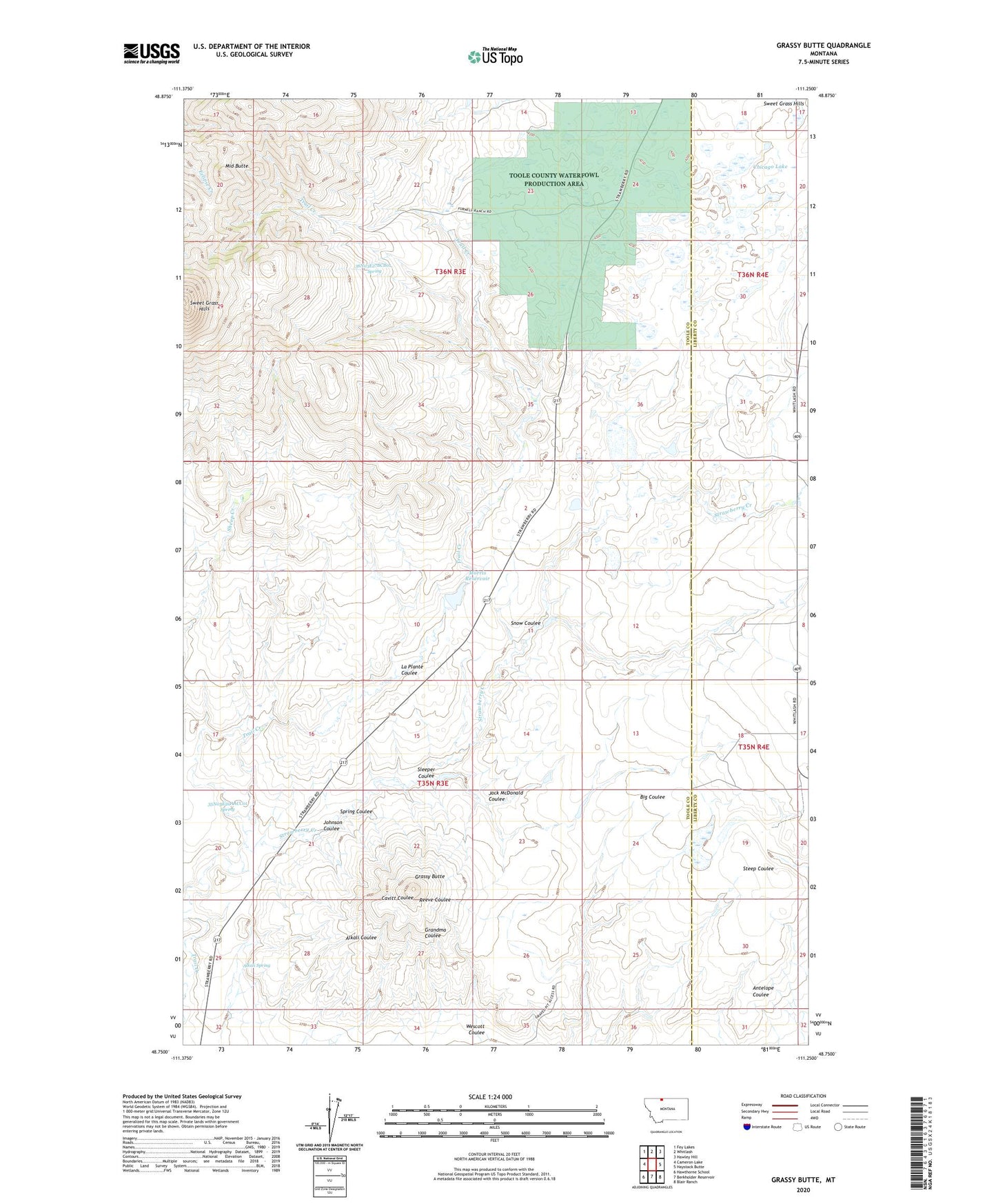
Grassy Butte Montana US Topo Map
Couldn't load pickup availability
2024 topographic map quadrangle Grassy Butte in the state of Montana. Scale: 1:24000. Based on the newly updated USGS 7.5' US Topo map series, this map is in the following counties: Toole, Liberty. The map contains contour data, water features, and other items you are used to seeing on USGS maps, but also has updated roads and other features. This is the next generation of topographic maps. Printed on high-quality waterproof paper with UV fade-resistant inks.
Quads adjacent to this one:
West: Cameron Lake
Northwest: Fey Lakes
North: Whitlash
Northeast: Hawley Hill
East: Haystack Butte
Southeast: Blair Ranch
South: Berkholder Reservoir
Southwest: Hawthorne School
This map covers the same area as the classic USGS quad with code o48111g3.
Contains the following named places: 35N03E10ABBD01 Well, 35N03E20AACC01 Spring, 35N03E21BDCD01 Well, 36N03E14CCCB01 Well, 36N03E14CCCC01 Well, Alkali Spring, Capacity Dam, Chicago Lake, Chicago Lake Dam, Furnell Ranch, Grassy Butte, Hartsook Ranch, Henry Dam Number 1, Henry Dam Number 2, Hofer 1 Dam, Hofer 2 Dam, Jack McDonald Coulee, Johnson Coulee, La Plante Coulee, Middle Butte, Morris Number 2 Dam, Morris Reservoir, Oh Henrys Place Dam, Old Indian Cemetery, Sleeper Coulee, Snow Coulee, Spring Coulee, Strawberry Creek, Swanp Cooler Dam, T C Morris Ranch, Toole County Waterfowl Production Area, Triple L and ER Fritz Dam, Wescott Coulee