MyTopo
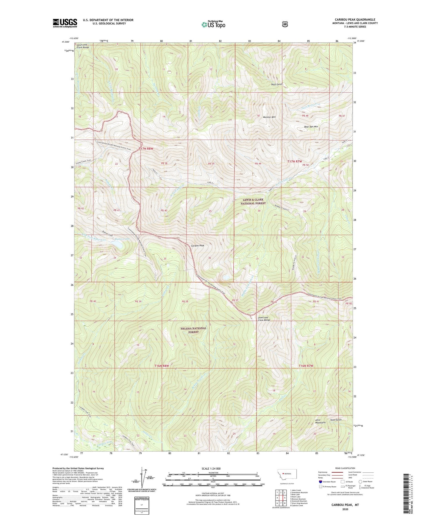
Caribou Peak Montana US Topo Map
Couldn't load pickup availability
Also explore the Caribou Peak Forest Service Topo of this same quad for updated USFS data
2024 topographic map quadrangle Caribou Peak in the state of Montana. Scale: 1:24000. Based on the newly updated USGS 7.5' US Topo map series, this map is in the following counties: Lewis and Clark. The map contains contour data, water features, and other items you are used to seeing on USGS maps, but also has updated roads and other features. This is the next generation of topographic maps. Printed on high-quality waterproof paper with UV fade-resistant inks.
Quads adjacent to this one:
West: Heart Lake
Northwest: Jakie Creek
North: Steamboat Mountain
Northeast: Bean Lake
East: Blowout Mountain
Southeast: Cadotte Creek
South: Silver King Mountain
Southwest: Stonewall Mountain
This map covers the same area as the classic USGS quad with code o47112b5.
Contains the following named places: Alice Mountains, Bear Den Mountain, Bighorn Lake, Camp Creek, Caribou Peak, Caribou Trail, East Fork Blacktail Creek, Fickler Creek, Middle Fork Camp Creek, Middle Fork Falls Creek, Monitor Mountain, South Fork Blacktail Creek, West Falls Trail