MyTopo
Steamboat Mountain Montana US Topo Map
Couldn't load pickup availability
Also explore the Steamboat Mountain Forest Service Topo of this same quad for updated USFS data
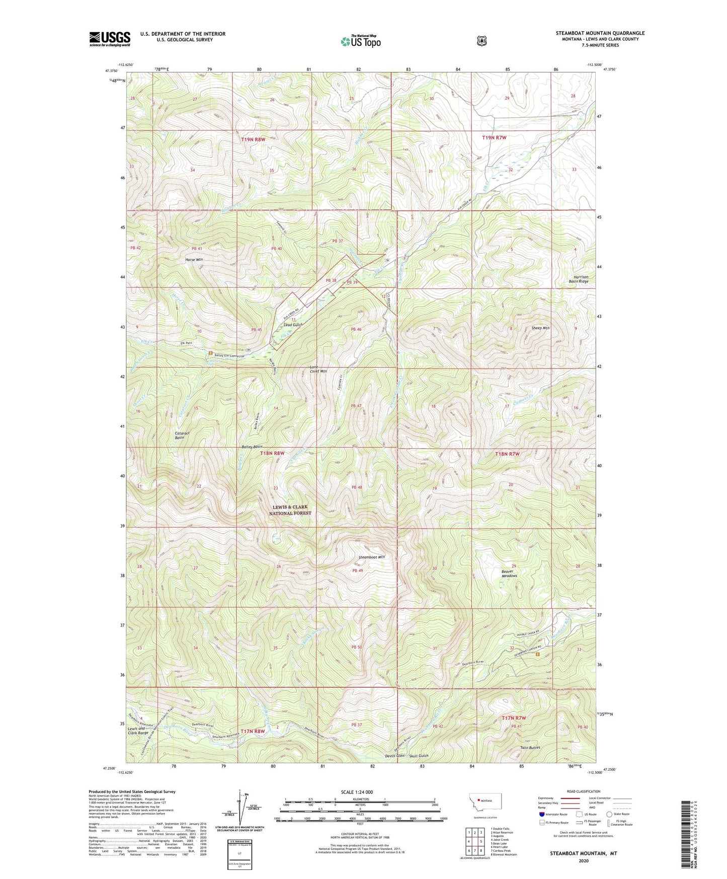
2024 topographic map quadrangle Steamboat Mountain in the state of Montana. Scale: 1:24000. Based on the newly updated USGS 7.5' US Topo map series, this map is in the following counties: Lewis and Clark. The map contains contour data, water features, and other items you are used to seeing on USGS maps, but also has updated roads and other features. This is the next generation of topographic maps. Printed on high-quality waterproof paper with UV fade-resistant inks.
Quads adjacent to this one:
West: Jakie Creek
Northwest: Double Falls
North: Nilan Reservoir
Northeast: Augusta
East: Bean Lake
Southeast: Blowout Mountain
South: Caribou Peak
Southwest: Heart Lake
This map covers the same area as the classic USGS quad with code o47112c5.
Contains the following named places: Bailey Basin, Bailey Creek, Beaver Meadows, Blacktail Creek, Bunch Grass Creek, C Bar N Camp, Cataract Basin, Cataract Creek, Cataract Falls, Cyanide Creek, Delta Queen Dam, Devils Glen, East Fork Cyanide Creek, Elk Creek Ranch, Frost, Grizzly Creek, Horse Creek, Horse Mountain, Lead Gulch, Lone Chief Mountain, Milky Stream, No Grass Creek, Rocky Stream, Sawmill Creek, Sheep Mountain, Short Creek, Skull Gulch, Sky Mountain Ranch, Steamboat Mountain, Twin Buttes, West Fork Blacktail Creek