MyTopo
Carlton Lake Montana US Topo Map
Couldn't load pickup availability
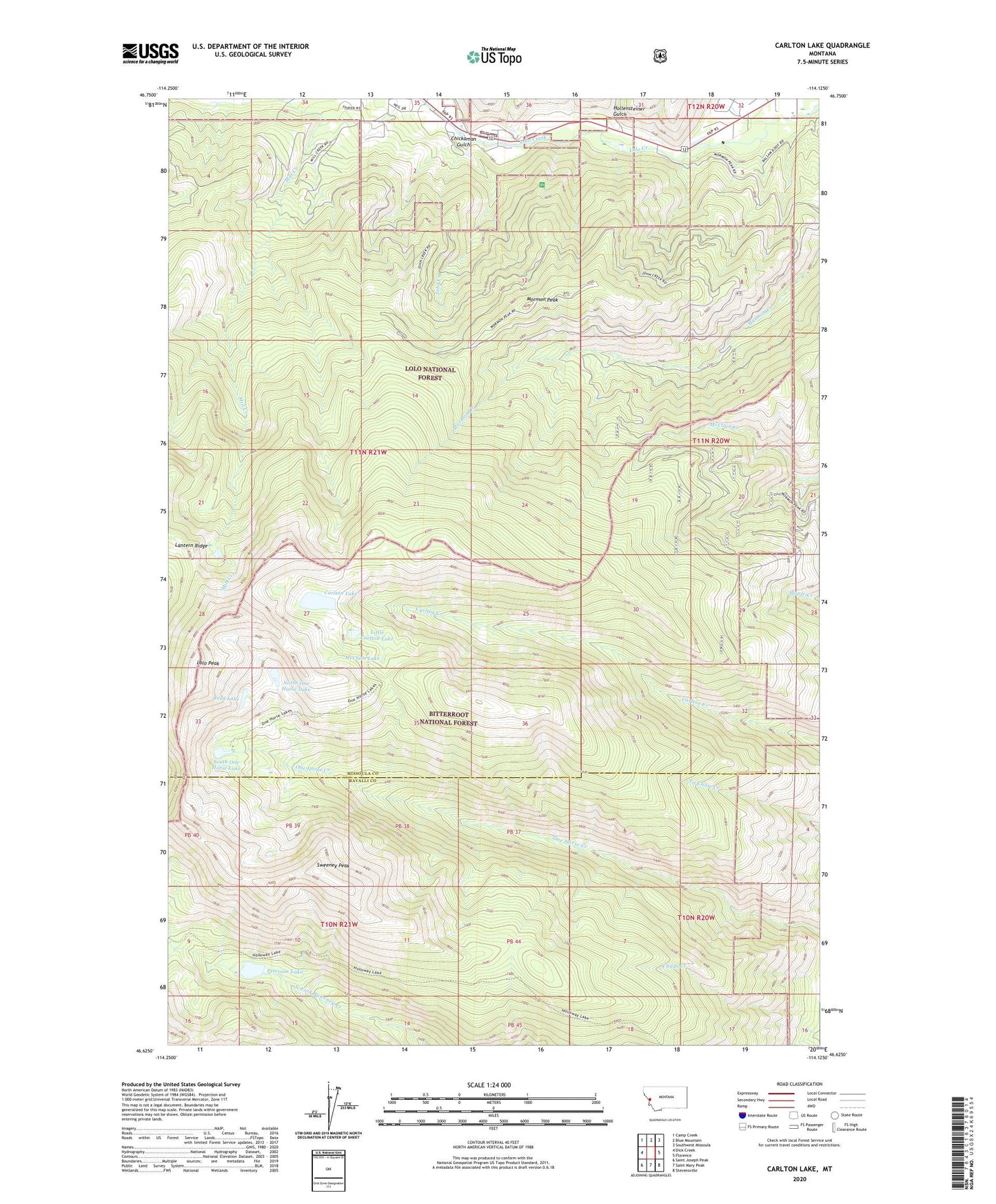
2020 topographic map quadrangle Carlton Lake in the state of Montana. Scale: 1:24000. Based on the newly updated USGS 7.5' US Topo map series, this map is in the following counties: Missoula, Ravalli. The map contains contour data, water features, and other items you are used to seeing on USGS maps, but also has updated roads and other features. This is the next generation of topographic maps. Printed on high-quality waterproof paper with UV fade-resistant inks.
Quads adjacent to this one:
West: Dick Creek
Northwest: Camp Creek
North: Blue Mountain
Northeast: Southwest Missoula
East: Florence
Southeast: Stevensville
South: Saint Mary Peak
Southwest: Saint Joseph Peak
Contains the following named places: Carlton Lake, Carlton Lake Number 1 Dam, Carlton Lake Trail, Chickaman Gulch, Fort Fizzle, Fort Fizzle Campground, Fort Fizzle Historic Site, Hollensteiner Gulch, John Creek, Lantern Ridge, Little Carlton Lake, Lolo Peak, McClain Lake, Mill Creek Mine, Mill Creek Trail, Mormon Peak, North One Horse Lake, Peterson Lake, Reed Lake, South One Horse Lake, Sweeney Peak, Sweeney Ridge Trail