MyTopo
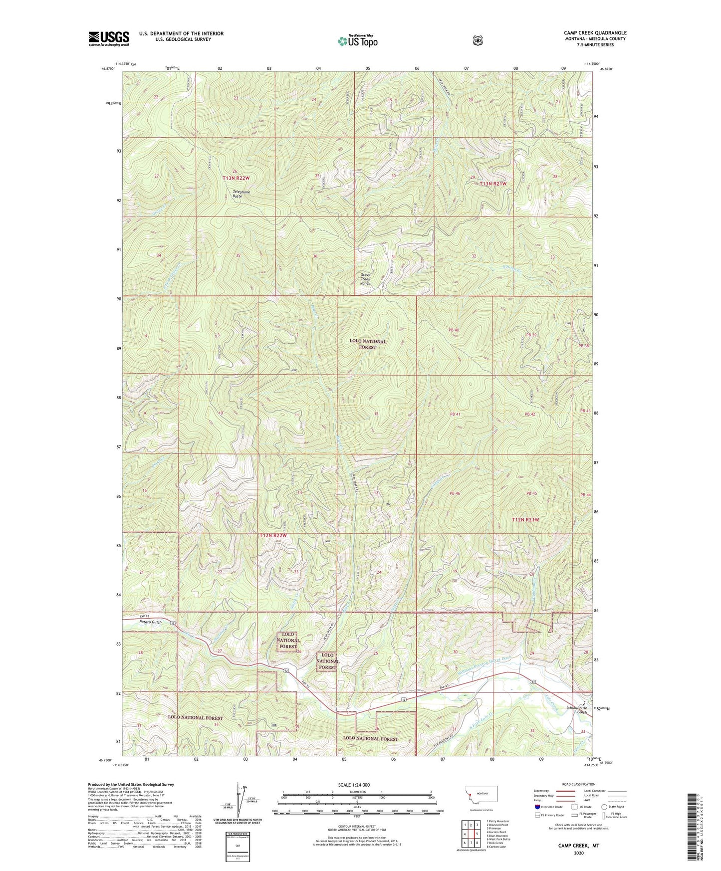
Camp Creek Montana US Topo Map
Couldn't load pickup availability
Also explore the Camp Creek Forest Service Topo of this same quad for updated USFS data
2024 topographic map quadrangle Camp Creek in the state of Montana. Scale: 1:24000. Based on the newly updated USGS 7.5' US Topo map series, this map is in the following counties: Missoula. The map contains contour data, water features, and other items you are used to seeing on USGS maps, but also has updated roads and other features. This is the next generation of topographic maps. Printed on high-quality waterproof paper with UV fade-resistant inks.
Quads adjacent to this one:
West: Garden Point
Northwest: Petty Mountain
North: Diamond Point
Northeast: Primrose
East: Blue Mountain
Southeast: Carlton Lake
South: Dick Creek
Southwest: West Fork Butte
This map covers the same area as the classic USGS quad with code o46114g3.
Contains the following named places: Bear Creek, Camp Creek, Grave Creek Range, Lawyers Combination, Lawyers Combination Mine, Lolo Creek Mine, Lolo Division, Potato Gulch, Schoolhouse Gulch, Sheldon, Sheldon Creek, Sheldon Mine, Smith Creek, South Fork Lolo Creek, Telephone Butte, Triantler, Triantler Mine, Upper Lolo Creek Mine, Upper Triantler Mine, West Fork Butte Creek, Williams Preston Hovet Ditch, Woodman Creek, Woodman Mine, Woodman Post Office, Woodman School