MyTopo
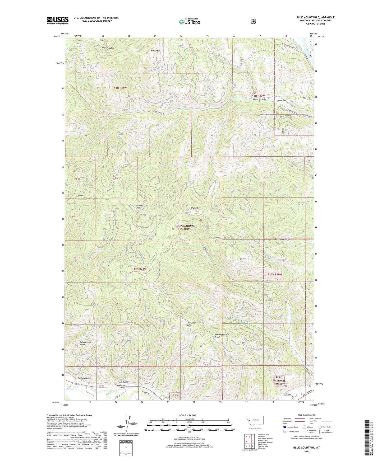
Blue Mountain Montana US Topo Map
Couldn't load pickup availability
Also explore the Blue Mountain Forest Service Topo of this same quad for updated USFS data
2024 topographic map quadrangle Blue Mountain in the state of Montana. Scale: 1:24000. Based on the newly updated USGS 7.5' US Topo map series, this map is in the following counties: Missoula. The map contains contour data, water features, and other items you are used to seeing on USGS maps, but also has updated roads and other features. This is the next generation of topographic maps. Printed on high-quality waterproof paper with UV fade-resistant inks.
Quads adjacent to this one:
West: Camp Creek
Northwest: Diamond Point
North: Primrose
Northeast: Northwest Missoula
East: Southwest Missoula
Southeast: Florence
South: Carlton Lake
Southwest: Dick Creek
This map covers the same area as the classic USGS quad with code o46114g2.
Contains the following named places: 13N20W21DA__01 Well, Anderson Gulch, Black Mountain, Blue Mountain, Blue Mountain Lookout, Blue Mountain Saddle, Chickaman Mine, Hagerty Gulch, Lick Gulch, Lyon Gulch, Mailbox Gulch, Mill Creek, North Fork Sleeman Creek, South Fork Sleeman Creek, Square and Round Dance Center, Tevis Creek, Westerman Creek