MyTopo
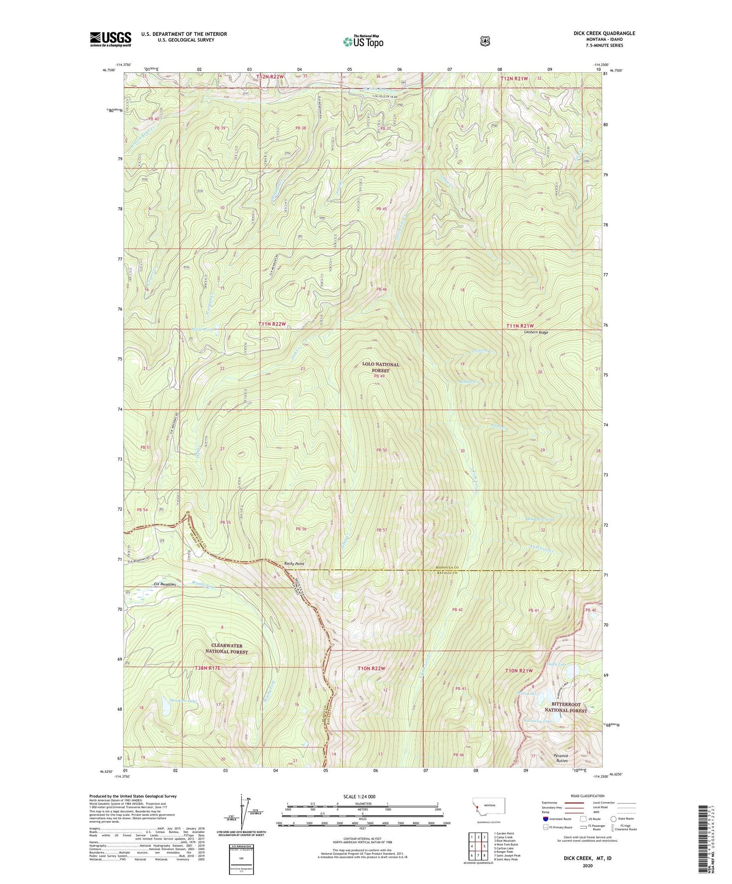
Dick Creek Montana US Topo Map
Couldn't load pickup availability
Also explore the Dick Creek Forest Service Topo of this same quad for updated USFS data
2024 topographic map quadrangle Dick Creek in the states of Montana, Idaho. Scale: 1:24000. Based on the newly updated USGS 7.5' US Topo map series, this map is in the following counties: Missoula, Ravalli, Idaho. The map contains contour data, water features, and other items you are used to seeing on USGS maps, but also has updated roads and other features. This is the next generation of topographic maps. Printed on high-quality waterproof paper with UV fade-resistant inks.
Quads adjacent to this one:
West: West Fork Butte
Northwest: Garden Point
North: Camp Creek
Northeast: Blue Mountain
East: Carlton Lake
Southeast: Saint Mary Peak
South: Saint Joseph Peak
Southwest: Ranger Peak
This map covers the same area as the classic USGS quad with code o46114f3.
Contains the following named places: Anderson Creek, Cedar Creek, Cooper Creek, Dick Creek, Duffy Lake, Duffy Lake Dam, Elk Meadows, Falls Creek, Holloway Lake, Holloway Lake Dam, Johny Creek, Lantern Creek, Lower Dick Creek Mine, Marshall Creek, Marys Pond, Meadow Creek, Middle Creek, Mills Lake, Pyramid Buttes, Rocky Point, Skookum Lake, Small Creek, Upper Dick Creek Mine, Ward Lode Mine